North Okinawa · MotobuNo.913★★Open in map →
Sesoko Island
— A bridge-linked island off the Motobu peninsula
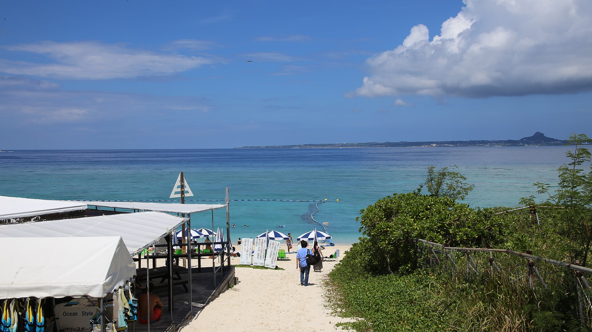
An island off the west side of the Motobu peninsula, reached by a bridge rather than a boat. A white-sand beach faces Ie Island across the channel, the sunsets run long, and the interior is fields and one small settlement.
- FromNago
- ~30 minCar or taxi from Nago
- Get off atSesoko Bridge (Prefectural Route 172)
- From there
- Sesoko Island
The sweet spot
Sesoko is not a secret. It appears on every list of northern Okinawa beaches. What it is instead is a beach island you can leave whenever you like, and the crowd here follows the swimming season and the middle of the day. Either side of that, the same water is quiet.
Where it is
41 more notes in Okinawa · open the map →What to look for — in walking order
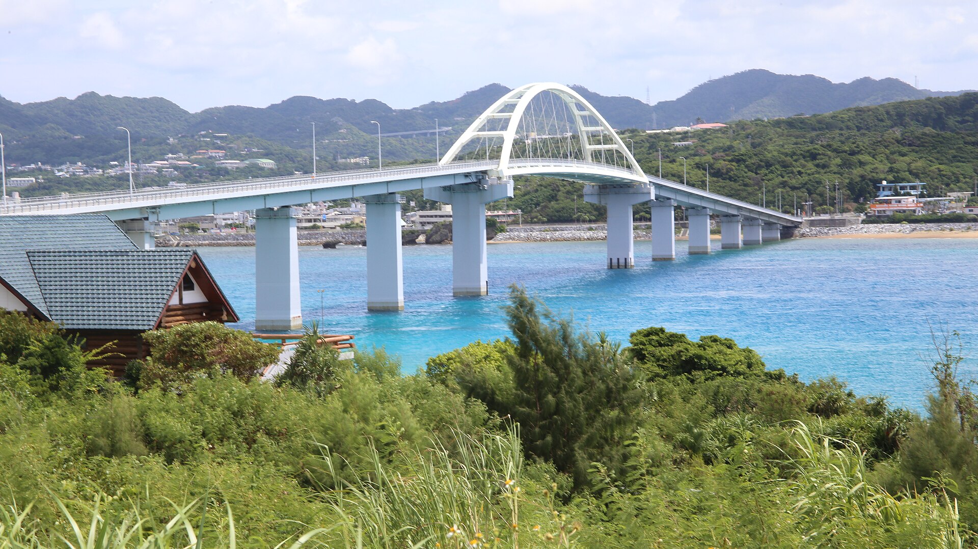
- Sesoko Bridgethe span from the peninsula, with shallow water reading pale on both sides
- Sesoko settlementthe village behind the bridgehead, the island's only cluster of houses
- Sesoko Beachthe white-sand shore on the west side, with a marked swimming zone in season
- The view across to Ie Islanda flat-topped island squared on the horizon, Minna Island low beyond the channel
- Sunset on the west shoreopen water taking the sun, and the reason the sand empties last
How to actually get there
- Nago town centre → the Motobu coast by car or taxi.
- Turn off for the bridge and cross onto Sesoko.
- Through the settlement behind the bridgehead and over to the western shore.
- Sesoko Beach, then back the same way — before the sunset or well after it.
- Car or taxi from Nago
- Nago town centre →(about 30 minutes by road)→ the Motobu coast, then across Sesoko Bridge on Prefectural Route 172. From Naha Airport the drive is roughly 90 minutes, most of it on the expressway.
- Back over the bridge
- The bridge is the only way off the island, and unlike a ferry it does not stop for the evening. Nago is the same run in reverse; if you are going straight through to Naha, leave margin for the afternoon traffic on the expressway.
About the place
Sesoko lies off the west side of the Motobu peninsula, close enough that the bridge reaching it is 762 m long. That single span is what sets the island apart from the others in northern Okinawa: no timetable, no crossing to book, no last boat to catch. The island itself is a low limestone plateau given over to sugarcane and pasture, with one settlement and a marine research station belonging to the University of the Ryukyus. The beach is on the western shore, facing open water. From the sand, Ie Island stands square on the horizon with Minna Island low beside it.
How to enjoy it
The marked swimming zone and its lifeguards are set out for the season only; outside it, the beach is for walking rather than swimming. Late afternoon is the shift worth waiting for, when the day crowd thins and the light turns over the water. From the end of summer into autumn the same shore doubles as a dark-sky spot, with the peninsula's lights behind you.
Background & history
Sesoko was reached only by boat until the mid-1980s. The bridge opened in 1985 and tied the island to the peninsula for the first time. Before it the school, the fields and the village kept a life largely separate from Motobu, and the crossing was a matter of tides and weather. What the bridge changed was not the island's size but its reach — day visitors first, then cafés, then a resort above the northern shore.
Before you go
- Cash
- The beach and the bridge cost nothing to cross or walk. Parking and the beach facilities are run locally and settled on the spot, so carry cash. What is open, and what it costs, changes with the season — check on arrival rather than in advance.
- Before you go
- Swimming is called off in typhoons and rough weather, and the marked zone exists only during the season. Fireworks, camping and barbecues are prohibited on the beach for conservation reasons. Jellyfish netting is not a given, so ask before going in.
- Another way
- Without a car, buses from Nago run out along the peninsula — routes 65 and 66 both serve Motobu — and a taxi covers the last stretch to the bridge. Reckon on walking or a taxi once you are across.
- After you get off
- Sesoko Bridge is the arrival point. The island road begins at the far end, the settlement sits just behind the bridgehead, and the beach is on the opposite, western shore.