West Tokushima · ObokeNo.637★★★Open in map →
Oboke and Koboke Gorges
— Schist canyon on the Yoshino River
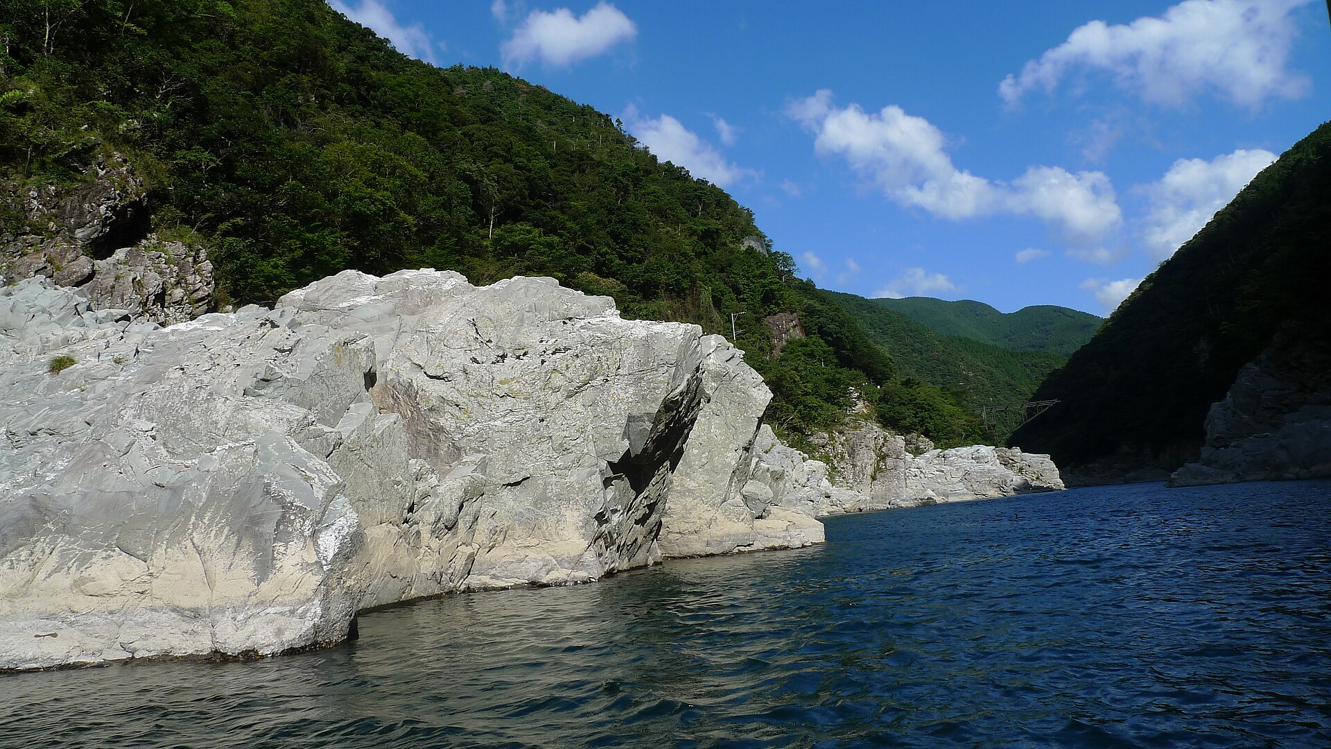
Two linked gorges on the Yoshino River in western Tokushima, cut through blue-green schist and named for the danger of walking them. A sightseeing boat works the upper reach, and the faster water below is one of Japan's main rafting runs.
- FromOboke Station (JR Dosan Line)
- ~20 min on footJR limited expresses stop
- Oboke and Koboke Gorges
Where it is
13 more notes in Tokushima · open the map →What to look for — in walking order
- Oboke Stationan unstaffed platform on the valley wall, with the canyon already open below it
- Michi-no-Eki Obokethe roadside station on Route 32, the first place the gorge opens up from the road
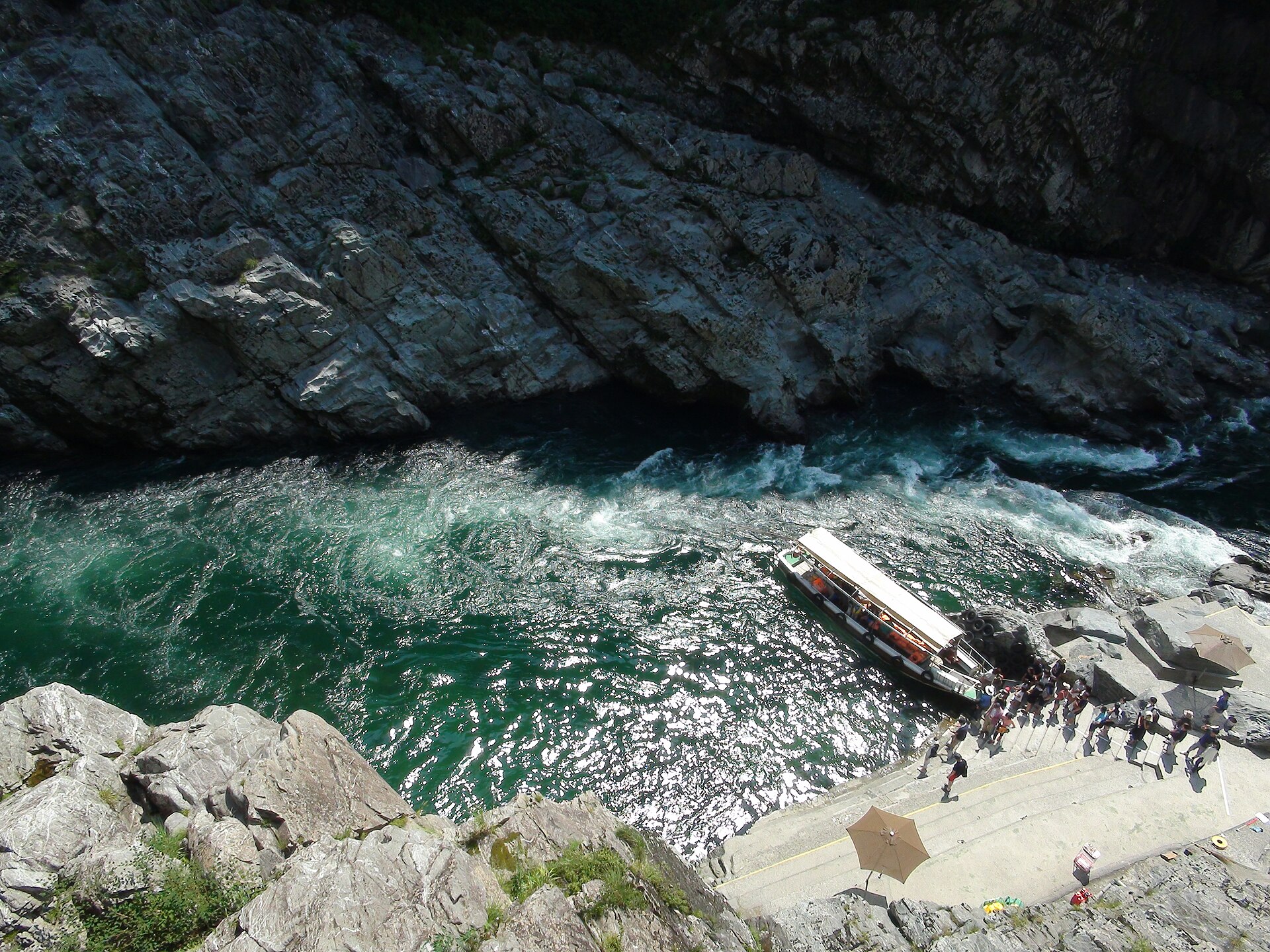
- The boat landingthe pier below the road, where the sightseeing boat sets out and returns
- The schist wallsblue-green rock in slabs and blades, tilted on edge and best read from the water
- Kobokethe lower gorge, tighter and faster, where the rafting runs begin
How to actually get there
- Okayama or Takamatsu → Oboke Station (JR Dosan Line; every limited express stops).
- Oboke Station → the boat landing on Route 32, about 20 minutes on foot or a few by taxi.
- Landing → the gorge and back, about 30 minutes on the water.
- Return to the station, or take the valley bus on up to the Iya vine bridge.
- Limited express to Oboke Station
- Oboke sits on the JR Dosan Line between Okayama or Takamatsu and Kochi, and every limited express stops there, which makes the gorge far easier to reach than its remoteness suggests. The station is unstaffed, so settle rail fares on the train or before boarding.
- Return from Oboke Station
- Expresses run both ways through the day and thin out in the evening. There is no onward public transport up the side valley to Iya after the last bus, so anyone combining the two needs to plan the gorge first and the valley second, or stay the night.
About the place
The Yoshino River cuts across the grain of the Shikoku mountains here rather than running along them, and it has been doing so for something on the order of 200 million years. What it has laid open is schist, the blue-green metamorphic rock Tokushima calls Awa no aoishi, folded and tilted and then polished by the water into slabs and blades along both banks. Oboke is the upper of the two gorges and Koboke the lower, with the same river through both. Road, railway and river share one narrow floor, which is why the canyon is easy to reach and almost impossible to build in.
How to enjoy it
The sightseeing boat runs about 30 minutes and returns to the landing it left from, so it is a there-and-back look at the walls rather than a passage downstream. It sails through the year; in the coldest months it goes out with a heated kotatsu table under the seats. From Oboke Station the landing is roughly 20 minutes on foot along Route 32.
Background & history
The name is older and stranger than the version told to visitors. The usual gloss says oboke means it is dangerous to walk here with long strides and koboke dangerous with short ones, but hoki, or hoke, is an old word for a cliff standing over a valley or a torrent, which is simply what these are. The rock itself was recognised late. The conglomeratic schist at Oboke was designated a national natural monument on 18 March 2014; the gorge became a national place of scenic beauty on 7 October 2015; and on 13 February 2018 Koboke was added and the pair renamed Oboke-Koboke.
Before you go
- Cash
- The sightseeing boat is ticketed at the landing on the day; rafting operators take bookings ahead. The station has no ticket window, so carry enough cash to cover fares settled on board.
- Before you go
- The boat is a river operation and can be suspended when the Yoshino runs high after heavy rain or a typhoon, and the last departure moves earlier through the winter half of the year. Route 32 through the gorge is narrow with rock on one side and a drop on the other.
- Another way
- The rafting course starts on the Koboke reach downstream and runs with certified guides through the year. The roadside station on Route 32 above the river is the other easy stop, with parking, food and a view down the canyon for anyone who does not want to go on the water.
- After you get off
- Everything starts at Oboke Station, high on the valley wall. From the platform the road drops to Route 32 and follows the river to the boat landing, about twenty minutes on foot; a taxi covers it in a few.