North Yamaguchi · Mishima IslandNo.821★★Open in map →
Mishima Island
— Yamaguchi's northernmost island, out in the Sea of Japan
An inhabited island at the northern limit of Yamaguchi, out in the Sea of Japan. It holds a Japanese cattle breed that was never crossed with Western stock, and a hillside of stone-piled burial mounds facing the water.
- FromHagi Port
- ~70 minFerry from Hagi Port
- Get off atMotomura Port (Hagi Kaiun ferry)
- From there
- Mishima Island
The sweet spot
This is not an undiscovered island. It has a tourism association, signed sites and a published timetable. What keeps it quiet is the sea between it and the mainland: the crossing eats most of a morning, sailings are few and weather-dependent, and there is no shortcut for a day-tripper. The people who come have decided to come.
Where it is
14 more notes in Yamaguchi · open the map →What to look for — in walking order
- Motomura Portthe arrival harbour at the south end, with the ferry berth, the city branch office and the island's inns
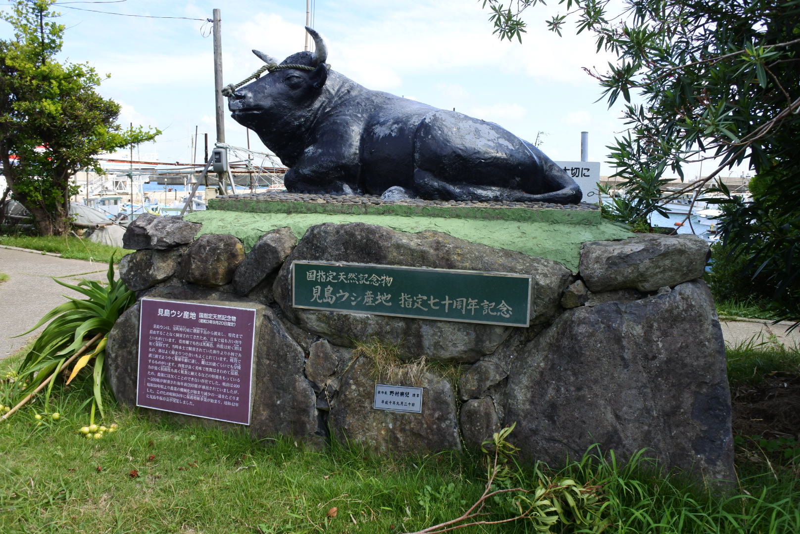
- Mishima-ushi memoriala monument beside the village to the island's native cattle breed
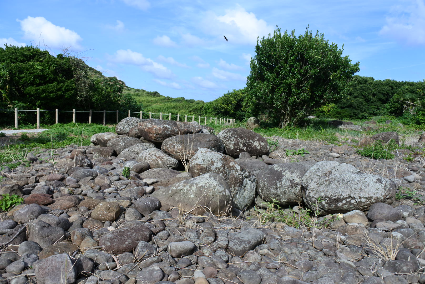
- Jikombo tomb grouproughly 200 stone-piled mounds on the slope east of the village, looking out over the water
- Utsu Portthe second harbour at the north end, across the plateau from Motomura
- Mishima-kita Lighthousethe light at the island's northern tip, the last built thing before open sea
How to actually get there
- Hagi city centre → Hagi Port at Hamasaki (the ferry berth for the island route).
- Hagi Port → Motomura Port, Mishima (Hagi Kaiun ferry Yuriya, about 70 min).
- Motomura Port → the village and the Mishima-ushi memorial (a few minutes on foot).
- Village → the Jikombo tomb group on the slope to the east, then the road north towards Utsu.
- Hagi Port to Motomura Port
- The Hagi Kaiun boat Yuriya crosses from Hagi Port, on the Hamasaki side of the city, to Motomura Port on Mishima. The prefecture gives the crossing as seventy minutes, with two to three round trips a day depending on season. Book the boat and a bed together rather than separately.
- The same boat back to Hagi
- Return sailings leave Motomura for Hagi on the same day, but the last one is early by mainland standards and the winter timetable is thinner than the summer one. If the sea gets up the boat does not sail and there is no other way off, so keep slack on any day you have to be somewhere else.
About the place
Mishima lies about 45 kilometres north of Hagi, a single inhabited island of 7.73 square kilometres at the top of the prefecture. It is a basalt plateau rather than a peak, so the middle of it is farmland and grass and all the drama sits at the rim, where the tableland breaks off into the sea. Two harbours serve it. Motomura, at the south end, is where the mainland boat ties up and where most of the houses stand; Utsu is the smaller settlement at the north. There is no bridge. The boat you arrive on is the only public way on or off.
How to enjoy it
The crossing runs about 70 minutes, with two or three round trips a day and more of them in spring and summer than in autumn and winter, so the timetable decides the shape of the visit rather than the other way round. A day trip fits the busier season's schedule but leaves you walking fast; a night at one of the village inns is what the island is built for. Confirm the sailing before you commit, because rough water on this coast cancels boats outright.
Background & history
On a slope above the sea east of Motomura stands the Jikombo tomb group, built not of heaped earth but of piled stone, and raised between the 7th and the 10th centuries. That is late for burial mounds in Japan, and a field of them on an island this small argues for a place that mattered on the sea route towards the continent rather than a backwater. The island's cattle make a related point: a Japanese breed that was never crossed with Western stock, which is why the herd is protected as a natural monument.
Before you go
- Cash
- Tickets are bought at the port counter before boarding. Carry cash for the island rather than counting on cards, and arrange meals and lodging with the inn ahead of the crossing.
- Before you go
- Sailings on this coast are weather-dependent and the autumn and winter timetable is thinner than the spring and summer one. The north of the island is open plateau and cliff edge, so the wind off the Sea of Japan is stronger there than anything you feel in the village.
- Another way
- Some sailings call at Utsu, the second harbour at the north end, as well as at Motomura. If yours does, the road between the two settlements becomes the spine of the day. Check which harbour your boat uses when you buy the ticket.
- After you get off
- The boat ties up at Motomura Port at the south end of the island, and the village begins at the quay. The branch office, the inns and the cattle memorial are all a few minutes on foot, and the road north towards Utsu starts here.