East Hokkaido · ShiretokoNo.1132★★Open in map →
Oshinkoshin Falls
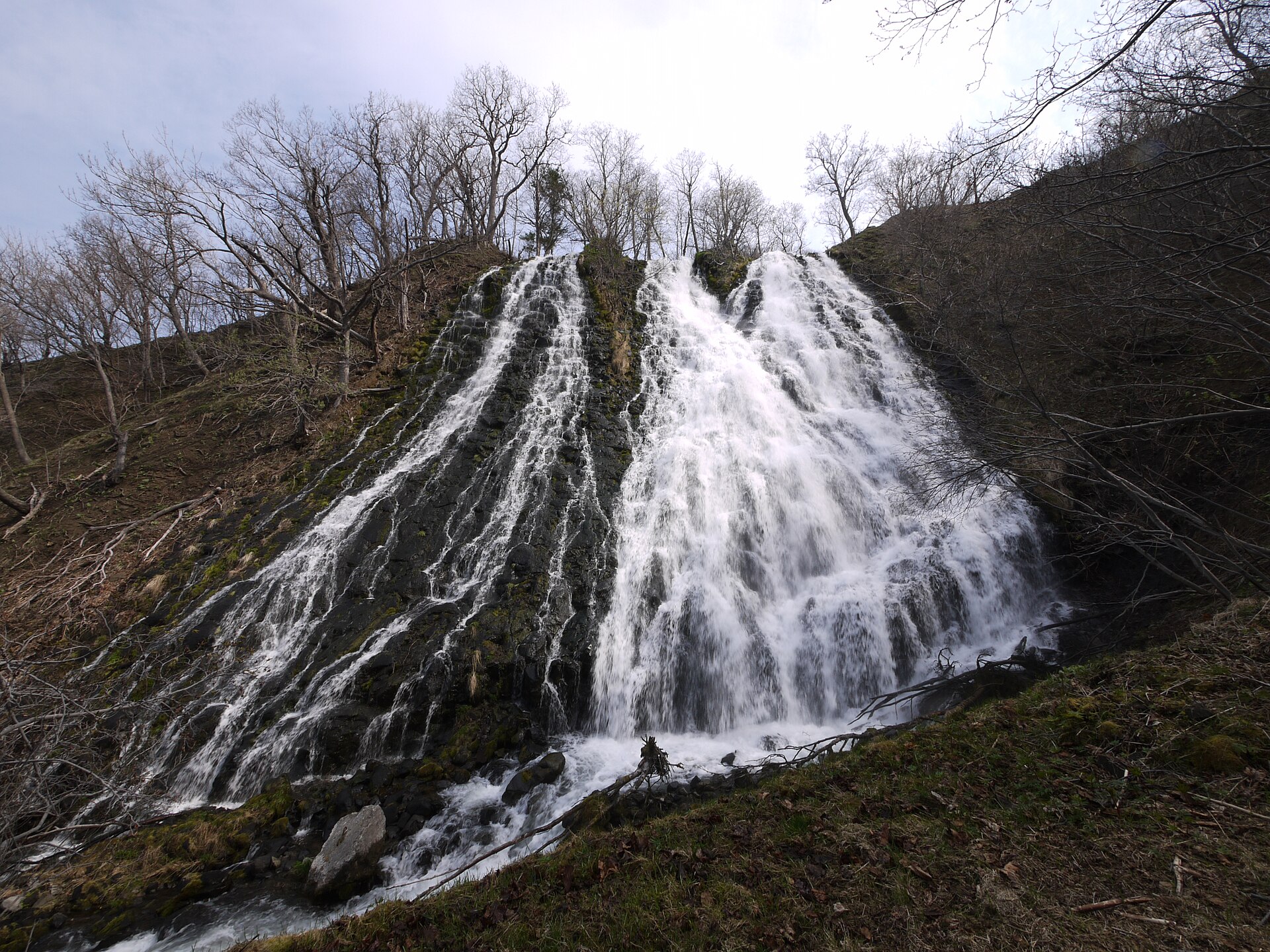
The largest waterfall on the Shiretoko Peninsula, splitting into two streams down a jointed lava cliff directly beside National Route 334. A stone stairway climbs to a deck at mid-height, and a separate lookout sits on top of the cliff.
- FromShiretoko-Shari Station
- ~40 minSharibus Shiretoko line
- Get off atOshinkoshin-no-taki (Sharibus Shiretoko line)
- From there
- Oshinkoshin Falls
The sweet spot
This is a fixture on every coach route between Shari and Utoro, so the bottom of the falls is loud and busy and makes no claim otherwise. The parts most people skip are the ones going upward. The stairway to the mid-height deck and the lookout on top of the cliff each take a few minutes, and the crowd thins with every step.
Where it is
102 more notes in Hokkaido · open the map →What to look for — in walking order
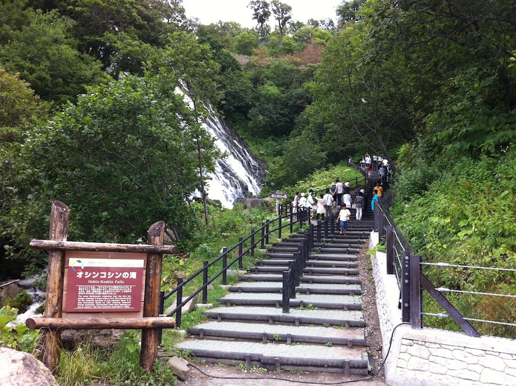
- The roadside pull-offa free car park on Route 334 with toilets and a gift house
- The foot of the cliffthe closest standing point to the spray, below the steps
- The stone stairwaysteps up the side of the gorge toward the mid-height deck
- The mid-height deckthe platform where the two streams part at eye level
- The Oshinkoshin lookoutthe higher viewpoint on the cliff top, facing the Sea of Okhotsk
How to actually get there
- Shiretoko-Shari Station → Oshinkoshin-no-taki (Sharibus Shiretoko line, about forty minutes).
- Pull-off → the foot of the cliff, where the spray reaches the path.
- Foot of the cliff → the stone stairway up to the mid-height deck.
- Deck → the Oshinkoshin lookout on top of the cliff, then back down to the stop.
- Sharibus Shiretoko line from Shiretoko-Shari Station
- Shiretoko-Shari is the Senmo Line station for the peninsula, and the Sharibus Shiretoko line leaves the terminal beside it heading for Utoro Onsen. The tourism association's own guide gives about forty minutes to the Oshinkoshin-no-taki stop, which is a roadside pole rather than a building. The line runs on separate summer and winter timetables, so the departures shift with the season rather than the day.
- Return toward Shari, or on to Utoro
- Both directions use the same roadside stop, so carrying on north to Utoro Onsen is as easy as going back. The service is thin either way and there is no shelter and no lighting. Take two times off the pole before you climb the steps: the one you want, and the last one.
About the place
The water does not come down in one sheet. It runs over the jointed face of a lava cliff and splits partway, which is why the old local name for it is the Twin Beauty Falls. The drop is about fifty metres and the spread about thirty, and that makes it the largest waterfall on the peninsula. The stream behind it is the Charassenai, which reaches the Sea of Okhotsk a few paces past the road. National Route 334 runs along the foot of the cliff, so this is one of the very few sights in Shiretoko that arrives without any walking.
How to enjoy it
Nothing here opens or closes, so the timetable that matters is the bus. Only a handful of services call at the falls each day on the Sharibus Shiretoko line, and the gap between two of them makes a natural length for the visit — enough for the stairway, the deck and the lookout without hurrying. The toilets at the pull-off shut for the winter months even though the falls do not.
Background & history
The name is Ainu. O-shunku-ush-i describes a river mouth thick with Ezo spruce, and the word moved from the shoreline to the settlement and finally to the waterfall itself. Charassenai, the river's own name, is read as the stream that chatters. Shiretoko was inscribed as a UNESCO World Natural Heritage site in 2005, though the falls had been on the map long before that: they are one of the eight designated views of the peninsula and one of Japan's hundred selected waterfalls.
Before you go
- Cash
- The falls, the car park and the stairway are all free. The gift house and the vending machines at the pull-off are the only places to spend anything, and neither can be relied on outside the season. Carry cash for the bus rather than assuming a card will work.
- Before you go
- The falls run all year and the site never shuts, but the toilets at the pull-off close for the winter and the stone steps ice over. In a hard winter the falls freeze in part. There is no lighting anywhere on the site, so after dark there is nothing to see from the road.
- Another way
- By car, Utoro Onsen is the near end of Route 334 and Shari the far end, and the same road carries on past the falls to the Shiretoko Nature Center and the Five Lakes. Coach tours between the two towns almost all stop here, which is why the bottom of the falls fills and empties in waves.
- After you get off
- The bus sets down on Route 334 at the pull-off, with the falls already visible above the road. Toilets and the gift house are on the sea side; the stairway starts on the cliff side, just past the interpretive board.