Aizu · UrabandaiNo.558★★★Open in map →
Goshikinuma Ponds
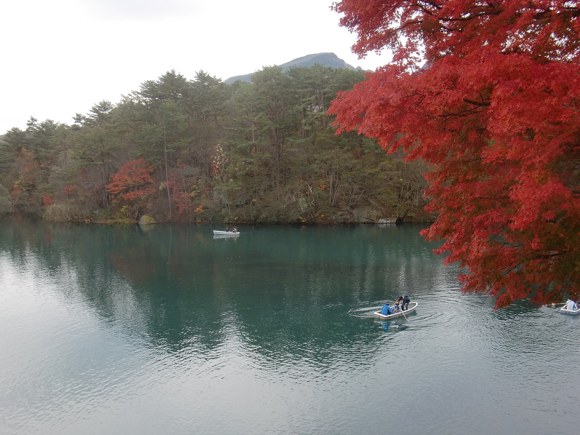
A chain of small volcanic lakes on the plateau north of Mount Bandai, each holding a different colour, linked end to end by a walking trail through the woods. Buses stop at both ends, so the walk does not have to double back.
- FromKoriyama Station
- ~70 minJR Ban'etsu West Line, then bus
- Get off atGoshikinuma-iriguchi bus stop (bus for Urabandai from Inawashiro Stn)
- From there
- Goshikinuma Ponds
Where it is
20 more notes in Fukushima · open the map →What to look for — in walking order
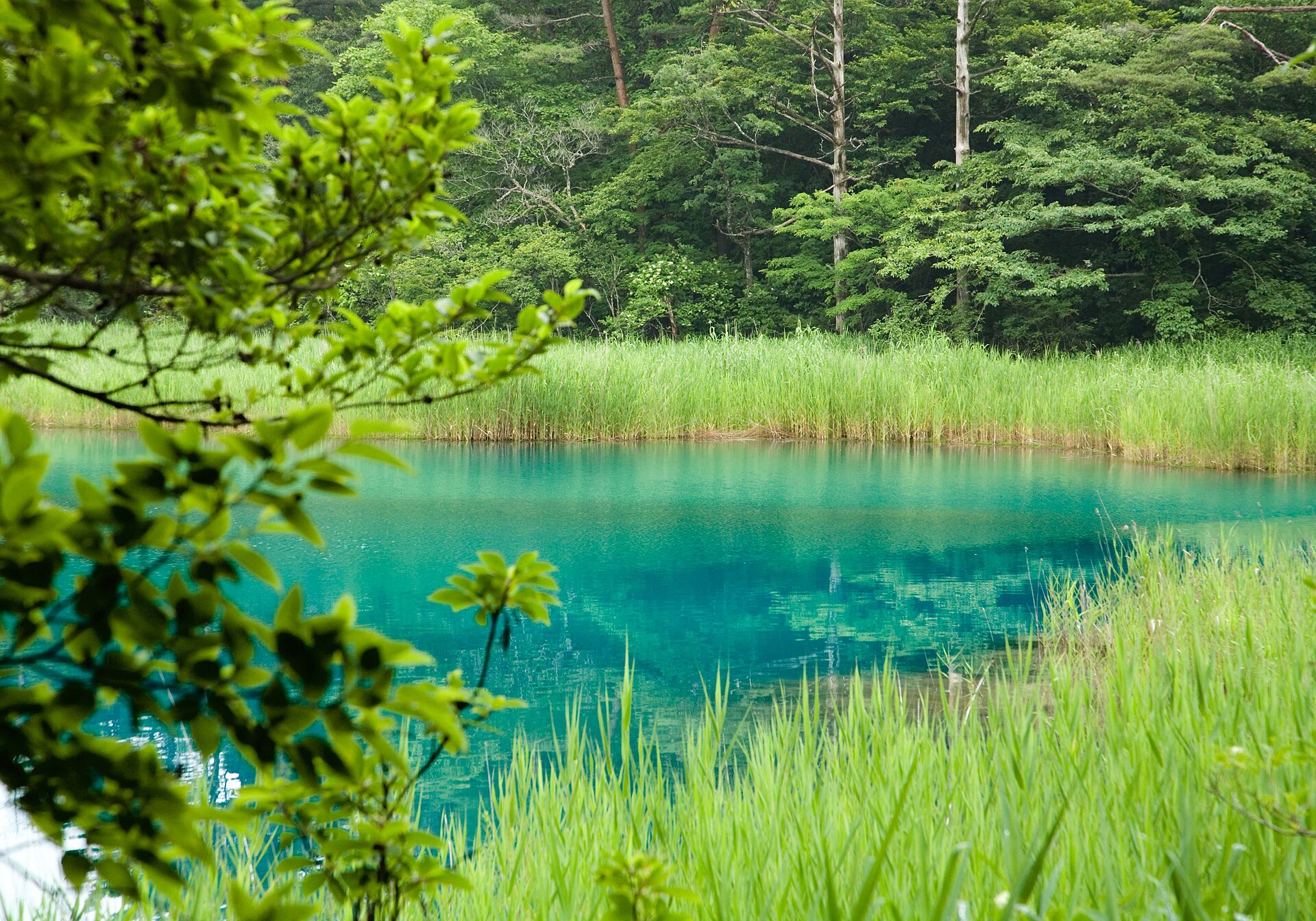
- Bishamon-numathe largest of the group, at the eastern trailhead, with hand-rowed boats in the green season
- Aka-numaa small pond early on the path, named for the colour standing in its shallows
- Benten-numathe wide open water at the middle of the walk, where the trees pull back from the bank
- Ao-numathe emerald pond of the western half, the strongest colour on the route
- Yanagi-numathe last pond, beside the western trailhead and its bus stop and shop
How to actually get there
- Koriyama Station → Inawashiro Station (JR Ban'etsu West Line, about 35 min).
- Inawashiro Station → Goshikinuma-iriguchi (bus for Urabandai, 25–30 min).
- Check the trail and weather at the visitor centre, then start at Bishamon-numa.
- Walk west to Yanagi-numa and take the bus back down from the western trailhead.
- JR Ban'etsu West Line from Koriyama
- Koriyama Station →(JR Ban'etsu West Line, about 35 min)→ Inawashiro Station. Koriyama is the Tohoku Shinkansen stop, so this is the standard approach from Tokyo. Aizu-Wakamatsu is about the same distance from Inawashiro on the other side, which makes the ponds an easy day out from either town.
- Return from the western trailhead
- Finish at Yanagi-numa and take the bus from the Urabandai-Kogen-Eki stop back down to Inawashiro Station, rather than walking the four kilometres a second time. Services are not frequent and the last one leaves in the afternoon, so photograph the timetable when you get off in the morning.
About the place
The ponds lie on the plateau north of Mount Bandai, in country the mountain built for them in a single morning. There are around thirty, and they do not share a colour: cobalt, emerald, jade, a rust red, sometimes two shades in one basin, depending on the volcanic minerals dissolved in each and on what grows in the water. A nature trail of about four kilometres runs the length of the group and strings eight of the ponds together end to end. Bishamon-numa, the largest, sits at the eastern end where the path begins, and the colours change as you go west.
How to enjoy it
Walk it one way, east to west, and let the bus do the return. The trail takes around an hour and a half at a normal pace, and the point is the sequence: the colour shifts pond by pond, so a single stop tells you almost nothing about the group. Autumn puts red over the water and is the busiest season. In winter the boats stop, snow closes over the path, and the visitor centre becomes the place to ask what is walkable that day.
Background & history
On 15 July 1888 the north flank of Mount Bandai gave way in a steam explosion. The debris avalanche swept down the slope and dammed the rivers below it, and several hundred lakes appeared across the plateau within hours. Goshikinuma is the best known cluster among them, which makes these ponds younger than photography itself. The area now sits inside Bandai-Asahi National Park, and the trail passes through a special protection zone where nothing may be collected.
Before you go
- Cash
- The trail is free to walk. The bus from Inawashiro Station to the Goshikinuma-iriguchi stop was posted at 920 yen at the time of checking. The visitor centre rents snowshoes and boots by the hour in winter. Carry cash — this is a rural route with small operators.
- Before you go
- The path is a woodland trail, not a promenade: loose rock underfoot and mud after rain. It runs through bear country, and the signs asking walkers to stay on the route are about plant protection as much as safety. Winter is the real constraint — snow lies deep on the plateau and can still be twenty to thirty centimetres here in late March, the boats are laid up, and buses run to a reduced timetable. Ask at the visitor centre before setting off.
- Another way
- From the Kitakata side, a bus runs to Urabandai in around an hour, which suits a route that comes in through the Aizu basin rather than from Koriyama.
- After you get off
- From in front of Inawashiro Station, take the bus for Urabandai and get off at Goshikinuma-iriguchi, twenty-five to thirty minutes up the hill. The stop sits beside the Urabandai Visitor Center and the plaza at the trailhead, with parking behind them; the path starts within sight of the road.