Kagawa · ShodoshimaNo.623★★★Open in map →
Angel Road
— A tidal sandbar out to the islets off Shodoshima
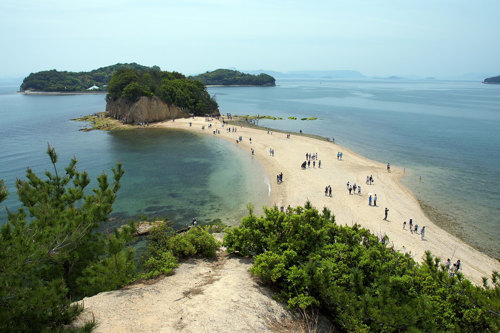
A ribbon of sand off the west coast of Shodoshima that joins the shore to a line of small islands, but only while the tide is out. At high water there is nothing to walk on, which makes the tide table the itinerary.
- FromTakamatsu Port
- ~60 minFerry, sailings through the day
- Get off atTonosho Port (Shodoshima ferry terminal)
- From there
- Angel Road
Where it is
25 more notes in Kagawa · open the map →What to look for — in walking order
- Yakusoku no Oka lookoutthe hill above the shore, with a bell and a view along the whole sandbar
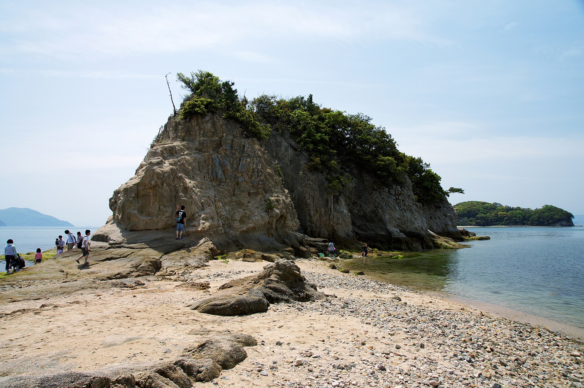
- Bentenjimathe first islet on the route, joined to Shodoshima at its base
- The sandbarthe ribbon of sand and shell that surfaces between the islands at low water
- Nakayoshimathe second islet, where most walkers turn round
- Oyoshimathe farthest island of the chain, seen from the end of the walk rather than reached
How to actually get there
- Takamatsu Port → Tonosho Port (Shikoku Ferry, about 60 min, 700 yen for an adult one way).
- Tonosho Port → the Angel Road stop (Olive Bus, about 10 min by the tourism association's reckoning).
- Check the day's low water first, then walk out from the shore to Bentenjima and on to Nakayoshima.
- Turn back with time in hand, then climb the lookout for the view along the whole bar.
- Shikoku Ferry from Takamatsu Port
- Takamatsu Port →(Shikoku Ferry, about 60 min)→ Tonosho Port. Sailings run through the day from early morning until evening, so the crossing is rarely the constraint — the tide is. Takamatsu Port sits on the waterfront beside the city's station area, which makes the connection from a mainland train straightforward.
- Return from Tonosho Port
- Ferries run back to Takamatsu through the day and into the evening, but the last sailings come earlier than a mainland rail service would. Fix your return before committing to a late tide: a missed boat here means a night on the island rather than an hour on a platform.
About the place
Angel Road runs off the western shore of Shodoshima toward a line of small islands known collectively as Yoshima. For most of the day it is not there. As the tide falls the water draws back on both sides and the bar surfaces as a walkable path, out to Bentenjima and then on to Nakayoshima; when the tide turns it goes under again, twice in every day. Nothing is built on it and nothing is charged for it — this is a piece of coastline that changes shape rather than a site. The island's other headline sight, the Kankakei gorge, sits high in the interior on the far side and wants a separate half-day.
How to enjoy it
Everything here runs on the tide table rather than the clock. Look up the day's low water before booking a ferry, and aim to be on the sand in the middle of the window rather than at its edge. Climb the lookout first for the shape of the whole bar, then walk it — in that order the walk reads as something, and in the reverse it reads as a beach.
Background & history
The islets offshore are known together as Yoshima, and the tidal path across them also carries the name Tenshi no Sanpomichi, the angel's walking path. A local story has attached itself to it: a couple who cross the sand hand in hand are said to stay together. On the rise above the shore stands the Yakusoku no Oka lookout, a small hill with a bell visitors ring and a view down the length of the bar. Between them the two have made this the centre of Shodoshima's reputation as a place couples travel to.
Before you go
- Cash
- Angel Road itself has no gate and no charge. The ferry was 700 yen one way for an adult when checked, with a return ticket cheaper than two singles and a child rate at half. Car parks by the shore are a mix of paid and free, the free one being the larger of the two.
- Before you go
- The bar is under water for most of the day, and the tide returns faster than it looks from the shore. Read the tide table the island's tourism association publishes before travelling, and start back well before the water closes behind you. There is no shelter out on the sand.
- Another way
- From the Honshu side, ferries reach Tonosho Port from Shin-Okayama Port. A passenger-only high-speed boat also covers the Takamatsu route more quickly than the car ferry, and sailings from Himeji land on the far side of the island at Fukuda Port.
- After you get off
- From Tonosho Port the island's Olive Bus runs to the Angel Road stop; the tourism association puts that ride at about ten minutes. The shore road is also walkable, or rideable on a rental bicycle, if the tide has given you time to spare.