Iwate · OfunatoNo.557★★Open in map →
Goishi Coast
— Sea-carved rock arches on the Sanriku shore
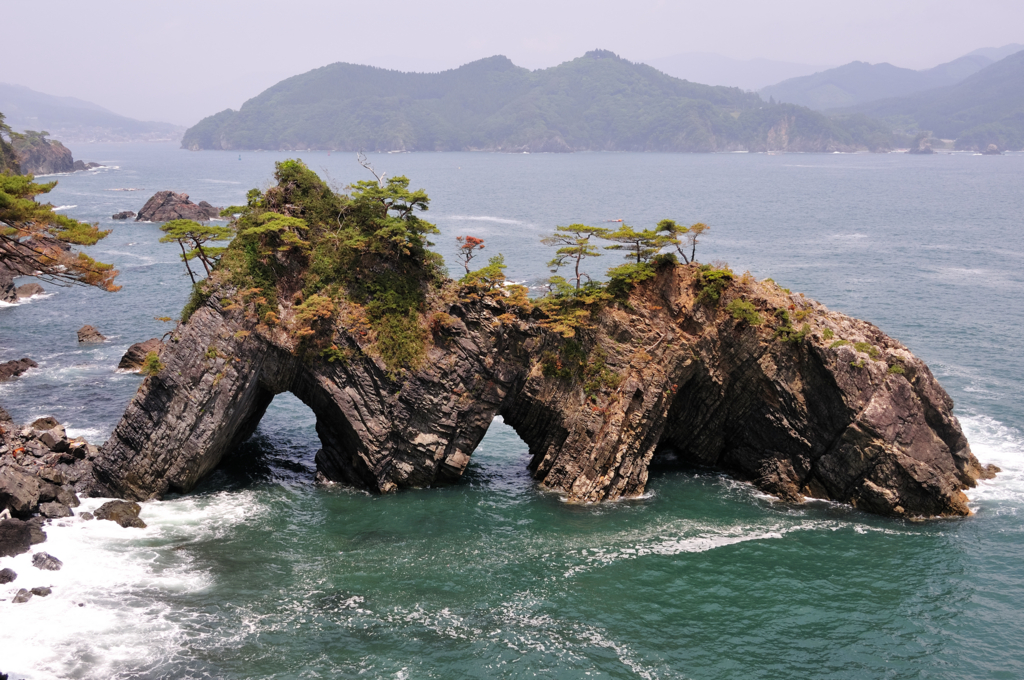
The outer face of the Massaki peninsula in Ofunato, where thin, tilted rock has been cut by the Pacific into arches, stacks and ravines. A signposted cliff path links the named viewpoints in order and ends at the black pebble beach that gave the coast its name.
- FromIchinoseki Station
- ~3 hrBRT + local bus
- Get off atGoishikaigan-guchi Station (JR Ofunato Line BRT)
- From there
- Goishi Coast
The sweet spot
This is a designated national scenic site, not a secret, but the Sanriku coast lies well off the Tokyo-Kyoto axis and most overseas itineraries never turn this far north-east. It also stays uncrowded because it is linear: walkers spread out along the cliff path instead of gathering on one platform.
Where it is
17 more notes in Iwate · open the map →What to look for — in walking order
- Anatoshi-isoa sea rock pierced by three tunnels, wide enough for a small boat to pass through
- Kaminari-iwaThunder Rock, where a heavy sea booms in the hollow beneath the ledge
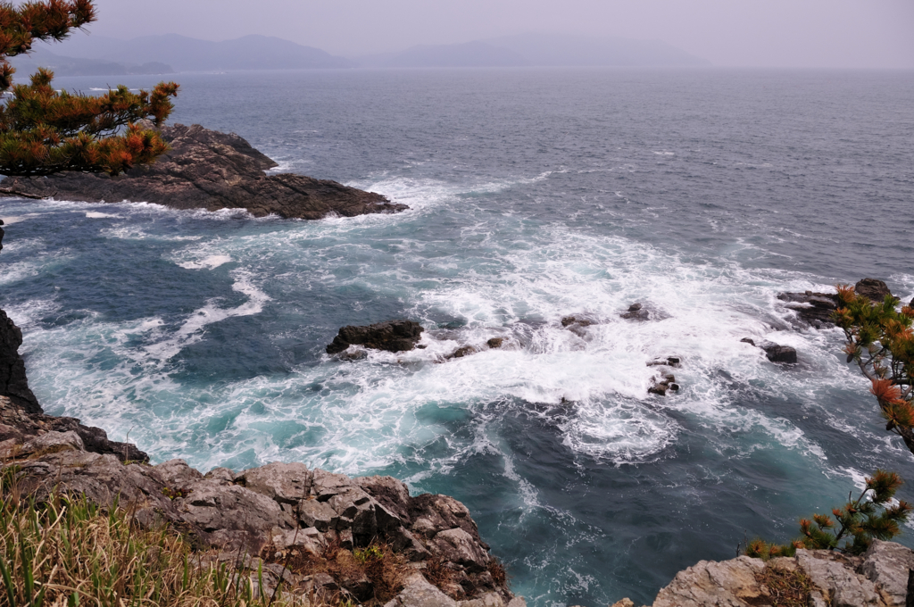
- Ranboyaa narrow ravine between sheer walls with white water breaking far below
- Goishi-misakithe point at the tip of the peninsula, with open water on three sides
- Goishi beachthe black pebble shore that names the coast, and the landing for the boat
How to actually get there
- Ichinoseki Station → Kesennuma (JR Ofunato Line), then the Ofunato Line BRT → Goishikaigan-guchi.
- Goishikaigan-guchi → Goishi Coast (local bus down the peninsula to the information centre).
- Information centre → Anatoshi-iso → Kaminari-iwa → Ranboya → Goishi beach (signposted cliff path).
- Ofunato Line and BRT from Ichinoseki
- Ichinoseki Station →(JR Ofunato Line)→ Kesennuma →(Ofunato Line BRT)→ Goishikaigan-guchi. Allow about two and a half hours for that chain. A local bus then covers the last run down the peninsula from the BRT stop to the coast.
- Back from Goishikaigan-guchi
- Take the local bus back up to Goishikaigan-guchi, the BRT to Kesennuma and the JR Ofunato Line to Ichinoseki for the Tohoku Shinkansen. Every leg is a rural service rather than a turn-up-and-go line, so read the departure times for all three before you start walking.
About the place
The Massaki peninsula pushes south out of Ofunato into the Pacific, and its outer face is the Goishi Coast. A footpath follows the cliff top, ducking into black pine and coming back out above the water at each headland. Because the strata here are thin and tilted, the sea has worked them into arches, free-standing stacks and knife-cut ravines instead of rounding them into bays. Small boats work the same water in season and run in under the rock. The named viewpoints are strung out along the shore in order, so the walk reads as a sequence rather than a single lookout.
How to enjoy it
The Anatoshi boat runs in the warmer half of the year in most seasons, threading the tunnels in the rock; it needs at least two passengers and is best booked the day before through the Goishi Coast Information Center. Walking the shore end to end takes most of a morning, so if the timetable is tight, start at Anatoshi-iso and turn back after Ranboya. Winter takes the boat off the water but leaves the path open.
Background & history
The coast is named for Goishi beach at its southern end, where the surf has ground the stones into flat black discs like go pieces. Japan lists the shoreline as a national Place of Scenic Beauty and Natural Monument, and it is counted among the country's hundred finest seashores. The hollow boom the swell makes under Thunder Rock put the coast on the national list of soundscapes worth keeping. The whole shore now sits inside Sanriku Fukko National Park.
Before you go
- Cash
- The cliff path and its viewpoints need no ticket. The Anatoshi boat is a paid seasonal service arranged through the Goishi Coast Information Center. Carry cash for the boat and the local bus.
- Before you go
- The path is exposed, and the stretches above the ravines drop straight to the water behind simple railings, so keep well back when the wind is up. There is no lighting once the light goes. The boat does not run through winter and its season shifts from year to year, so confirm it before you build a day around it.
- Another way
- From Sendai, take the Tohoku Shinkansen to Ichinoseki and join the same Ofunato Line chain. By car, the coast is signposted from the Ofunato-Goishikaigan interchange on the Sanriku Expressway, and there is a large car park at the trailhead.
- After you get off
- From Goishikaigan-guchi, take the local bus down the peninsula and get off at the Goishi Coast stop beside the information centre. The path to the viewpoints starts at the edge of the car park there and is signposted from the first junction.