Aomori · Tsugaru PeninsulaNo.797★★Open in map →
Cape Tappi
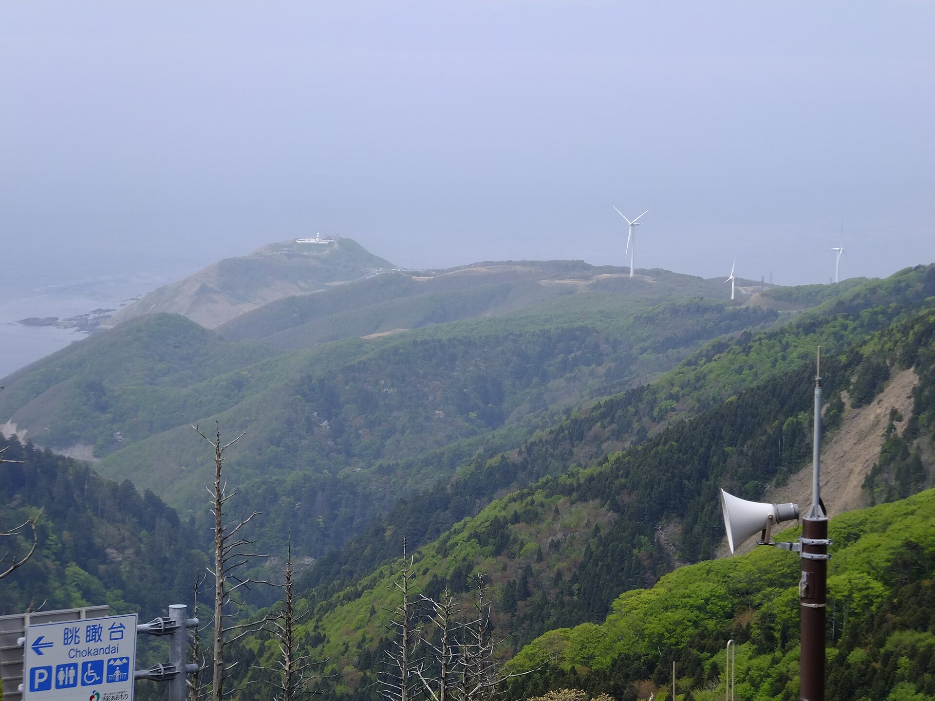
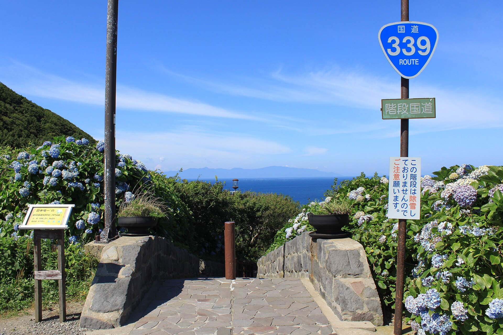
The northern tip of Aomori's Tsugaru Peninsula, where National Route 339 gives up asphalt and climbs the headland as a public staircase. A lighthouse, a hill of stone monuments and the Seikan Tunnel museum stand at the top.
- FromAomori Station
- ~3 hrRail + local bus
- Get off atTappi-zaki Todai bus stop (Sotogahama town loop bus)
- On foot
- Cape Tappi
The sweet spot
This is a well-known name in Aomori and coaches reach it through the summer, so it is not an undiscovered corner. What thins the numbers is distance. The railway north of Kanita has been out of service since the storm damage of August 2022, and the last two legs are local buses, so most day trips out of Aomori never get this far north.
Where it is
34 more notes in Aomori · open the map →What to look for — in walking order
- Tappi-zaki Lighthousea white tower on the clifftop, counted among Japan's fifty selected lighthouses
- Monument hilla rise of stone markers to Dazai Osamu, Yoshida Shoin and others, with a song monument that plays at the push of a button
- Seikan Tunnel Memorial Museumthe record house for the undersea tunnel, with a cable car down into the working shaft
- Stairway National Route 339the walking-only stretch of the national road, dropping from the lighthouse side to the harbour
- Tappi fishing harbourthe foot of the staircase, where the cape's houses and boats sit under the cliff
How to actually get there
- Aomori Station → Kanita Station (JR Tsugaru Line).
- Kanita → Minmaya (Sotogahama town replacement bus or shared taxi, standing in for the closed rail section).
- Minmaya → Tappi-zaki Todai (Sotogahama town loop bus, about 30 minutes).
- Tappi-zaki Todai → lighthouse and monument hill (walk about 7 minutes uphill), then down the stairway road to Tappi harbour.
- Rail to Kanita, then local buses
- From Aomori Station the JR Tsugaru Line runs as far as Kanita. North of Kanita the line has been closed since the rainstorm damage of August 2022, and Sotogahama town runs replacement buses and shared taxis toward Minmaya in its place. From Minmaya the town loop bus reaches the Tappi-zaki Todai stop in about 30 minutes. Trains and buses alike come only a few times a day, so allow most of a morning for the three legs.
- Return from Tappi-zaki Todai
- The way back retraces the same three legs: town loop bus to Minmaya, replacement service to Kanita, then the Tsugaru Line to Aomori. Every leg runs on a handful of departures a day, so settle the return before you walk down the steps. Sotogahama town reissues the replacement-service leaflet whenever the timetable changes.
About the place
The peninsula narrows here and simply stops above the Tsugaru Strait. National Route 339 runs up the cape from the fishing harbour toward the lighthouse, but that section is not a road at all. It is a staircase of 362 steps, 388.2 metres long, gaining about 70 metres of height. No car and no motorcycle can use it, which leaves it as the country's only stairway national road. Wind is the constant condition here, and the place name is usually read as the point where dragons take off. On a clear day the Matsumae Peninsula of Hokkaido lies across the water.
How to enjoy it
Take the stairway downhill rather than up. From the lighthouse side the whole flight reads as a single line to the harbour, and the climb back is the part worth skipping. Give the museum its own slot instead of squeezing it in, and treat the cape as a half day rather than a stop. Town buses run only a few times a day, so photograph the return timetable at the stop before you start down.
Background & history
For a long time the cape was a place to watch the strait rather than a place to visit, and the rise above the lighthouse carries stones for the people who came anyway. Yoshida Shoin, the late-Edo scholar, has one there. So does Dazai Osamu, who lodged at the inn below the cape while gathering material for his book on Tsugaru, and that building later served as the village's visitor house. Beneath the water runs the rail tunnel to Hokkaido, and the museum on the headland keeps the record of how it was driven through.
Before you go
- Cash
- The cape itself, the stairway road, the lighthouse grounds and the monument hill cost nothing. The Seikan Tunnel museum and its cable car are charged separately. Fares on the town bus and on the replacement service are paid on board, so carry cash.
- Before you go
- The stairway section of Route 339 is shut through the northern winter, and the Seikan Tunnel museum runs a season rather than opening year round. Wind is the defining condition of the cape and the clifftop is exposed in any month. The visitor house at the foot of the cape closed in spring 2026 by the town's notice, and enquiries now go to the museum.
- Another way
- By car, leave the Tohoku Expressway at the Aomori interchange, follow Route 280 north along Mutsu Bay and change to Route 339 for the cape. While the railway beyond Kanita is out of service, this is the more practical approach.
- After you get off
- Get off at Tappi-zaki Todai. It is about seven minutes uphill on the paved road to the lighthouse and the monument hill, and the top of the stairway national road opens just beyond them on the harbour side.