North Aomori · ShimokitaNo.1002★★★Open in map →
Oma Tuna
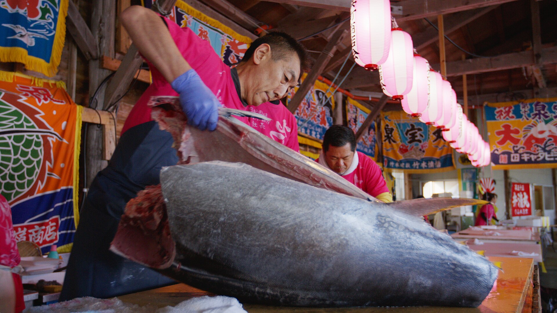
Oma Tuna is the co-operative's brand for bluefin landed at the top of Honshu. The cape it takes its name from is a wind-scoured point of rock and grass, with Hokkaido close enough to read across the strait.
- FromMutsu Bus Terminal
- ~100 minShimokita Kotsu bus from Mutsu
- Get off atOmazaki (Shimokita Kotsu, Sai line)
- From there
- Oma Tuna
Where it is
34 more notes in Aomori · open the map →What to look for — in walking order
- Omazaki Resthouserest stop beside the car park, doubling as the tourist information point
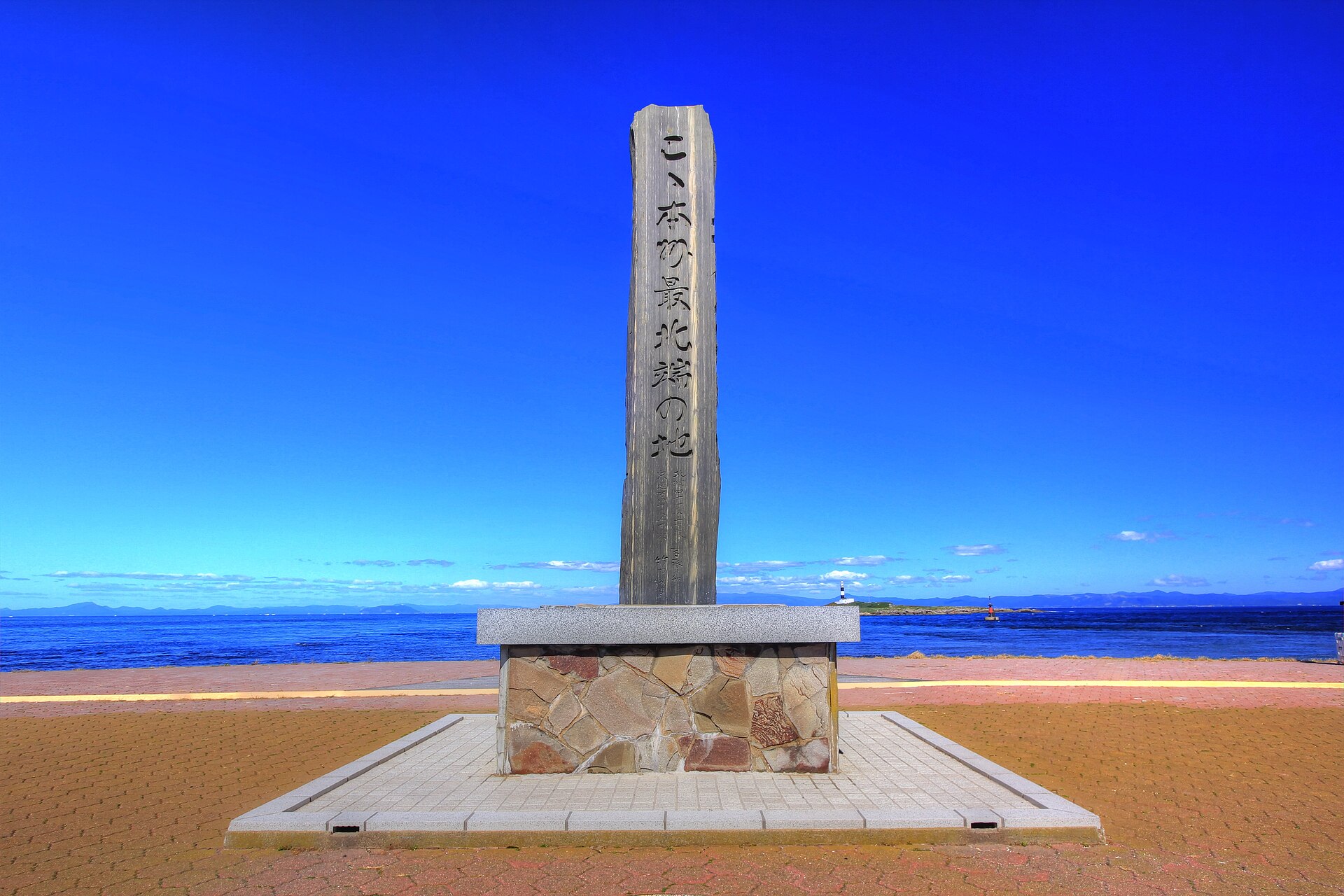
- Northernmost point of Honshu markerstone set on the grass at the very tip of the cape
- Tuna hand-line monumentsculpture of a bluefin arched over a fishing line
- Bentenjima and the Oma lighthouselow island offshore, carrying a shrine and the light
- Ishikawa Takuboku poem stoneverse stone close by the tip, read locally as being about the island
How to actually get there
- Aomori or Hachinohe → Shimokita Station (JR Ominato Line), then Mutsu Bus Terminal.
- Mutsu Bus Terminal → Omazaki (Shimokita Kotsu, Sai line).
- Walk out to the marker and the tuna monument at the tip.
- Back past the rest house for the certificate and the timetable home.
- Bus from Mutsu
- Shimokita Kotsu runs its Sai line west along the coast from Mutsu Bus Terminal to a stop at the cape itself. Mutsu is reached by the JR Ominato Line from Aomori and Hachinohe, getting off at Shimokita Station, and the bus terminal is the town's hub, so the whole trip is effectively one change. Departures are spread thinly through the day rather than running often.
- Back towards Mutsu
- The same coast road east, taking a little longer in that direction. Services thin out as the afternoon goes on, so the return time rather than the arrival is what decides the shape of the day. Read the board at the stop before you walk off.
About the place
The cape is the northernmost land on Honshu. Across the water, Hokkaido's Cape Shiokubi lies 17.5 kilometres off, and the strait between runs fast enough to keep the fish that pass through it hard and lean. Six hundred metres offshore sits Bentenjima, a low island carrying a shrine and the Oma lighthouse. Boats out of the port take bluefin here by hand-line through the day and by long-line at night. Any fish over the co-operative's 30-kilogram bar gets a numbered sticker on its cheek before it is shipped.
How to enjoy it
The tuna season runs from around August into January, and the big, fat fish come in as the water cools from autumn into winter. Outside that stretch the boats are after other things and the brand stickers are scarce. The cape itself has nothing to close, so what shapes the day is the bus, not an opening hour.
Background & history
The Oma Fisheries Co-operative registered the name as a regional collective trademark in 2007, fixing it to one port rather than leaving it to any boat that wanted it. Its reputation was made at the New Year auctions in Tokyo, where in 2019 a 278-kilogram fish from Oma sold for 333.6 million yen. The cape carries an older marker of the same trade: a tuna arched over a hand-line, set on the grass above the water.
Before you go
- Cash
- Nothing is charged for the cape, the marker or the monument. The shops by the car park sell a printed certificate of arrival at Honshu's northern tip, and the stalls are small, so cash is the safe assumption. What is on sale depends on what came in, and the stock changes with the season.
- Before you go
- The tip is exposed and the wind off the strait is constant. In winter the crossing to Hakodate can be held in port. The tuna boats do not fish year-round, and out of season the bus timetable becomes the real limit on a visit.
- Another way
- From Hokkaido the crossing is short: Tsugaru Kaikyo Ferry links Hakodate and Oma in about 90 minutes, the shortest sea route between the two islands. From the ferry terminal the cape is a walk along the shore, and the same bus route passes that way.
- After you get off
- The bus sets down at the cape's car park, in front of the rest house. The marker and the monument are a short walk out across the grass, with the island in view the whole way.