Nagasaki · Tsushima StraitNo.1237★★Open in map →
Tsushima Island
A long, ridged island in the strait between Kyushu and Korea, nearer to Busan than to Fukuoka. Boats from Hakata land at Izuhara in the south; the drowned inlets of Aso Bay and a lookout facing Korea lie north of it.
- FromHakata Port, Fukuoka
- ~2 hr 15 minKyushu Yusen jetfoil, ~2 hr 15 min
- Get off atIzuhara Port (Kyushu Yusen)
- From there
- Tsushima Island
The sweet spot
Tsushima is not undiscovered. It is a port of entry with customs and immigration, and the route from Busan lands foreign visitors directly on the quay. What keeps it unhurried is distance and shape: the sights sit far apart along one winding road, so the island absorbs its visitors instead of concentrating them in a single street.
Where it is
Open Nagasaki in the map →What to look for
- Izuharathe port town at the southern end, once the castle town of the So lords and still the island's centre
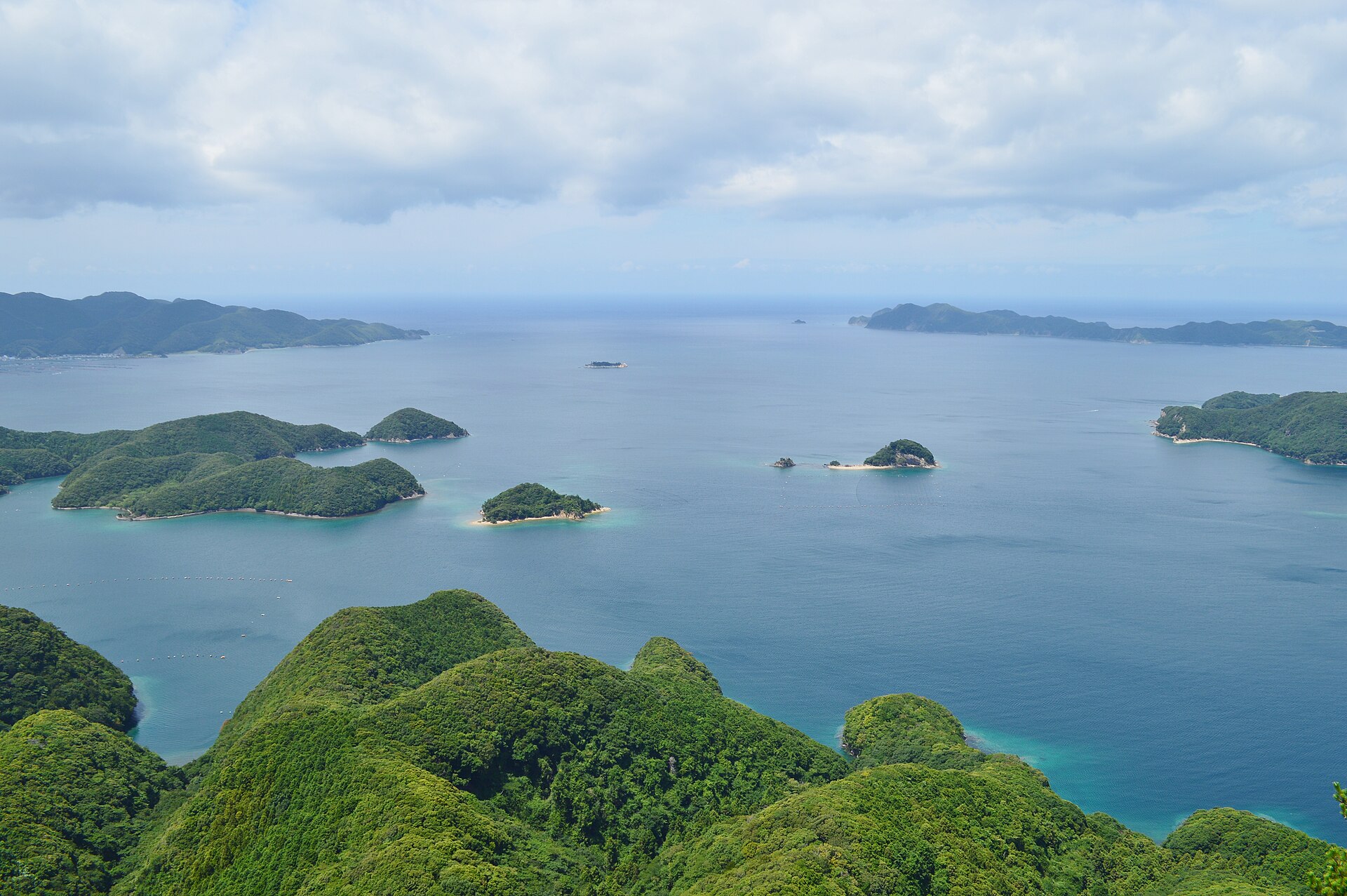
- Aso Baya drowned valley in the middle of the island, its inlets and wooded islets inside a quasi-national park
- Kaneda Fortressstone walls and natural cliff on Mount Jo, a special national historic site above the bay
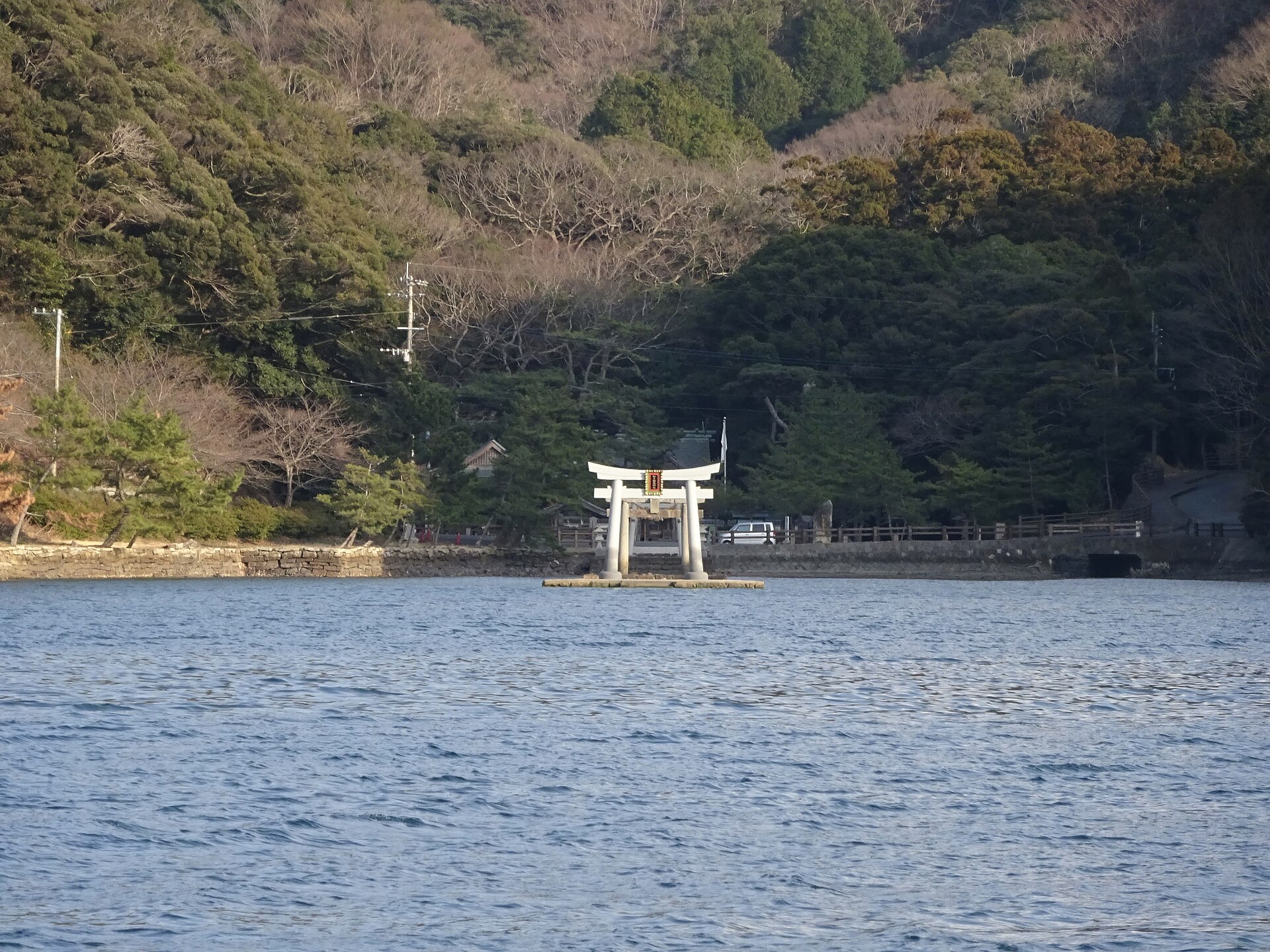
- Watatsumi Shrinea shrine at Nii on the bay, its torii standing out into the water as the tide moves
- Korea Lookouta deck at the northern tip built in Korean style, facing Busan across the strait
How to actually get there
- Hakata Port (Hakata Futo) → Izuhara Port (Kyushu Yusen jetfoil via Iki, about 2 hr 15 min; the car ferry on the same line takes roughly twice as long).
- Izuhara Port → the town centre, a few minutes on foot, or straight to a car-hire desk booked in advance.
- Izuhara → north on Route 382 for Aso Bay, Watatsumi Shrine and, at the far tip, the Korea Lookout.
- Come back to Izuhara for the boat, or fly out of Tsushima Yamaneko Airport on the way south.
- Kyushu Yusen from Hakata Port
- Hakata Port →(Kyushu Yusen jetfoil, about 2 hr 15 min, calling at Iki on the way)→ Izuhara Port. The same line is also worked by a car ferry that takes roughly twice as long and sails at night as well as by day. Sailings are seasonal and the pattern changes from month to month, so check the operator's timetable for your date before fixing anything on the island.
- Back to Hakata, or out by air
- Boats for Hakata leave from the same terminal at Izuhara. Tsushima Yamaneko Airport, north of the town, has flights to Fukuoka and to Nagasaki and is the quick way off the island. Either way, settle the return before you arrive: seats and car-deck space are limited, and rough weather in the strait can cancel a sailing outright.
About the place
Tsushima is a long, ridged island set in the strait between Kyushu and the Korean Peninsula, 49.5 kilometres from the Korean coast at its nearest point. Hills cover almost all of it, and the sea cuts deep into the middle at Aso Bay, a drowned valley whose inlets and wooded islets give the island its shape on a map. One main road runs the length of the island, from Izuhara in the south to Hitakatsu at the northern tip, with side roads dropping from it to the water. Bus services exist but are thin, so distance here is measured in driving time.
How to enjoy it
Give the island two nights rather than one: the run from Izuhara to the northern tip and back fills a day on its own, and the sailings eat half a day at either end. If Watatsumi Shrine is on the list, read the tide table before setting out, because the water decides what the torii look like. When the weather turns, the streets of Izuhara hold a day by themselves.
Background & history
Tsushima has been the forward edge of Japan toward the continent for as long as there are records of it. Fearing invasion from Tang China and Silla, the court walled a ridge above the south shore of Aso Bay in 667 and put a garrison on it. Mongol fleets came ashore here first, in the thirteenth century. In the Edo period the So lords of Tsushima held the shogunate's only sanctioned trade with Korea, and the Joseon embassies to Japan passed through Izuhara on their way east.
Before you go
- Cash
- Izuhara is the administrative centre of the island, with the city hall and the post office beside the port, so it is the place to draw cash and clear errands before heading north. Tickets are sold at the terminal counter; note that only the jetfoil can be reserved through the operator's website.
- Before you go
- The strait is the weather here. Wind and swell cancel the jetfoil more often than the ferry, and a cancelled boat can undo a same-day plan. Inland roads are narrow and unlit. The island's wildcat, which the airport is named after, moves at night, so drivers are asked to slow down once it is dark.
- Another way
- By air, Fukuoka and Nagasaki both serve Tsushima Yamaneko Airport, which sits between Izuhara and the middle of the island, with a Tsushima Kotsu bus running south from it toward the town. The island's other port, Hitakatsu at the northern tip, also takes ferries from Hakata — landing there and driving south reverses the usual order.
- After you get off
- Boats berth at the Izuhara terminal on the north side of the harbour. The exit leads onto the harbour road, and the town's main street, the city hall and the bus stands are a few minutes' walk from there. Car-hire desks are close by, but arrange the car before you sail rather than on arrival.