Northeast Hiroshima · TaishakukyoNo.614★★Open in map →
Taishakukyo Gorge
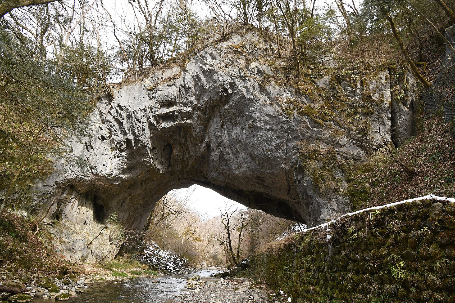
A limestone canyon on the boundary of Shobara and Jinsekikogen, cut by the Taishaku River. Its centrepiece is Onbashi, a natural rock arch left standing when the river found a lower course. The southern half is filled by a reservoir.
- FromTojo Station (JR Geibi Line)
- ~1 hrTaxi from Tojo, then a trail
- Taishakukyo Gorge
The sweet spot
No scheduled bus reaches the gorge, so arrivals are by car or taxi, and the two halves are approached by separate roads, which spreads visitors out. The prefecture and the Shobara tourism body document it thoroughly in Japanese; in English there is almost nothing.
Where it is
25 more notes in Hiroshima · open the map →What to look for
- Hakuundo Cavea limestone cave with about 200 metres of it opened to visitors
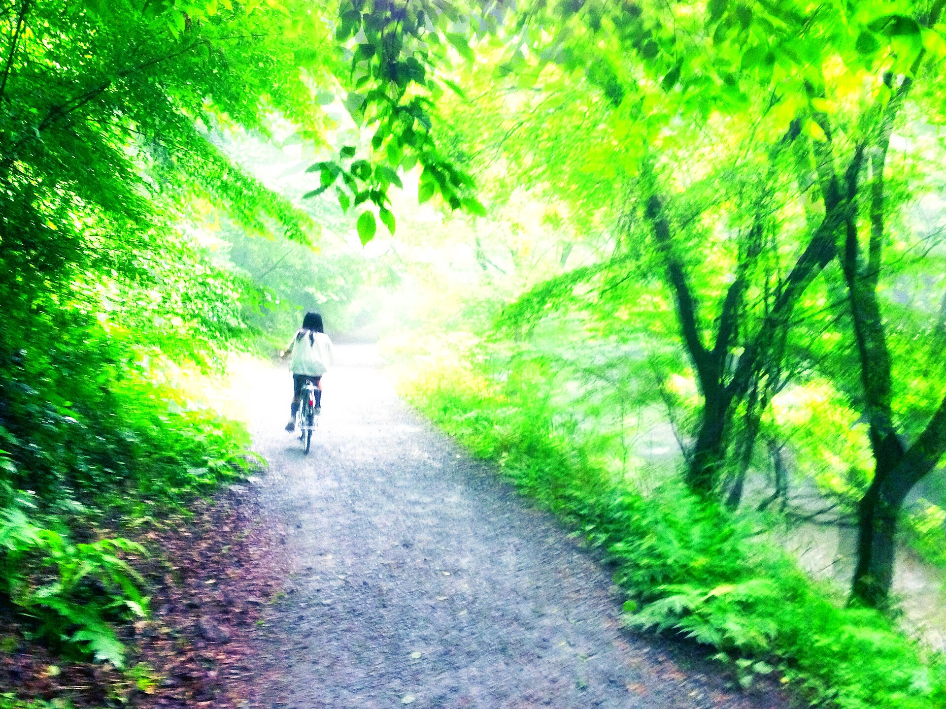
- The Kami-Taishaku trailthe riverside footpath through the upper gorge, also ridden on rental bicycles
- Onbashia natural limestone arch about 90 metres long, standing some 40 metres above the river
- Lake Shinryuthe reservoir filling the lower gorge, worked by sightseeing boats
How to actually get there
- Hiroshima Bus Center → Tojo (Bihoku Kotsu highway coach, about two and a half hours).
- Tojo Station → Kami-Taishaku car park (taxi or rental car, Prefectural Route 23).
- Car park → Hakuundo Cave, then on along the riverside path.
- Riverside path → Onbashi (about 30 minutes on foot), then back the same way.
- Taxi or car from Tojo Station
- Tojo Station on the Geibi Line is the nearest railway stop. There is no scheduled bus to the gorge, so it is a taxi or a rental car from here. The Kami-Taishaku car park lies about 10 kilometres from the Tojo interchange on the Chugoku Expressway, along Prefectural Route 23. From the car park, the trail to Onbashi is about a thirty-minute walk.
- Returning from Tojo
- The Geibi Line through Tojo runs only about three round trips a day toward Bingo-Ochiai, so settle the return before you leave the station. Bihoku Kotsu's highway coach between Hiroshima and Tojo is the more dependable way back; book the taxi to meet it.
About the place
The Taishaku River has worked down through a limestone plateau in the north-east corner of Hiroshima, leaving a canyon roughly 18 kilometres long. It is not one place but two. The upper reach, Kami-Taishaku, is walked on a footpath among caves and rock arches; the lower reach is flooded by Lake Shinryu, where sightseeing boats work the water. Both lie inside the Hiba-Dogo-Taishaku Quasi-National Park. The prefecture's park pages put the plant communities peculiar to limestone country alongside the rock formations as the reason to come. The two halves are far enough apart that you pick one.
How to enjoy it
From the Kami-Taishaku car park the walk to Onbashi takes roughly thirty minutes each way, so allow half a day for the upper gorge on its own. Check the Shobara tourism site before you set out: at the last confirmation, rockfall had closed the stretch north of Onbashi. If the path is shut, the lower half and its boat route make the better use of the day.
Background & history
Water cut this canyon, not people — but the lower half was remade by hand. In the Taisho era a dam on the Taishaku River backed the water up into Lake Shinryu. Part of the gorge went under, and the boat route that runs there today took its place. The whole reach was later taken into the Hiba-Dogo-Taishaku Quasi-National Park, and the prefecture treats the canyon as the park's principal scenic district. Limestone dissolves in water; this landscape is what that property makes over time.
Before you go
- Cash
- The gorge itself is open country and costs nothing to walk. Hakuundo Cave and the Lake Shinryu boats are run as paid attractions and their charges and seasons change, so check them on the day. Carry cash for the taxi.
- Before you go
- When the Shobara tourism site was last checked, rockfall had closed the stretch running from the north side of Onbashi to Shunuri Bridge. That notice carries a date and is kept updated there, so read it before you set out. This is highland country and the route is a river path.
- Another way
- The lower half is reached separately. Lake Shinryu sits at the southern end of the canyon on the Jinsekikogen side, and the sightseeing boats work from there.
- After you get off
- Taxis drive in as far as the Kami-Taishaku car park. The upper-gorge footpath begins at the far end of it and follows the river.