West Aizu · MishimaNo.579★★Open in map →
Tadami Line First Bridge Viewpoint
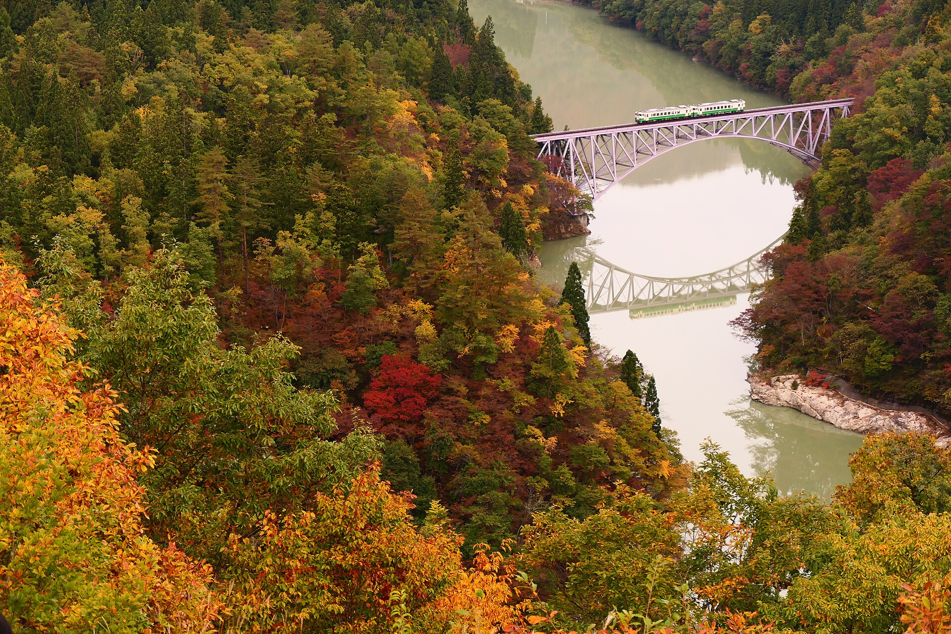
A signposted footpath on the ridge above the Tadami river in Mishima, looking down on the Tadami Line's first arch bridge. Lookouts are cut into the slope on the way up, with no gate and no fee, and the path starts from a roadside station car park on Route 252.
- FromAizu-Miyashita Station (JR Tadami Line)
- ~45 min on footJR Tadami Line + hill path
- Tadami Line First Bridge Viewpoint
The sweet spot
This is not an unknown place. It is on prefectural posters and in the town's own leaflets, and photographers arrive for the good trains. What thins out is timing: between passing times the ridge empties, and the cold half of the year brings mist off the reservoir that most visitors never plan for.
Where it is
20 more notes in Fukushima · open the map →What to look for — in walking order
- Oze Kaido Mishima-juku roadside stationthe Route 252 car park and information board where the footpath is signposted
- The Kawai tunnel portal patha short level stretch from the east side of the car park to the foot of the steps
- The lower lookoutstwo cuttings on the way up, each with a wider frame on the river bend than the last
- The ridge-top lookoutthe highest platform, looking straight down the arch and its reflection
How to actually get there
- Aizu-Wakamatsu Station → Aizu-Miyashita Station (JR Tadami Line; only a few services a day, so check the timetable first).
- Aizu-Miyashita Station → Oze Kaido Mishima-juku roadside station (walk about 45 minutes along Route 252).
- Car park → trail entrance (the footpath leaves from the east side, left of the Kawai tunnel portal, and reaches steps).
- Climb the ridge past the lower lookouts to the top one, timing your arrival to a posted train.
- JR Tadami Line up the valley from Aizu-Wakamatsu
- Take the JR Tadami Line from Aizu-Wakamatsu to Aizu-Miyashita. Only a handful of trains run each way per day, so the timetable, not your pace, decides the shape of the visit. The ride up the Tadami valley is itself the reason many people come. From Aizu-Miyashita the viewpoint is a walk of about 45 minutes along Route 252.
- Return from Aizu-Miyashita Station
- Walk back down to Route 252 and on to Aizu-Miyashita for the return train. Because services are sparse, fix your return before you set out rather than after you come down the ridge. If you would rather not walk the last stretch twice, the bus back to the station runs on advance booking — ask the roadside station staff while you are still there.
About the place
The path starts behind the car park of the Oze Kaido Mishima-juku roadside station, on National Route 252 in Mishima, and climbs the wooded ridge above the Komanakase tunnel portal. Three lookouts are cut into the slope, and each one opens the frame a little wider on the arch below. From the top the river bends away in both directions and the bridge sits in the middle of it. The valley here belongs to the Echigo-Sanzan Tadami Quasi-National Park, so the far bank is forest with no buildings on it. The bridge itself is a steel arch that carries a single track and nothing else.
How to enjoy it
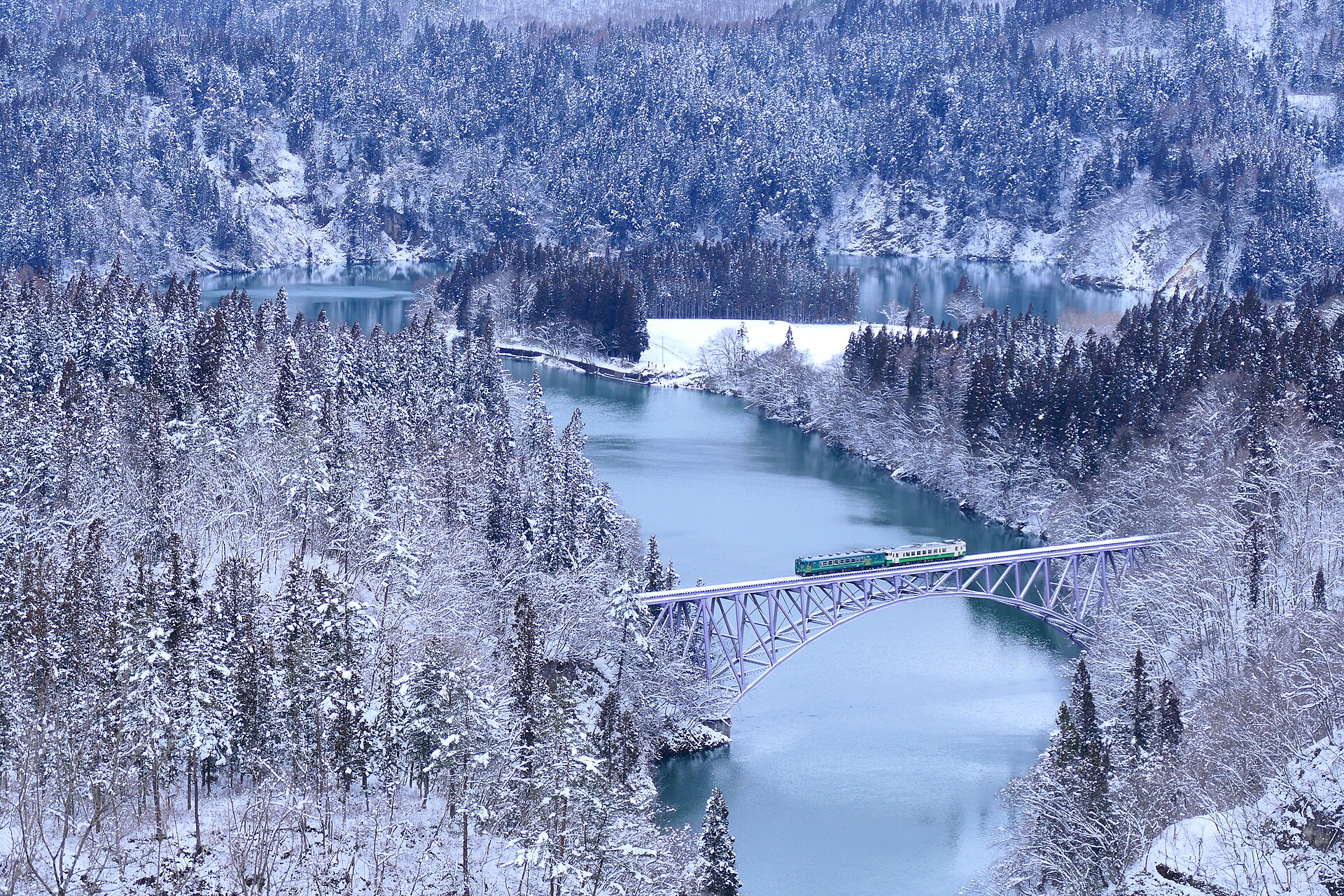
Read the train passing times published by the town before you climb, then pick a service and be in place a few minutes early — the crossing takes seconds. Cold mornings are the reason many photographers come, because mist rises off the water and wraps the arch. If you are travelling by train rather than car, work backwards from your return service, since the walk from the station eats most of an hour each way.
Background & history
The bridge belongs to a line that nearly did not survive. Heavy rain across Niigata and Fukushima in July 2011 washed out spans further upstream and cut the Tadami Line in two; through running was only restored on 1 October 2022, eleven years later, under an arrangement in which Fukushima Prefecture owns the track and JR East runs the trains. In 2021 the Japan Society of Civil Engineers listed seventeen structures on the line, this arch among them, as heritage of civil engineering. The town cut the ridge footpath in the meantime, so the view has outlasted the closure.
Before you go
- Cash
- The footpath and the lookouts are free and have no gate. Leave a car at the roadside station car park. The Tadami Line does not accept IC travel cards anywhere on the route, so carry cash for the fare.
- Before you go
- The path is an earth ridge trail with steps, unlit, and it is closed when the snow is heavy. Winter is also when the river mist is at its best, so check the town's notices before travelling rather than assuming access. Rental bicycles at the station are a warm-season service only.
- Another way
- By car it is about twenty minutes from the Aizu-Bange interchange on the Ban-etsu Expressway to the roadside station car park. A town bus also links Aizu-Miyashita Station with the roadside station, but it does not run on Sundays or public holidays.
- After you get off
- From Aizu-Miyashita Station follow Route 252 north-east along the river for about 45 minutes to the Oze Kaido Mishima-juku roadside station, then take the signposted footpath from the east side of the car park and climb.