Hokkaido · NakashibetsuNo.867★★Open in map →
Kaiyodai Observatory
— Lookout over the Konsen dairy plateau
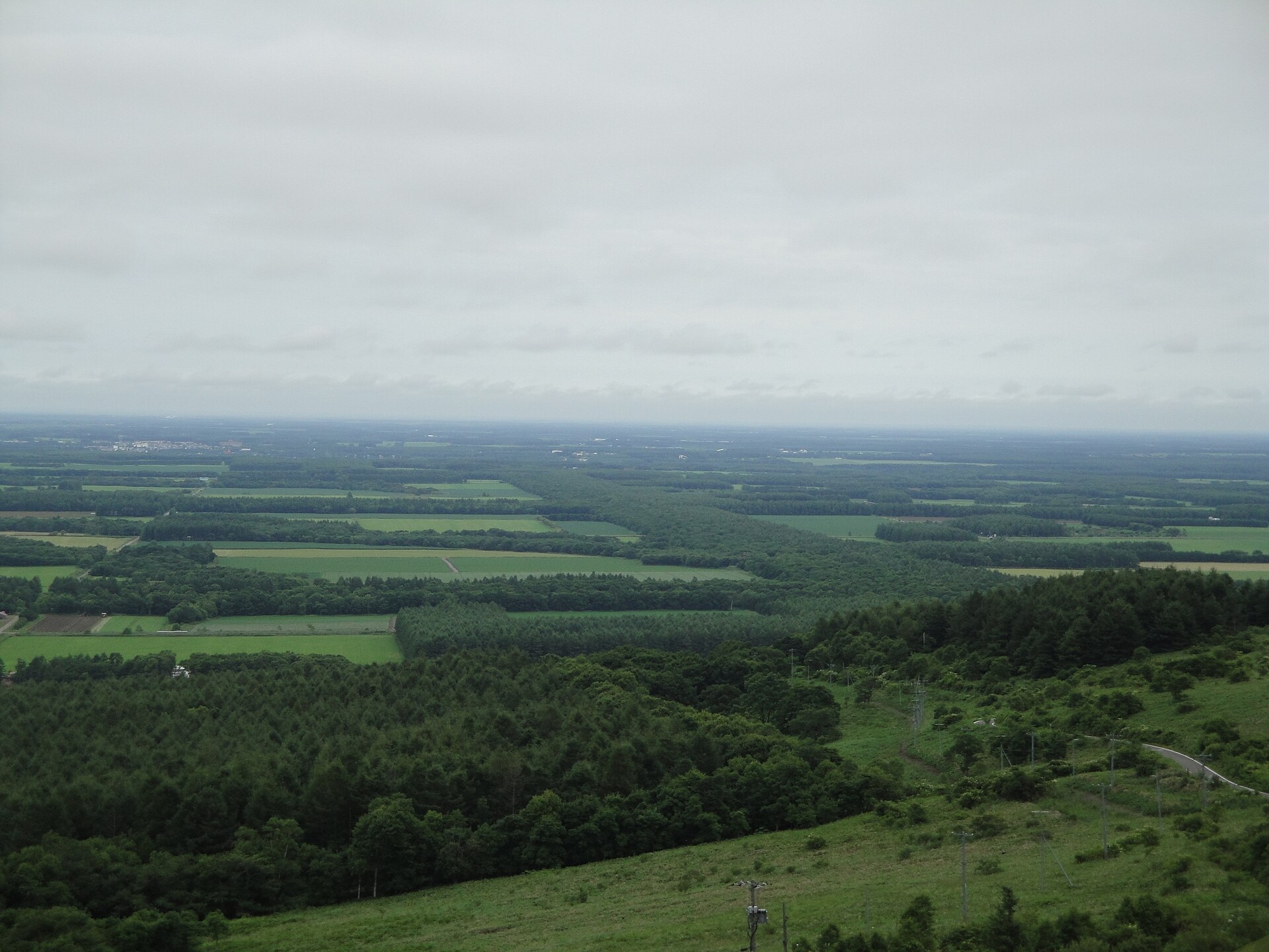
A lookout on the dairy plateau east of Nakashibetsu, where the horizon runs unbroken over pasture and grid-planted windbreak forest. The building below shuts for the winter; the deck on its roof never closes.
- FromNakashibetsu Airport (Nemuro-Nakashibetsu)
- ~15 minHire car from the airport
- Kaiyodai Observatory
The sweet spot
Kaiyodai is not a secret. It is the town's own landmark and the finish line of a motorcycling route that has been famous since the 1980s. What thins the crowd here is the clock rather than the season. The building keeps office hours and closes for the winter, while the roof deck and the car park stay open the whole year, so the hours when the plateau is quietest are exactly the hours the café below is shut.
Where it is
102 more notes in Hokkaido · open the map →What to look for — in walking order
- The Milk Road (Kita-19)the straight dairy-tanker road that runs up to the rise, and the reason motorcyclists come
- Kaiyodai Observatory buildingtwo floors under the deck, with a café using milk from the plateau and a photo gallery above it
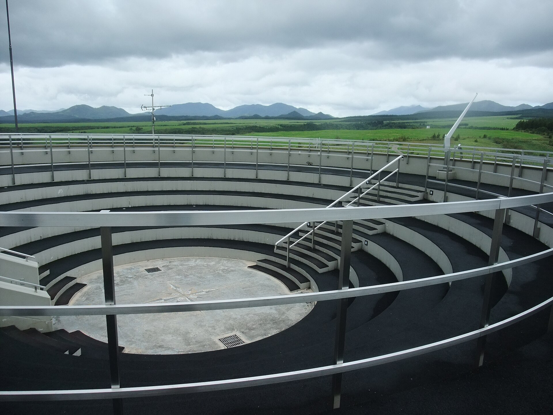
- The roof deckopen circle of paving with telescopes, unlocked all year, above the closed building in winter
- The grid windbreaksdark belts of trees ruled across the pasture, listed as Hokkaido Heritage
- Kaiyodai pasture groundgrazing land on the west side of the rise, with a marked path through the grass and birdlife
How to actually get there
- Nakashibetsu Airport → Kaiyodai by hire car, on the road signed for the lookout.
- Park at the foot of the building; the car park and its toilets stay open through the year.
- Take the stairs to the roof deck first for the full circle, then the gallery floor below it for the local photography.
- Drive back down Kita-19, the Milk Road, and stop on the straight for the view back up towards the rise.
- Hire car from Nakashibetsu Airport
- There is no bus to Kaiyodai, and the town says so plainly on its own page, so the journey is a hire car, a taxi or your own motorcycle. The airport counters are the usual starting point. The road runs out through the edge of town and then climbs steadily onto the plateau.
- Back down the same road
- The return is the same road into Nakashibetsu and on to the airport. Nothing runs up here after dark and the deck has no lighting, so if you stay for the stars you are driving back on an unlit country road with deer about.
About the place
Kaiyodai is a low rise on the Konsen plateau east of Hokkaido, standing about 270 metres above sea level on the edge of the town of Nakashibetsu. From the deck the ground falls away into grass in every direction, and the town advertises a 330-degree view, the missing arc being the bulk of Mount Musa behind. What you are looking at is working farmland rather than wilderness: pasture, milking sheds, and the dark belts of windbreak forest that were planted across the plateau in a grid. Those belts carry a Hokkaido Heritage listing of their own. After dark the same deck becomes one of the easiest star fields in the country to stand under.
How to enjoy it
Try to be here twice in one day. Late afternoon, when the light rakes low across the grass, is when the grid of the windbreaks reads most clearly. After dark the same deck turns into a star field, because the nearest street lighting is a long way off. The building keeps daytime hours, roughly ten in the morning until half past four, and the roof above it does not, which is the whole trick of the place.
Background & history
The plateau was cleared for dairy farming, and the rise above the town was turned into a viewpoint by the local authority in the post-war decades, once a broadcast relay station on the hill had shown how far the eye reached from it. It became a pilgrimage for motorcyclists after the novelist Jo Sasaki set his 1982 touring novel here, and riders have been coming up the straight road ever since. The windbreak grid below was planted to hold the soil against the plateau wind, and was recognised later as Hokkaido Heritage.
Before you go
- Cash
- There is no admission for the deck, the car park or the toilets. The café on the ground floor of the building is the only thing you are likely to pay for, and it is a small rural counter, so carry cash as well as a card.
- Before you go
- The building opens for the green season, from the end of April to the start of November, and closes for the winter. The roof deck, the car park and the toilets are open all year. Fog and low cloud can erase the entire view within minutes, and bad weather can close the building on a day it should be open.
- Another way
- From the Shiretoko side the plateau is reached on the road in from Shibetsu. From the south, Nakashibetsu is the junction town for traffic between Kushiro and Nemuro, and hire cars are available in the town as well as at the airport.
- After you get off
- The airport sits east of Nakashibetsu and the lookout west of it, so the drive crosses the town and then climbs. At the top the car park lies directly below the building, and the deck is one flight of stairs above that.