East Izu · ItoNo.792★★Open in map →
Jogasaki Coast
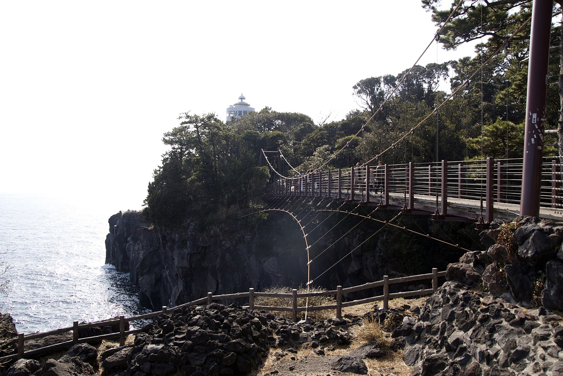
A wall of lava cliffs on the east coast of Izu, laid down when Mount Omuro erupted and its flow reached the sea. A suspension bridge and a lighthouse stand at the busiest point, with footpaths running the length of the shore.
- FromIto Station
- ~30-35 min walkIzukyu Line, then a coast walk
- Get off atJogasaki-Kaigan Station (Izukyu Line)
- From there
- Jogasaki Coast
The sweet spot
This is a well-known stop on the east coast, not a secret one, and the section by the bridge fills up through the day. The coast is long, though, and most visitors see only the few hundred metres nearest the car park. Walking on in either direction gives you the same lava cliffs with far fewer people, which is a matter of distance rather than obscurity.
Where it is
16 more notes in Shizuoka · open the map →What to look for — in walking order
- The lane from the stationa signed residential street that narrows into a footpath through pine and scrub
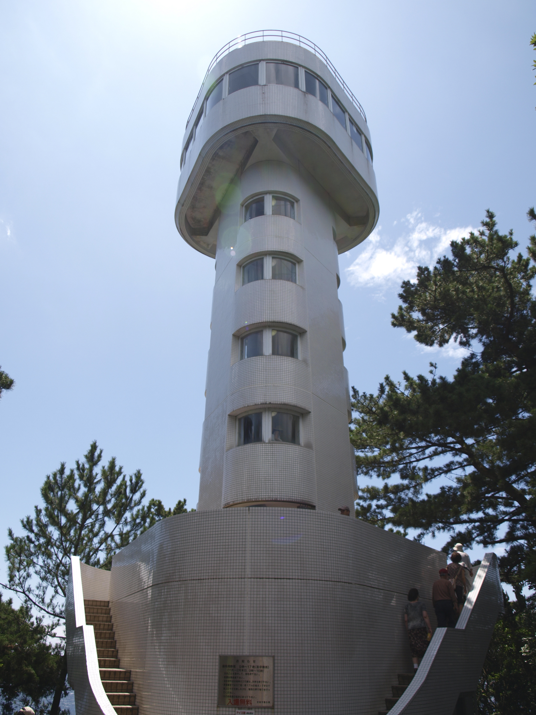
- Kadowakisaki Lighthousea working light on the headland with an observation floor looking out to the Izu islands
- Kadowaki Suspension Bridgeforty-eight metres across an inlet, twenty-three metres above the water
- The lava shelves belowflat black rock where the flow stopped, with anglers out on the ledges
- The cliff path beyondthe same course continuing above the inlets, quiet within minutes of the bridge
How to actually get there
- Atami or Ito → Jogasaki-Kaigan Station (Izukyu Line).
- Jogasaki-Kaigan Station → the cliff-top course on foot, following the signs seaward.
- Kadowakisaki Lighthouse → Kadowaki Suspension Bridge, then on along the Picnical Course.
- Back to the station on the same path, or take the coast bus down to Ito.
- Izukyu Line from Ito
- Ito Station is where the JR Ito Line hands over to the Izukyu Line running down the east coast, and Jogasaki-Kaigan is a few stops south. From the station the route to the bridge is signposted and takes around half an hour on foot, first through a residential lane and then on the cliff path. Trains are less frequent than on a city line, so read the departure board before you leave the platform.
- Return from Jogasaki-Kaigan Station
- Walk back the way you came and take the Izukyu Line north to Ito, where JR services continue to Atami and the Shinkansen. Departures thin out on this stretch in the evening, and the cliff path has no lighting at all, so fix a return train before you set off and turn back with daylight still in hand.
About the place
Jogasaki is not a beach. The shore southeast of Ito is a wall of dark rock, notched by small headlands and inlets, and the sea works at the foot of it all day. The rock is lava. When Mount Omuro erupted inland, the flow ran east and pushed the coastline out into the Sagami Sea, and what cooled there is the ground you walk on. Two linked footpaths run along the top of it, the Picnical Course and the Nature Trail, about nine kilometres of cliff edge between them. The crowded part is short: the stretch around the lighthouse and the suspension bridge, where the car park is.
How to enjoy it
Give this a couple of hours rather than half an hour. The walk out from the station takes about that long each way, so the part worth the trip, the cliff path on either side of the bridge, needs time of its own on top. Late afternoon light comes across the water from behind you and the rock reads black rather than grey.
Background & history
The coast is roughly four thousand years old, which is young for a landscape. Mount Omuro, the smooth grass cone standing inland, built itself in that eruption and sent lava east until it met the sea and set. Everything else here is later and human. A bridge was strung across one of the inlets, a lighthouse went up on the headland beside it with a floor open to visitors, and the two footpaths were cut to join them. The Izu Peninsula Geopark treats the whole shore as one exhibit of a single eruption.
Before you go
- Cash
- The shore, the bridge and the lighthouse observation floor are open without a ticket. The city car park at Kadowaki is the main parking and it is charged, with the first fifteen minutes free and a flat rate after that as published by the tourism association. Bring coins for the machine.
- Before you go
- There is no lighting on the cliff path and no barrier along much of the edge. The lava is uneven underfoot and stays slippery after rain, and swell breaks over the lower shelves in bad weather, so stay off the rock when the sea is up. The bridge is exposed and the spray reaches it in a strong onshore wind.
- Another way
- Buses run from Ito Station down the coast to the Jogasaki area and set down closer to the bridge than the train does. By car the tourism association directs drivers off the Tomei at Atsugi from the Tokyo side and at Nagaizumi-Numazu from the Nagoya side, then to the city car park at Kadowaki.
- After you get off
- Leave Jogasaki-Kaigan Station on the sea side and follow the signed lane downhill. It becomes a footpath through the pines and then joins the cliff-top course; turn left at the coast for the lighthouse and the bridge. The last stretch is unpaved and uneven, so wear shoes rather than sandals.