Central Hokkaido · UryuNo.967★★Open in map →
Uryunuma Wetland
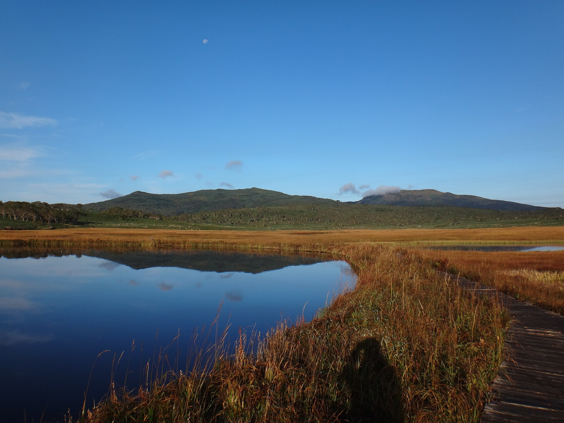
A high plateau of peat and small pools in central Hokkaido, reached only on foot from a gravel-road trailhead. It is a Ramsar-listed wetland inside a quasi-national park, and the way in is open for a few months a year.
- FromTakikawa Station
- ~1 h 20 min to trailheadBus then taxi — no bus to trailhead
- Get off atUryunuma Wetland Gate Park (trailhead, car or taxi only)
- From there
- Uryunuma Wetland
The sweet spot
Japanese hikers know this wetland well — it is Ramsar-listed and sits inside a quasi-national park, so it is not undiscovered. What keeps it uncrowded is the way in: no bus serves the trailhead, the second half of the approach road is gravel, and the route is only open for part of the year.
Where it is
102 more notes in Hokkaido · open the map →What to look for — in walking order
- Gate Park trailheadthe hut where every walker files an entry form before starting up the trail
- The suspension bridgea bridge on the climb that the town removes once the season closes
- The wetland terracea rest deck at the point where the trail reaches the edge of the peat
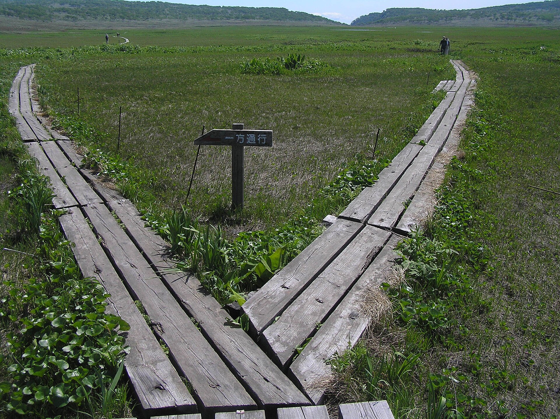
- The boardwalk and the poolsa raised walkway among more than a hundred pools called chito
- The lookout above the marsha viewpoint on the slope above, looking back across the whole plateau
How to actually get there
- New Chitose Airport or Sapporo → Takikawa Station (JR limited express).
- Takikawa Station → Uryu (Sorachi Chuo Bus, Fukataki line via Uryu, or Hokkaido Chuo Bus, Takikawa–Hokuryu line).
- Uryu → Uryunuma Wetland Gate Park (taxi or rental car; roughly 26 kilometres, gravel and narrow beyond the Shokan dam).
- Gate Park → the wetland terrace (on foot up the marked trail; file the entry form before starting).
- JR to Takikawa, bus to Uryu, then taxi
- Take a limited express to Takikawa Station, then a Sorachi Chuo Bus service on the Fukataki line via Uryu, or a Hokkaido Chuo Bus service on the Takikawa–Hokuryu line, and get off at Uryu. No bus continues from there. A taxi or rental car covers the last leg to the Gate Park trailhead, which Uryu Town lists at about fifty minutes. Taxi operators in the town are few, so book the ride instead of turning up and hoping.
- Work the descent back from the bus
- Set your turnaround time from the return taxi and the last bus from Uryu to Takikawa, which is a rural service with few runs a day. Agree the pick-up time before you set off: mobile signal is poor at the Gate Park, on the plateau and on Mount Minami-Shokan, so you cannot call for a car from up there.
About the place
Uryunuma sits at about 850 metres on the eastern shoulder of Mount Shokanbetsu, in the town of Uryu. The wetland spreads roughly four kilometres east to west and two kilometres north to south, over a plateau of basalt lava where peat has built up on the flat rock. Pools called chito lie scattered across that peat, and a boardwalk carries walkers over it. There is no road in. The last stretch is a marked trail that starts at the Gate Park, at the end of a long forest road. Hokkaido Government maintains the boardwalk, and walkers are asked to stay on it.
How to enjoy it
The way in is open only for a stretch of summer — roughly late June to early October, with the exact opening date announced by the town each year. Flowers turn over inside that window: skunk cabbage and marsh marigold at the start, orange day lilies and irises at the height of it, gentians at the end. This is brown bear country, so the town asks walkers to carry a bell, avoid going alone, and stay off the trail in the dim hours at either end of the day.
Background & history
The plateau is the top of a fluid basalt lava flow, and the wetland is a peat bog that formed on that flat rock; the pools sit in hollows in the peat. Uryunuma was taken into the Shokanbetsu-Teuri-Yagishiri Quasi-National Park when the park was designated in 1990. In 2005 the Ministry of the Environment added it to the Ramsar list of wetlands of international importance. Hokkaido Government, which manages the park, has laid and rebuilt the boardwalk that crosses the peat.
Before you go
- Cash
- Uryu Town asks every walker to file an entry form at the Gate Park, and asks adults for a contribution towards environmental upkeep; the current amount is published on the town's page. There are no shops on the mountain and the tap water around the Gate Park is not for drinking, so carry what you need. A drinks machine stands inside the Minami-Shokanso hut.
- Before you go
- Outside the open season the town takes out the suspension bridge on the trail, so the route cannot be walked at all. Snow arrives on the plateau once autumn sets in, and the forest road can close after heavy rain. Bear sightings are posted on the town's site through the summer — read them before the drive.
- Another way
- From Asahikawa Airport, take a bus to Asahikawa Station, a train to Fukagawa, then a Sorachi Chuo Bus service via Uryu. Note that Fukagawa Station and the Fukagawa Jujigai bus stop are apart, so leave room for the change.
- After you get off
- From the Gate Park the marked trail climbs about three and a half kilometres to the edge of the wetland. A rest terrace marks the point where the boardwalk begins.