Miyako Islands · TaramaNo.688★★Open in map →
Tarama Island
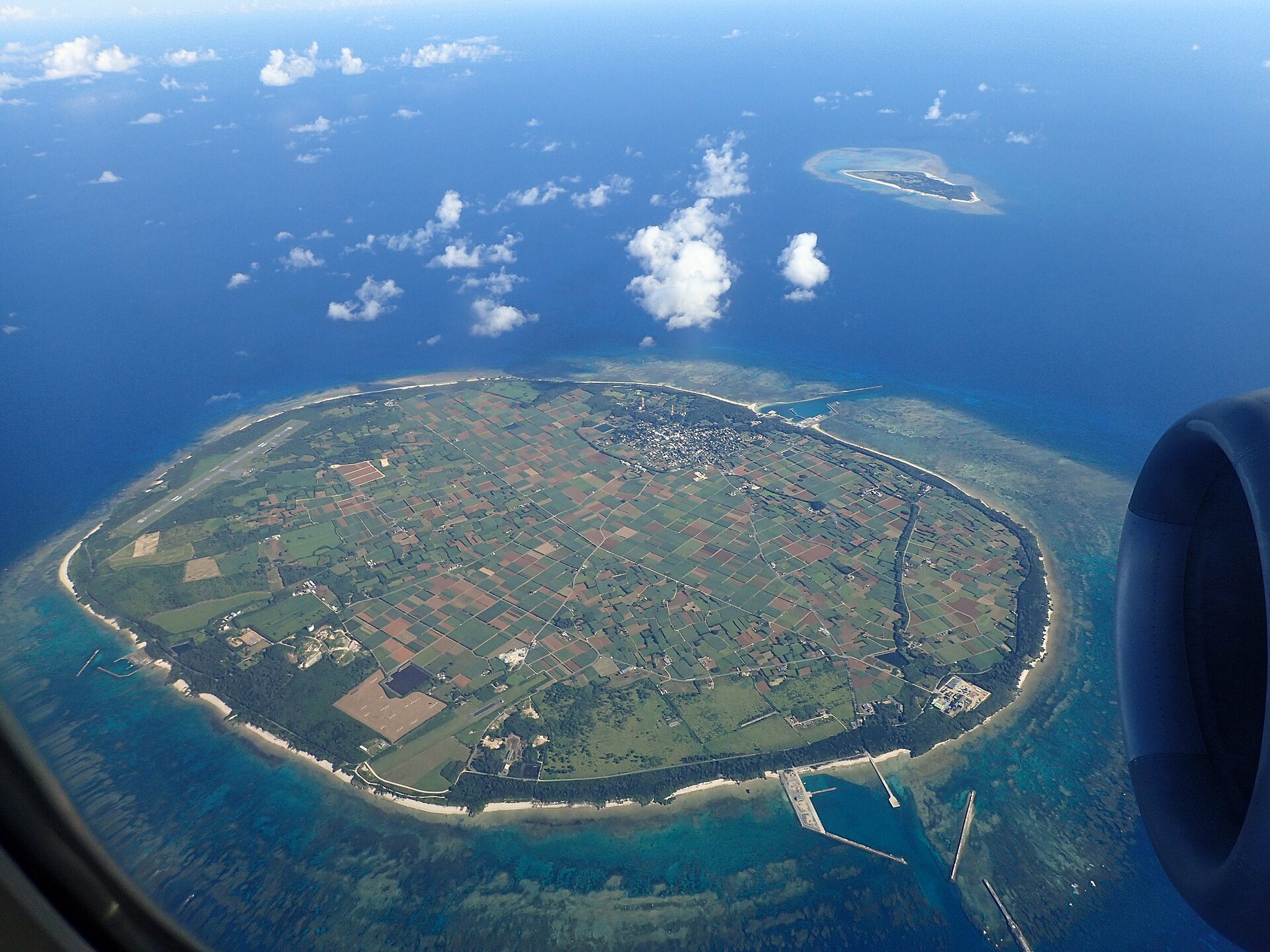
Between Miyako and Ishigaki lies a flat coral island with no hills and no rivers, where the hamlets were laid out to a feng shui plan and hedged in by fukugi trees. Two old watch mounds on the north side still look out over the sea lanes.
- FromHirara Port, Miyako Island
- ~2 hrFerry from Miyako, once a day
- Get off atTarama Port at Futenma (Tarama Kaiun ferry)
- From there
- Tarama Island
The sweet spot
This is less a hidden island than an awkward one. The village publishes its own map and festival calendar and the prefecture keeps a page for it. But the ferry sails once a day and not on Sundays, the plane is small, and there is no resort at the other end, so the island never takes in more than a boatload at a time.
Where it is
Open Okinawa in the map →What to look for — in walking order
- Tarama Port at Futenmathe southeast harbour where the Miyako ferry ties up, with the sugar mill on the road inland
- Shiokawa and Nakasujitwo grid-plan hamlets hedged in by fukugi windbreaks, with the village office and library between them
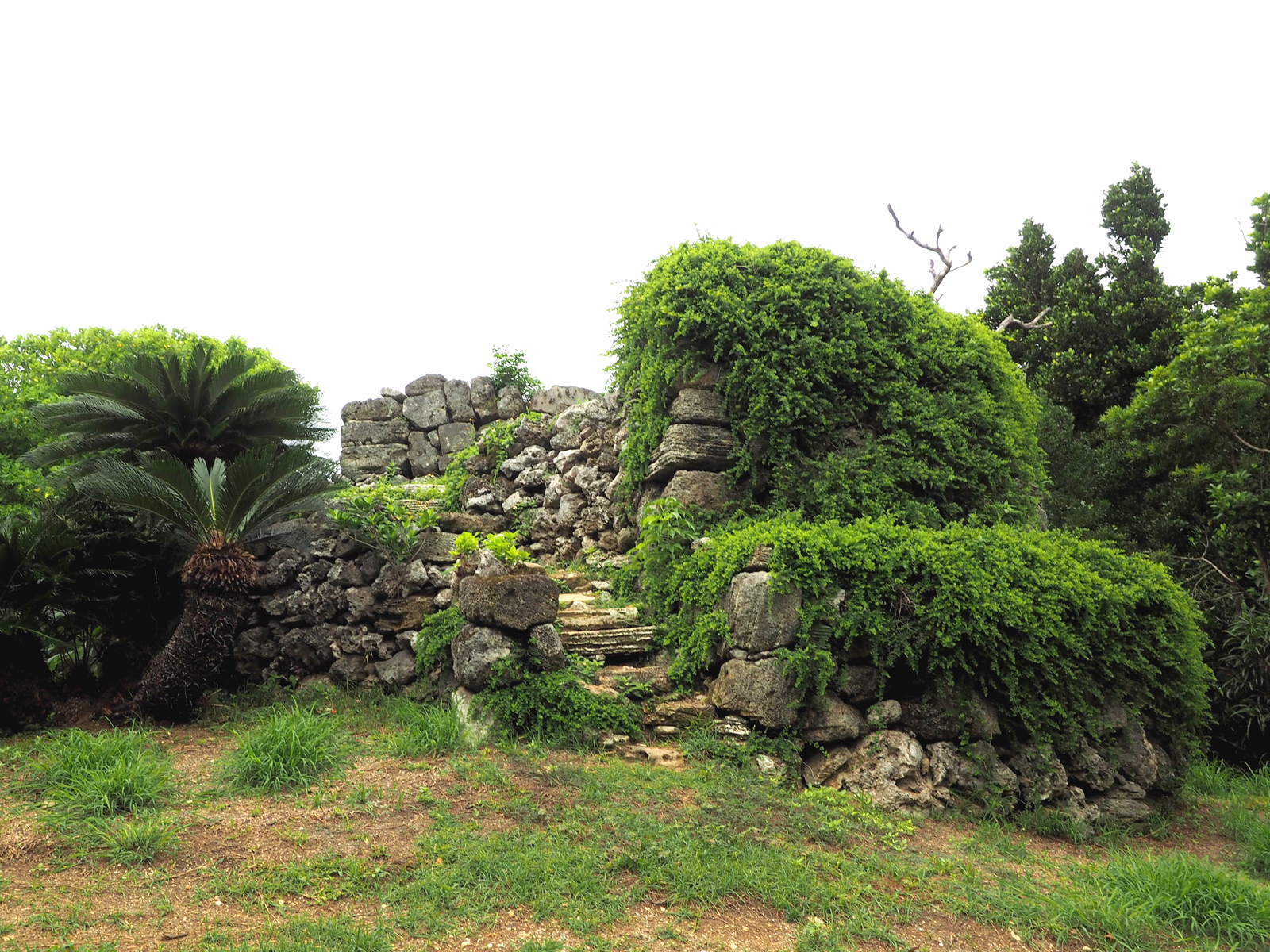
- Miyako Tomi mounda stone watch station facing the Miyako side, designated as a village monument
- Maedomari Portthe northern harbour, used by the ferry in some conditions and by charter boats to Minna Island
- Yaema Tomi moundthe second watch station, on the low rise at the island's northwest corner
How to actually get there
- Naha → Miyako Airport (air), then into central Hirara for the ferry office and pier.
- Hirara Port → Tarama (Tarama Kaiun ferry, about 2 hr; no sailing on Sundays).
- Port → Shiokawa and Nakasuji by rental car, bicycle or the village bus.
- Hamlets → Miyako Tomi mound → Maedomari Port → Yaema Tomi mound on the north side.
- Ferry from Hirara Port
- Hirara Port on Miyako Island →(Tarama Kaiun ferry, about 2 hr)→ Tarama. One sailing each way per day, out in the morning and back after midday, with no service on Sundays. Miyako itself is reached by air from Naha. Tickets are bought at the counter by the pier rather than in advance.
- Return to Hirara
- The return sailing leaves Tarama not long after the boat has arrived, so a same-day round trip buys only a couple of hours ashore and is not worth the crossing. Most visitors stay a night in one of the island's few lodgings, or fly one leg and sail the other.
About the place
Tarama is one raised-coral platform of about 19.75 square kilometres, sitting roughly 67 kilometres west of Miyako and rather closer to Ishigaki. There are no hills and no rivers on it. Almost the whole surface is cane field and pasture, cut into a grid, and the two hamlets of Shiokawa and Nakasuji sit in the middle of that grid with fukugi windbreaks around every block. The layout is not accidental: the settlement was planned on Ryukyuan feng shui, and it is the reason Tarama is the one village in Okinawa admitted to the national association of Japan's most beautiful villages.
How to enjoy it
Build the day around the boat, because the ferry rather than the road is the constraint here. If your dates fall in the eighth lunar month, the three days of the harvest dance are the whole reason to be on Tarama and everything else is filler. Otherwise the fixed points are the two watch mounds and a slow circuit of the fukugi lanes on a bicycle, and after dark a sky with almost nothing lit under it.
Background & history
Two low stone mounds on the north of the island are the remains of a lookout system. In the days of the Ryukyu kingdom the Sakishima Islands kept watch for tribute ships bound for China and for unfamiliar vessels, and each station passed word onward by smoke until it reached the royal government. Tarama has two of these, named for the Miyako and Yaeyama directions they faced, and the village lists both as designated monuments. The island's other inheritance is not built at all: the harvest dance held over three days from the eighth day of the eighth lunar month was designated an Important Intangible Folk Cultural Property in 1976.
Before you go
- Cash
- Carry cash. Fares are paid at the pier counter, and there is no taxi on the island, so the ways to move are the village bus, a rental car or a rental bicycle — all of which are easier to arrange before you sail than after you land.
- Before you go
- Which harbour the ferry uses changes from day to day: the operator posts whether the sailing is in and out of Futenma in the southeast or Maedomari in the north, and cattle auctions on set dates in certain months shift the timetable as well. Rough weather cancels the crossing outright. Read the operator's notice the evening before rather than on the morning.
- Another way
- Ryukyu Air Commuter flies between Miyako Airport and Tarama Airport, a short hop on a small propeller aircraft. It is the fallback when the sea is up, and the only way to make Tarama a day trip.
- After you get off
- There is nothing walkable from the pier itself. The road runs northwest across the cane grid, with the hamlets about four kilometres inland and the two watch mounds a couple of kilometres beyond them, so arrange a car, a bicycle or the village bus in advance. Shade is scarce once you leave the fukugi lanes.