Kumamoto · AsoNo.512★★★Open in map →
Daikanbo Lookout
— The high point of Aso's northern caldera rim
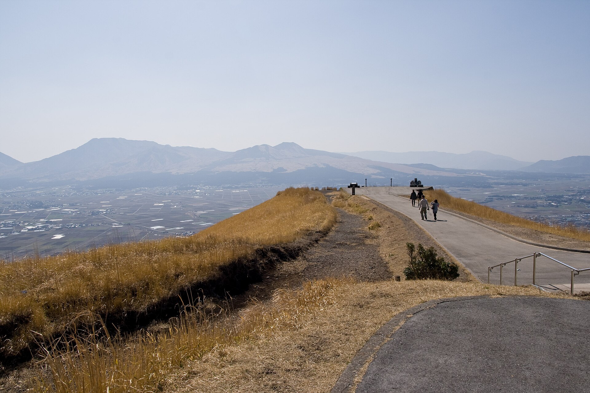
A grassy promontory on the northern rim of the Aso caldera, reached by a short paved path from the car park. The five central peaks of Aso fill the view on one side, the Kuju range stands behind them, and the inhabited crater floor lies directly below.
- FromAso Station (JR Hohi Main Line)
- ~30 minCar or taxi from Aso Station
- Daikanbo Lookout
Where it is
18 more notes in Kumamoto · open the map →What to look for — in walking order
- The rest house and car parksouvenir counters and food stalls at the road end, and the start of the walk out
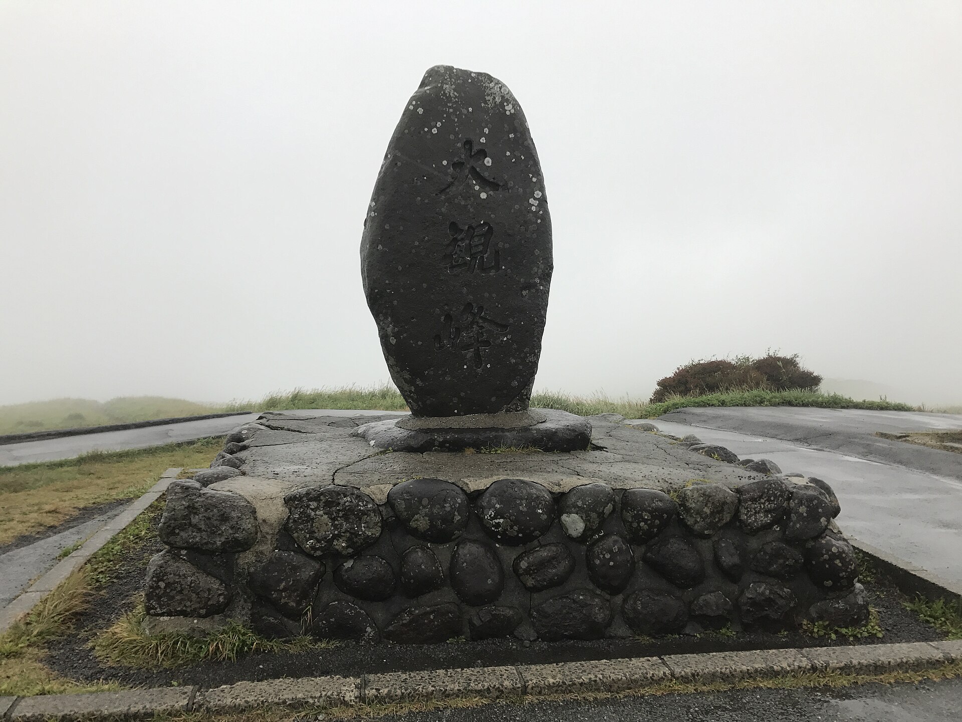
- The Daikanbo stelean inscribed standing stone marking the promontory, where the path leaves the road
- The ridge patha level paved walk out to the point, with grassland dropping away on both sides
- The lookout at the pointthe railed edge, with the five peaks of Aso ahead and the Kuju range behind them
- The caldera floorAso town, its rice fields and its road grid, laid out directly under the rim
How to actually get there
- Kumamoto Station → Aso Station (JR Hohi Main Line).
- Aso Station → Daikanbo by taxi or rental car, climbing onto the rim by the Milk Road.
- Park at the rest house and walk the paved path out along the ridge.
- Work round the railed edge for the full turn: Aso's five peaks, the caldera floor, then the Kuju range behind.
- Car or taxi from Aso Station
- Aso Station → Daikanbo takes about thirty minutes by road, climbing out of the caldera and running along the rim on the prefectural route known as the Milk Road. There is no regular weekday bus. On Saturdays, Sundays and public holidays a route bus runs from in front of JR Aso Station and is listed at about forty minutes. For a dawn visit, a taxi or a rental car is the only workable option.
- Back down into the caldera
- The return is the same road down to Aso Station, and it is worth timing against the JR Hohi Main Line, which is not frequent. If you have driven up for the cloud sea, allow extra time on the rim road while the mist is still lying in it. Kurokawa Onsen lies on the far side of the rim if you would rather go on than go back.
About the place
Daikanbo is a high point on the northern outer rim of Aso, about 936 metres above sea level, looking straight across the caldera at the five central cones. The rim here is grassland rather than forest, so the view opens the moment you leave the car park and there is nothing to climb. Local people read the profile of the five peaks as a reclining Buddha, head to the left, and once it has been pointed out the shape is difficult to unsee. What makes the scale legible is that the caldera floor is inhabited: a town, rice fields and a road grid sit inside the crater, and they give you something to measure it against.
How to enjoy it
Come before sunrise from autumn into winter if you want the sea of cloud, which forms inside the caldera on clear, cold, still mornings and burns off soon after the sun is up. At any other hour the view still works, but the light is flatter and the coaches are in. The rim is exposed and noticeably colder than the town below, so bring a layer even in summer, and stay for the turn back toward Kuju rather than only photographing the five peaks.
Background & history
The promontory takes its present name from the writer and journalist Tokutomi Soho, a Kumamoto man, who called it Daikanbo — roughly, the peak of the great view. The rim it stands on is the wall of the Aso caldera, thrown up by eruptions on a scale that is hard to picture until you are looking at towns inside the crater. A prefectural road along the rim, the Milk Road, brought the point within reach of ordinary traffic, and the car park and rest house followed. Nothing here is engineered except the path and the railings at the edge.
Before you go
- Cash
- There is no admission charge for the lookout. The souvenir shop and food counters at the rest house keep their own hours and are best treated as cash businesses, and there is nowhere on the rim to draw money — do it in Aso town.
- Before you go
- The rim is fully exposed and the view shuts down completely in cloud or rain, so check the forecast before committing to the drive. There is no lighting on the path, and the rim road is slow in fog. Volcanic activity affects the crater area rather than this lookout, but road conditions around Aso change; the prefecture's tourism site posts a current status for the area's main roads.
- Another way
- From Kurokawa Onsen the drive across the rim takes about half an hour, which makes the two an easy pair in one day. From Kumamoto city the drive is roughly ninety minutes, and from Kumamoto Airport about an hour. Sightseeing buses circling the Aso area also call here in season.
- After you get off
- Aso Station is the transfer point rather than the trailhead: the lookout is up on the rim, well above and north of the town, and there is no walking route worth taking. From the car park at the top, the edge is a level few minutes away on a paved path.