West Gunma · Usui PassNo.953★★Open in map →
Apt-no-Michi Rail Trail
— The abandoned Usui Pass line, walked end to end
A footpath laid along the abandoned railway over the Usui Pass, running from Yokokawa up through a chain of brick tunnels to the Meganebashi viaduct. The formation is surfaced, lit and signposted, and it climbs the same grade the trains did.
- FromTakasaki Station
- ~35 min + walkJR to the end of the line, then on foot
- Get off atYokokawa Station (JR Shin'etsu Main Line)
- From there
- Apt-no-Michi Rail Trail
The sweet spot
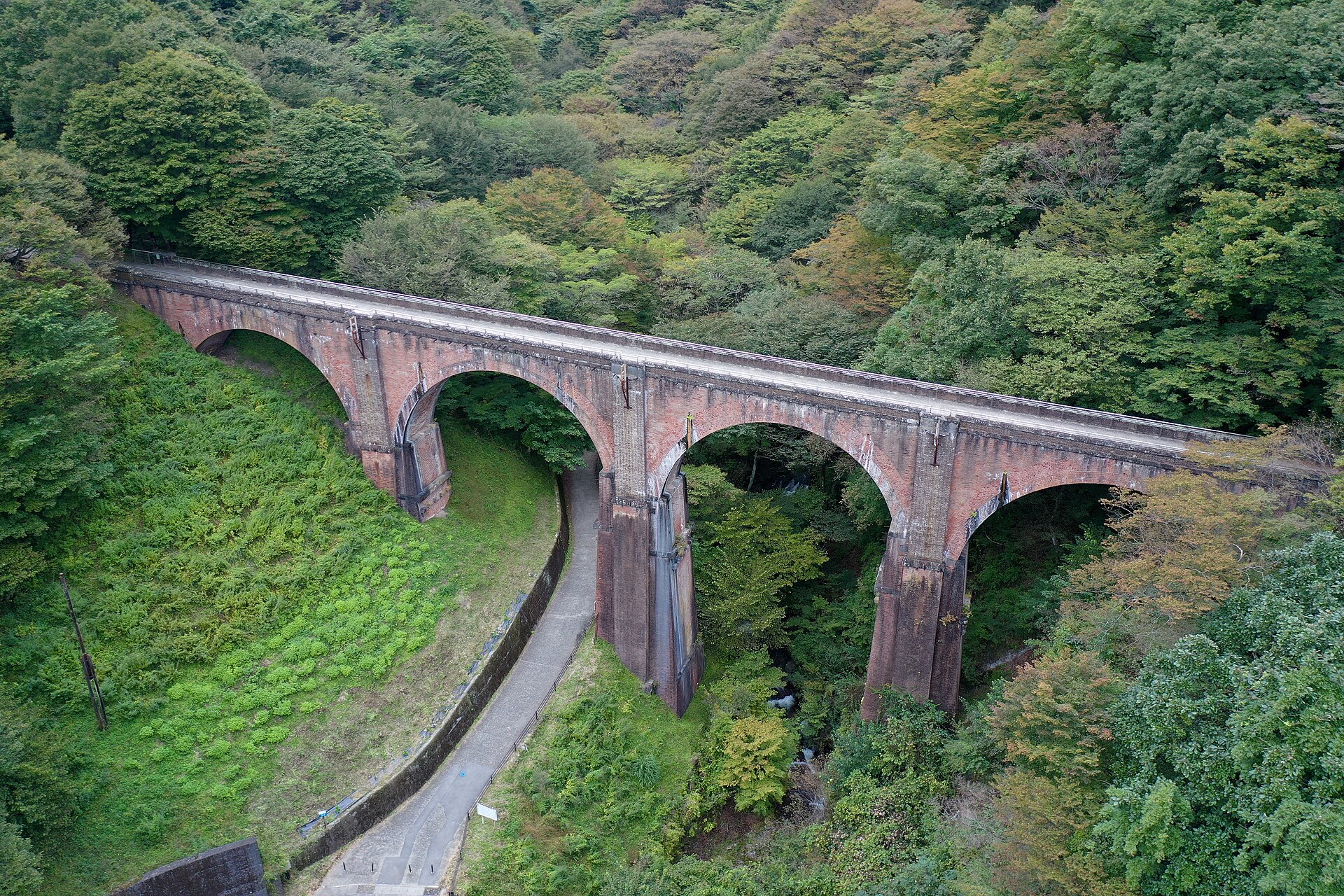
This is not a ruin you have to find. The surface is made up, the tunnels are lit, and the viaduct has its own car park on the road below, so it is possible to see the arches without walking a step. What thins people out is the distance between the two ends: the tunnels and cuttings in the middle take time that a photo stop does not.
Where it is
20 more notes in Gunma · open the map →What to look for — in walking order
- Old Maruyama Substationa pair of red-brick buildings from the line's electrification, their outsides and roofs restored
- Toge-no-Yua hot-spring bathhouse that the trail passes on its way up the valley
- Lake Usuia small reservoir just off the route, with its own car park and a bridge across
- Meganebashi viaductfour brick arches standing 31 metres above the river, about two million bricks in all
- Old Kumanotaira stationthe far end of the path, where the platforms and tunnel mouths of a passing station remain
How to actually get there
- Takasaki Station → Yokokawa Station (JR Shin'etsu Main Line, about 35 min; Yokokawa is the terminus).
- Yokokawa Station → trail entrance beside the Usui Pass Railway Heritage Park (walk about 3 min).
- Follow the old formation uphill past the substation, the bathhouse and the reservoir to the Meganebashi viaduct, then take the stairway up onto the deck.
- Carry on to the old Kumanotaira station, or turn back at the viaduct, and return to Yokokawa along the same path.
- JR Shin'etsu Main Line from Takasaki
- The Shin'etsu Main Line now ends at Yokokawa, and the heritage park beside the station puts the run from Takasaki at about 35 minutes. Because Yokokawa is the terminus there is no risk of overshooting it. The trail entrance is a few minutes from the ticket gate, past the heritage park.
- Back down from Yokokawa
- Trains return to Takasaki from the same platform, and from Takasaki the Shinkansen and the Takasaki Line run through to Tokyo. Services on the branch are not frequent, so fix your return train before you start walking, especially if you plan to reach Kumanotaira and come back.
About the place
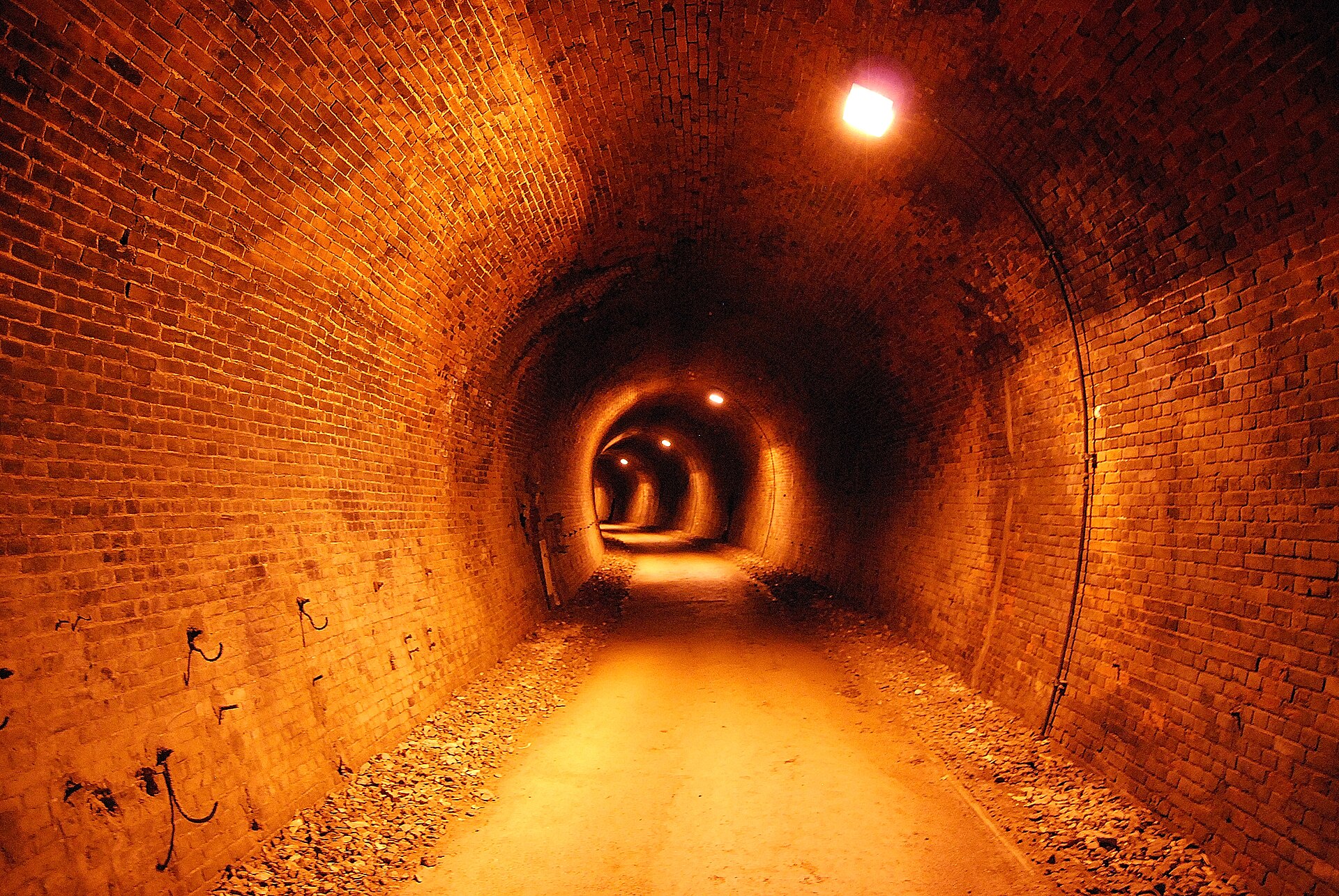
The pass between Yokokawa and Karuizawa was the hardest link on the line from Takasaki to the Japan Sea coast. The climb reaches 66.7 per mille, which is 66.7 metres of rise for every kilometre of track, and the engineers answered it with a rack system and a chain of brick tunnels and viaducts. The walking route follows that formation for about six kilometres and passes through ten tunnels on the way, all of them lit and signposted by Annaka City. The gradient underfoot is the gradient the locomotives fought.
How to enjoy it
The tunnel lights come on at seven in the morning and go off at six in the evening, and the tunnels are genuinely dark afterwards, so build the walk to finish while they are still lit. Most people go out and back along the same formation; turning round at the viaduct makes a shorter day than pressing on to Kumanotaira. Bicycles are not allowed on the path.
Background & history
The Yokokawa to Karuizawa section opened in 1893, worked by an Abt rack system copied from German mountain railways. Rack working ended in 1963 when a new alignment took over, and the section closed altogether in 1997 once the Shinkansen reached Nagano. Five of the brick bridges had already been designated an Important Cultural Property in 1993 as the Usui Pass Railway Facilities, which is why the structures outlived the trains.
Before you go
- Cash
- Walking the trail and standing on the viaduct cost nothing. The Usui Pass Railway Heritage Park beside the station charges admission separately, and its car park is free for visitors to the park but chargeable for people who only park there.
- Before you go
- Tunnel lighting is switched off in the evening and Annaka City warns against going into the tunnels at night. Bicycles are not permitted on the path. The route runs through mountain forest for its whole length, so carry what you need for the round trip.
- Another way
- By car, leave the Joshin-etsu Expressway at Matsuida-Myogi and follow Route 18. The city puts the viaduct at about fifteen minutes from the interchange, and there is a car park below the arches for around twenty-two cars, which lets you see the bridge without the full walk.
- After you get off
- From Yokokawa Station the trail entrance is about three minutes on foot, alongside the heritage park. From there you simply follow the old formation uphill, and the substation is the first landmark on the way.