Okinawa · Tonaki IslandNo.920★★Open in map →
Tonaki Island
— One of only two preserved village districts in Okinawa
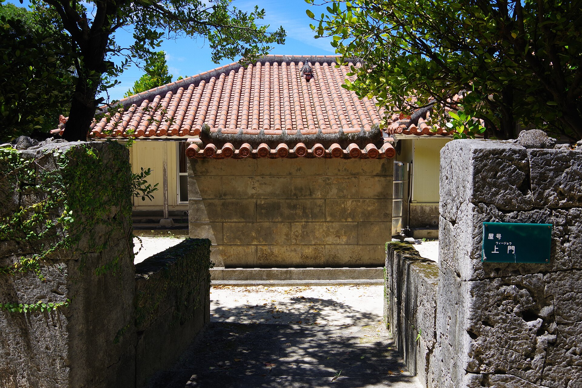
One ferry a day reaches Tonaki, and the village it lands in is a national preservation district — red tile roofs, coral stone walls and lanes of swept white sand, with the houses set below the level of the path.
- FromTomari Port, Naha
- ~1 hr 55 minFerry, one sailing each morning
- Get off atTonaki Port (Kume Shosen ferry)
- From there
- Tonaki Island
The sweet spot
Tonaki is not undiscovered so much as hard to fit into a schedule. One ferry a day arrives and one leaves, so a visit is normally an overnight, and the island's tourism association asks that lodging be booked before you sail. That filter, rather than obscurity, is what keeps the lanes quiet.
Where it is
6 more notes in Okinawa · open the map →What to look for — in walking order
- Tonaki Ferry Terminalthe arrival point at the western edge of the village, with the information counter facing it
- The white sand lanesswept coral sand between coral stone walls, with the house floors set below the lane
- Wījō-yaa traditional house with the deepest drop from the road of any in the settlement
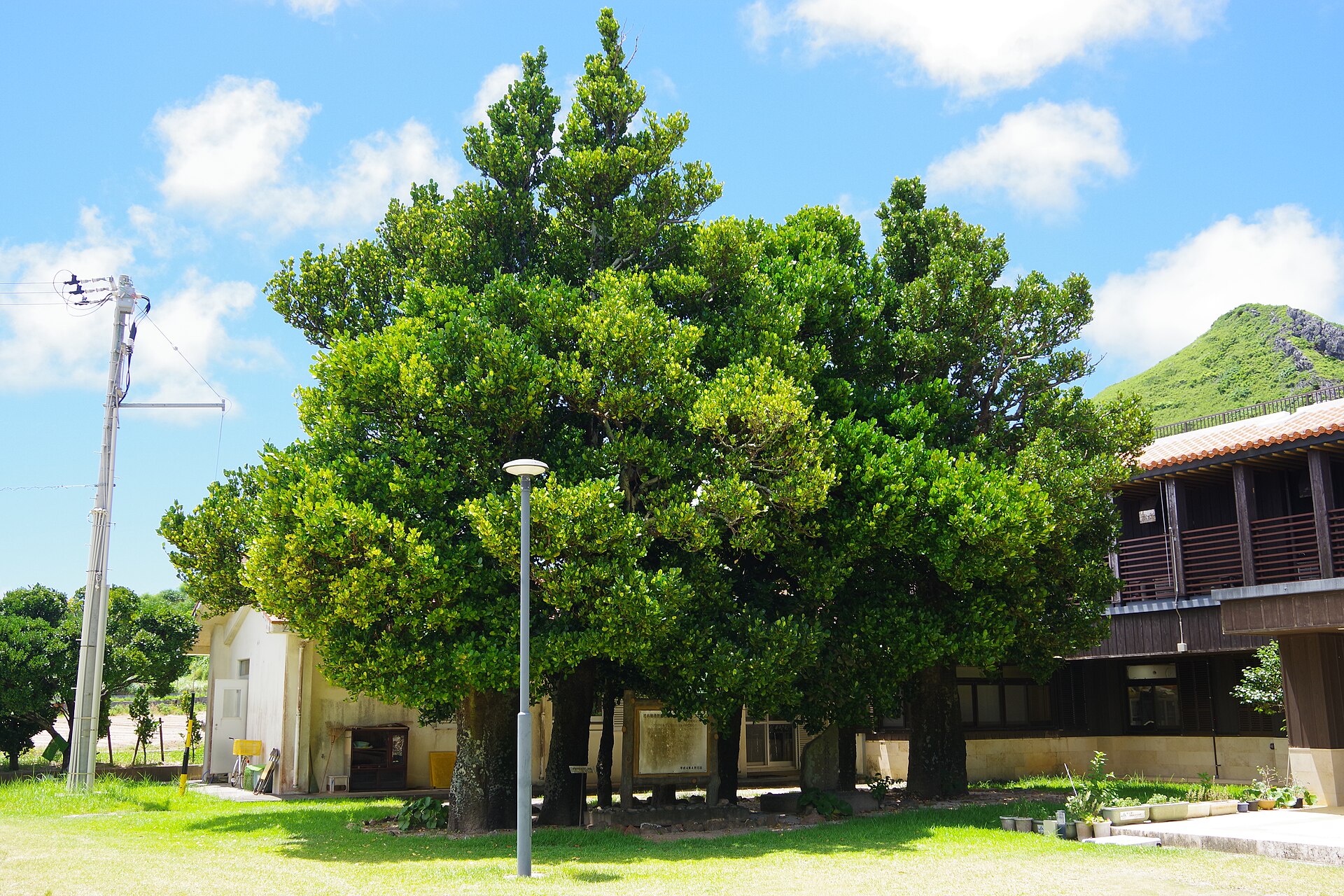
- Fukugi grove at the old Tonaki Bansho sitebroad-crowned trees on the ground of the former district office and school
- The upper lookout and Sato Utakisteps to a view over the village and Agari Hama, with the island's chief prayer site on the ground above
How to actually get there
- Naha → Tomari Port (Tomarin); Kume Shosen sells tickets on the first floor.
- Tomari Port → Tonaki Port on the morning ferry bound for Kume Island.
- Collect a map at the tourism association counter opposite the terminal.
- Walk inland into the sand lanes; the lookout steps and Sato Utaki are above the village.
- The morning ferry from Naha
- Kume Shosen runs one sailing a day from Tomari Port in Naha toward Kume Island, calling at Tonaki on the way. It leaves Naha at 09:00 and reaches Tonaki at 10:55. The village office and the island's tourism association publish the same timetable, and both note that this is the only arrival of the day.
- Back to Naha
- The northbound boat comes up from Kume Island in the morning, leaves Tonaki at 10:35 and reaches Tomari at 12:30. From April through October there is a Friday afternoon sailing as well, departing Tonaki at 15:35 — the one day of the week on which a return trip from Naha fits into a single day.
About the place
Tonaki lies in the sea northwest of Okinawa's main island, with Aguni to the north and Kume to the west. Its coastline runs about 12.5 km. The island began as two separate hills; sand filled the channel between them and joined the pair, and the village now stands on that flat waist. Its lanes are surfaced in white sand, and behind the coral stone walls the houses sit lower than the lane itself. One village governs the whole island, and the tourism association states there is no car hire on it — the settlement is walked.
How to enjoy it
Because the boat lands late in the morning and leaves early the next day, the village walking falls into two blocks — the afternoon you arrive, and the stretch before you sail. After dark the lanes are lit by low footlights set into the ground, which makes the same route a different walk. Sato Utaki is an active prayer site, so keep to the path and photograph from it.
Background & history
The Agency for Cultural Affairs selected the Tonaki settlement as an Important Preservation District for Groups of Traditional Buildings in 2000, entering it under the heading of island farming village. Only one other place in Okinawa carries that status — Taketomi, far to the southwest in the Yaeyama group. The listing covers the layout as much as the buildings: the grid of sand lanes, the coral stone enclosures, and the house plots dug below them. The island's tourism association describes the higher ground north of the village, called Sato, as the site of the earlier settlement.
Before you go
- Cash
- The village office lists the adult one-way fare between Naha and Tonaki at ¥2,750, with a discounted round-trip ticket. The tourism association states that cards are not accepted at the lodgings or the shops, so carry cash. There is a post office and an ATM on the island, but no convenience store.
- Before you go
- Sailings are cancelled for typhoons, rough winter seas and tsunami advisories, and the association advises building slack days around the crossing. When the ferry is cancelled a subsidised helicopter taxi becomes available, though it needs clear visibility to fly. The Nishimui hilltop park is closed after a landslide, so check at the information counter before setting out for it.
- Another way
- Come the other way, from Kume Island. The same boat calls at Tonaki northbound in the morning, so an itinerary that begins on Kume can set you down here and carry you on to Naha the following day.
- After you get off
- The ferry terminal stands at the western edge of the settlement, and the tourism association's information counter faces it across the road. The village begins immediately behind it — turn inland from the pier and the sand lanes start within a couple of minutes on foot.