Hokkaido · NukabiraNo.917★★Open in map →
Taushubetsu River Bridge
— Drowned railway arch on Lake Nukabira
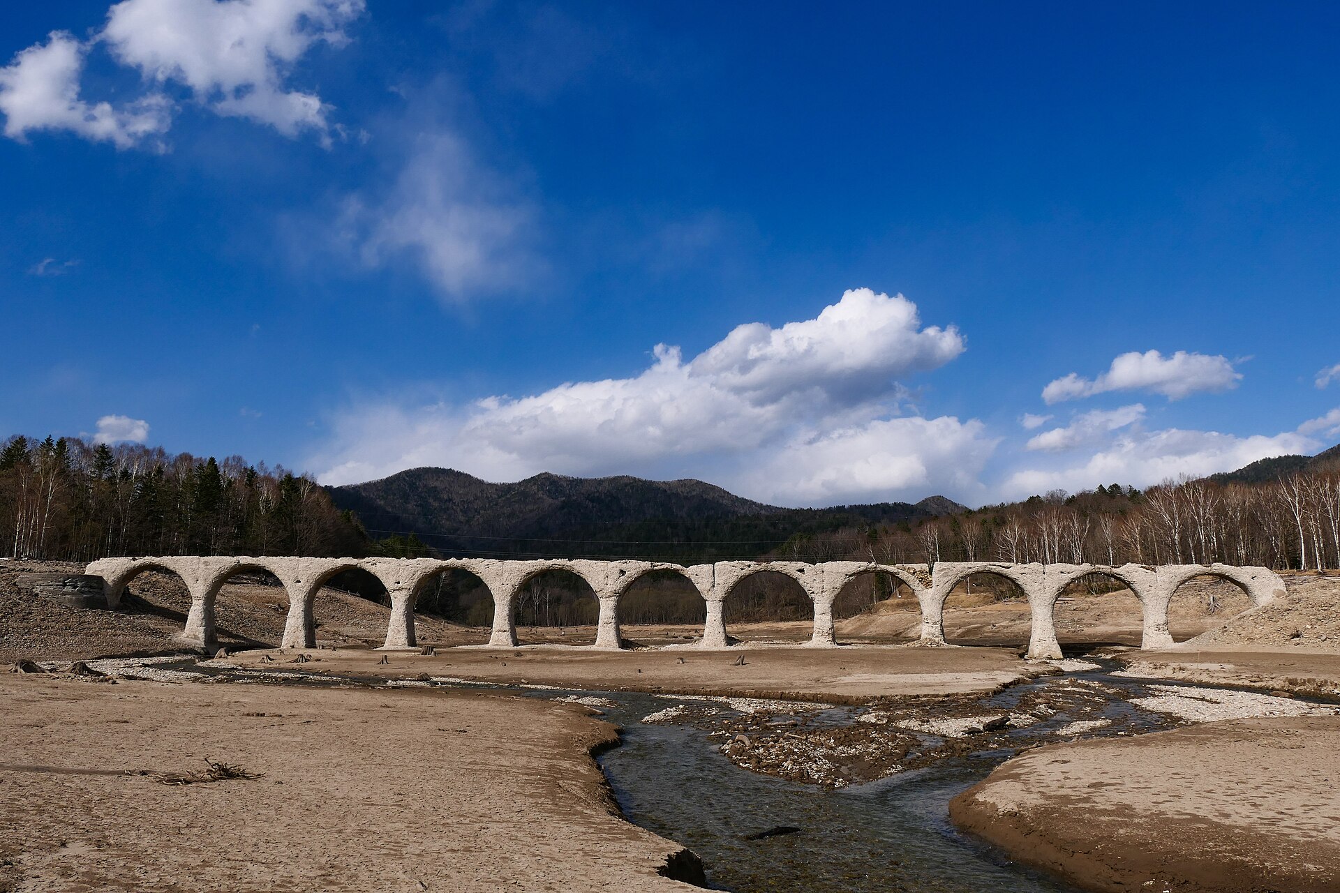
A railway arch bridge that spends part of every year under a reservoir in the mountains of eastern Hokkaido. It reappears on the winter ice, stands clear in spring, and goes under again as the meltwater fills the lake.
- FromObihiro Station
- ~1 h 50 minBus from Obihiro, then road
- Get off atNukabira Onsenkyo (Tokachi Bus / Takushoku Bus, Kamishihoro line)
- From there
- Taushubetsu River Bridge
The sweet spot
This is not an undiscovered ruin. It is the signature image of Kamishihoro and it sits on the front of the town's own tourism pages. What keeps the crowd small is the approach rather than the fame: the forest road to the bridge is closed to unauthorised vehicles, and to walkers and cyclists as well, so nearly everyone sees it from a lookout on the highway. Going closer is a booking, not a decision made on the day.
Where it is
102 more notes in Hokkaido · open the map →What to look for — in walking order
- Higashi-Taisetsu Nature Centrefree visitor centre in the hot-spring village, with the day's lake and bear information and the village bicycle station
- Sannosawa Bridgeanother arch of the same line, standing beside the highway with its own parking bay
- Taushubetsu Lookoutroadside viewpoint over the reservoir, about 750 metres away from the bridge
- Fifth Otofuke River Bridgean arch at Horoka, in clear view from the modern road bridge above it
- Tokachi-Mitsumatathe hamlet where the line ended, now a clearing in the forest with a couple of houses left
How to actually get there
- Obihiro Station bus terminal → Nukabira Onsenkyo (Tokachi Bus / Takushoku Bus, Kamishihoro line).
- Higashi-Taisetsu Nature Centre in the village: check the water level, the bear notices and the tour desk, and hire a bicycle here if you have no car.
- North on Route 273 to the Taushubetsu Lookout, which is signed from the road and has its own pull-in.
- For a close view, join a guided tour, or reserve the forest-gate key online and collect it at Michi-no-Eki Kamishihoro.
- Tokachi Bus / Takushoku Bus from Obihiro
- The Kamishihoro line runs from the bus terminal beside Obihiro Station, through the town of Kamishihoro, to the hot-spring village of Nukabira Onsenkyo, with no change on the way. Departures are spread thinly across the day and some runs do not operate at weekends or on holidays. Read the timetable before you build a plan around it.
- Same line back to Obihiro
- Buses to Obihiro leave from the same stop in the village. The service finishes earlier than a city route does, and the last departure decides how long you can stay by the lake. Check the board when you arrive rather than when you want to go.
About the place
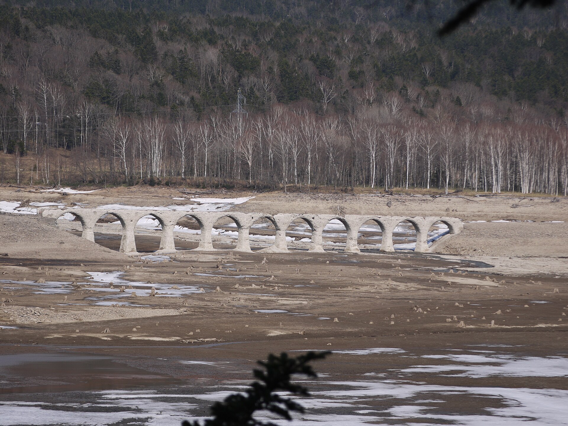
Taushubetsu River Bridge stands inside Lake Nukabira, a reservoir in the Higashi-Taisetsu mountains of eastern Hokkaido. It is a concrete arch bridge about 130 metres long, carried on eleven arches, and it is the best known of a scattered group left behind by the old Shihoro Line. The reservoir is drawn down through the cold months, and the bridge comes back out onto the ice around January. Meltwater refills the lake from late spring, the level climbs, and by the end of summer the arches are under the surface again. No other arch bridge in Japan keeps a calendar like this, which is why the town calls it the phantom bridge.
How to enjoy it
Come in the cold half of the year, while the arches are out of the water. Early morning is the quiet trick: the wind is down, the surface holds still, the reflection closes each arch into a circle, and that is why the bridge is nicknamed the spectacles bridge. From the village it is eight kilometres up the highway to the lookout, an easy drive and a fair ride on a hired bicycle. Tours and the gate key are arranged in advance, not on the morning.
Background & history
The Shihoro Line ran north from the Tokachi plain into the Higashi-Taisetsu mountains, and this bridge was built for it in 1937. When a dam closed the valley the water rose over the old alignment, the track was moved to higher ground, and the arches were left where they stood. The railway itself is long gone; what remains of it along the highway is a line of concrete arches and a station platform in the trees. The concrete has weathered badly since, and pieces of the structure have fallen away.
Before you go
- Cash
- The lookout, the roadside arch bridges and the nature centre in the village cost nothing to visit. The guided tours and the forest-gate key both carry a charge, the key is reserved online in advance rather than over a counter, and payment methods vary by operator, so carry cash as well as a card.
- Before you go
- The forest road is not cleared of snow and its gate stays shut through winter, when the way to the bridge is a guided walk over the frozen reservoir instead. In late summer there can be nothing to see at all, because the arches are under water. This is brown bear country, and the town posts sightings on the bridge's own page.
- Another way
- By car the run from Obihiro is Route 241 and then Route 273. The same highway comes down from Sounkyo over Mikuni Pass, which puts the bridge on a crossing of the Daisetsuzan range rather than at the end of a dead end.
- After you get off
- The stop stands in the hot-spring village, where the nature centre, the inns and the bicycle station are all a few minutes apart on flat ground. The bridge is not walkable from here: the lookout is up the highway, and the forest road beyond the gate is closed to people on foot as well as to cars without a permit.