West Kochi · Tengu KogenNo.1188★★Open in map →
Shikoku Karst Tengu Plateau
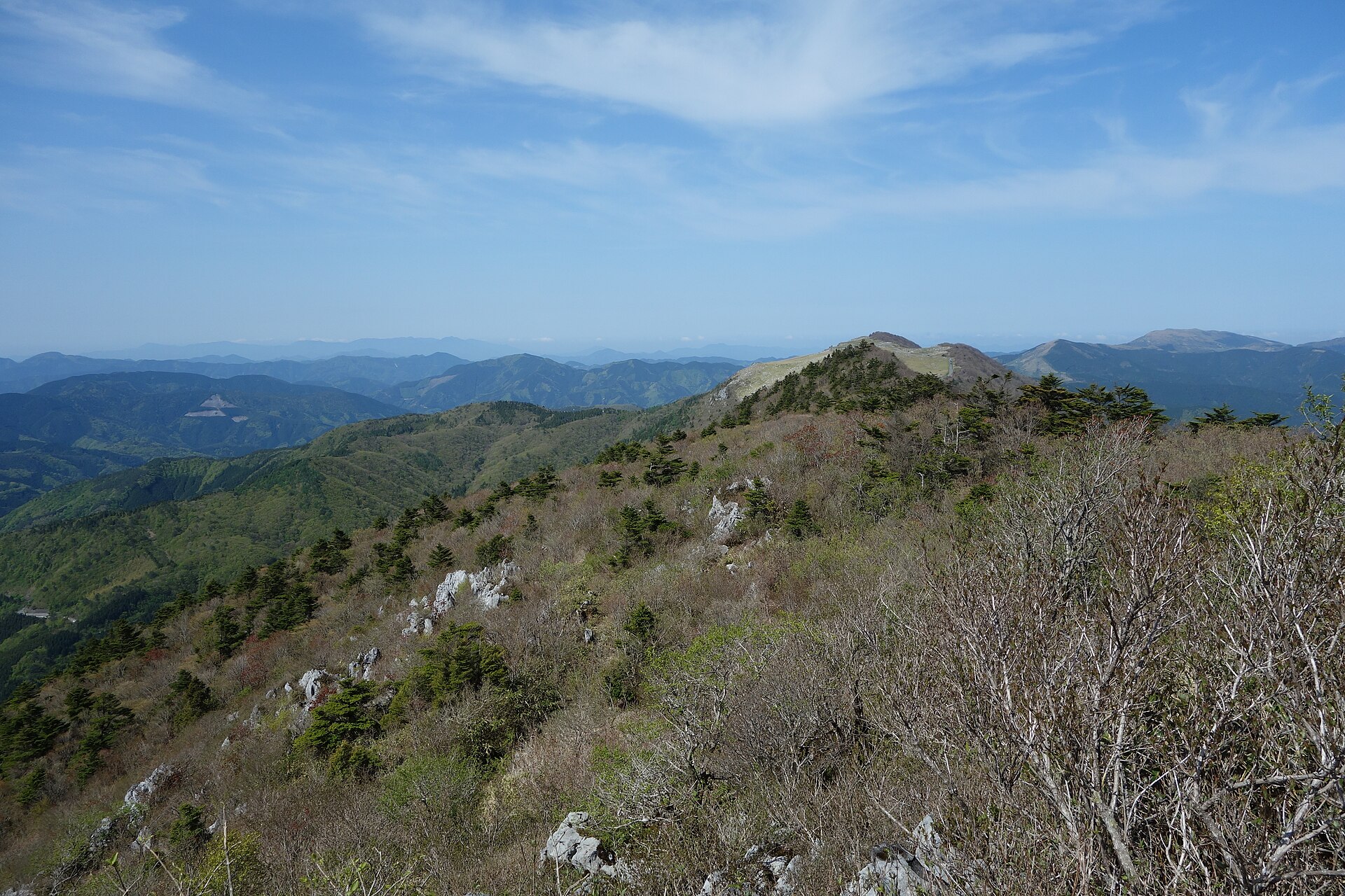
The Kochi end of the Shikoku Karst, a limestone ridge of open pasture on the Ehime border. A nature-learning centre, a lodge with an observatory and a set of wood-chip forest paths all share one car park at the top.
- FromSusaki Station (JR Dosan Line)
- 1 hr+ by carRental car or taxi, no bus
- Shikoku Karst Tengu Plateau
The sweet spot
This is a well-known drive, not a hidden place. What thins the numbers is the approach. No railway reaches the ridge, the town has withdrawn the bus that used to run up to the plateau lodge, and snow closes the road through winter. Getting here at all takes a deliberate plan, and that plan is the whole filter.
Where it is
18 more notes in Kochi · open the map →What to look for — in walking order
- Karst Terracethe nature-learning centre at the car park, with displays on the limestone and the plants of the plateau
- Hoshifuru Village TENGUthe town-run lodge next door, with an observatory, a planetarium and rooms built for looking at the sky
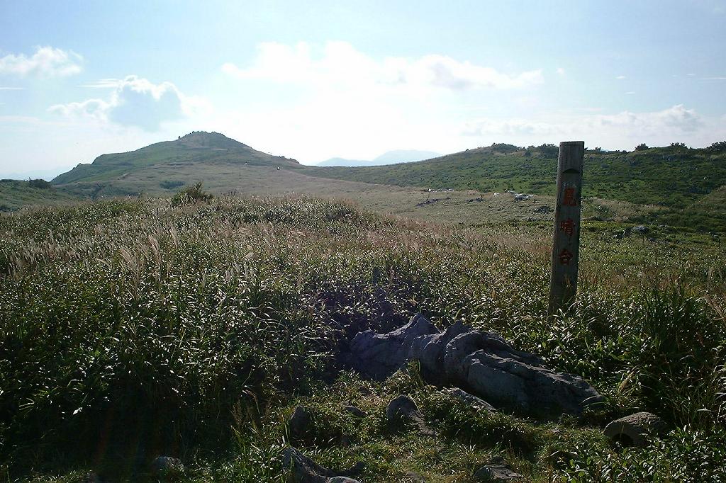
- Miharashidai lookouta marked post out on the open grass, with the grazing slopes and the far ranges in view
- Forest therapy pathsabout one kilometre of wood-chip path through beech and himeshara, starting beside the lodge
- Tengu-no-Morithe 1,485-metre high point of the whole karst, on a ridge path east of the lodge
How to actually get there
- Susaki Station (JR Dosan Line) → arrange a rental car or a taxi; there is no bus up to the plateau.
- Susaki-higashi interchange → mountain roads up to Prefectural Route 383, the ridge road (over an hour).
- Ridge road → the car park shared by Karst Terrace and Hoshifuru Village TENGU, at the Kochi end of the karst.
- On foot from the car park: the open grass and the lookout, then the wood-chip forest paths, then the ridge to the high point.
- Rental car from Susaki, the nearest railhead
- No public bus reaches the plateau. Tsuno Town withdrew the service that used to climb to the lodge, and nothing has replaced it. Susaki Station on the JR Dosan Line is the nearest railhead, and the practical move is to arrange a rental car or a taxi there. The official access page lists several mountain approaches, all of which end on Prefectural Route 383 along the ridge, and puts the climb from the Susaki-higashi interchange at over an hour. Treat it as a half-day out rather than a detour.
- Down the same mountain roads
- There is no second way off the ridge. The roads are narrow, unlit and shared with ridge traffic, so the descent is easier in daylight. Petrol stations are scarce once you leave the valley, which is why the tank is worth filling in Susaki on the way up. If you are staying at the lodge, make the descent a next-morning job rather than a night drive.
About the place
The Shikoku Karst runs for about 25 kilometres along the mountain border between Ehime and Kochi, and Tengu Plateau is its eastern end, on the Kochi side. White limestone pushes up through the turf in ribs and blocks, and shallow bowls dimple the ground where rain has worked its way down into the rock. Cattle are put out on the open grass from spring through autumn. One prefectural road, nicknamed the sky road, threads the whole ridge and strings the four plateaus together. Tengu sits at its far end, and it is where the public facilities cluster: a nature-learning centre and a lodge ring one car park, and the footpaths begin there.
How to enjoy it
Call at the nature-learning centre first — the official site gives nine to five, closed on Mondays — then take the grass and the wood-chip paths in whatever order the weather allows. The other half of this plateau is the night: the lodge runs an observatory and a planetarium, so a clouded-over evening still has something to look at. If you are driving on, the ridge road continues west past the grazing pastures toward the Ehime side.
Background & history
The limestone began as reef rock built up on an oceanic plate in the Carboniferous and the early Permian, then arrived at the edge of the Japanese arc later in the Permian as part of an accreted terrane. Rain has been dissolving it ever since, leaving the exposed ribs and the saucer-shaped hollows that give karst country its look. Kochi Prefecture designated its side of the boundary a prefectural natural park in 1961, and Ehime later designated its own side under the same name.
Before you go
- Cash
- The grassland and the ridge road are free to walk and drive. Charges at the nature-learning centre and at the lodge — entry, guided walks, meals, a bed — are set by each of them and are not posted in one place, so check with them directly. Assume cash on the mountain, and draw what you need down in Susaki.
- Before you go
- Snow closes the ridge road through the winter, and the nature-learning centre and the lodge each keep their own closed days. Cloud settles on the plateau often enough that a clear view is never a given, and there is no shelter out on the open grass. Check the road status before setting out any time between late autumn and early spring.
- Another way
- From the Ehime side, the ridge road climbs from Kuma-kogen over the Jiyoshi pass, runs past the central pasture and Godan Plateau, and reaches Tengu at the far end. It is the same single road rather than a shortcut, and it shuts in the same snow.
- After you get off
- Susaki Station is down on the coast and there is no walking route up to the ridge; the railhead and the plateau are two separate problems. At the top, the nature-learning centre and the lodge share one car park, and everything on foot starts from it — the grass, the lookout, the wood-chip paths and the ridge climb. Guides put the wood-chip circuit at about an hour there and back.