Kochi east · MurotoNo.896★★★Open in map →
Cape Muroto
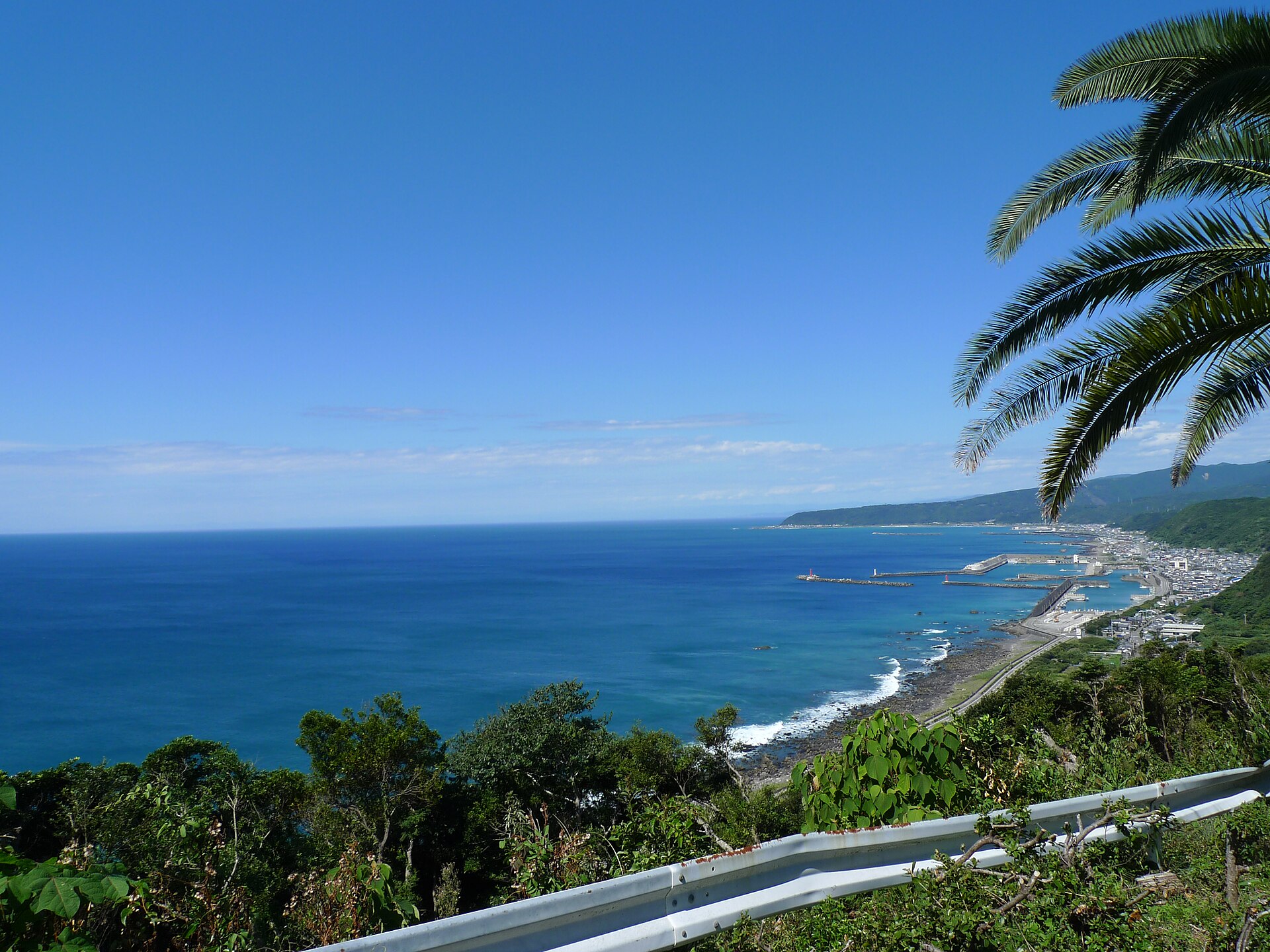
The blunt end of Kochi's eastern peninsula, where rock scraped off the sea floor has been pushed up into the air. A shoreline promenade runs out among it, and the geopark that reads the ground covers the whole city rather than a fenced site.
- FromNahari Station
- ~1 hrKochi Tobu Kotsu bus
- Get off atMuroto-misaki (Kochi Tobu Kotsu bus)
- On foot
- Cape Muroto
Where it is
18 more notes in Kochi · open the map →What to look for — in walking order
- Nakaoka Shintaro statuethe bronze figure at the roadside where the bus stops, with a lookout up the steps behind it
- Ranshō promenadethe shoreline walkway that leaves the road and works out through the rocks
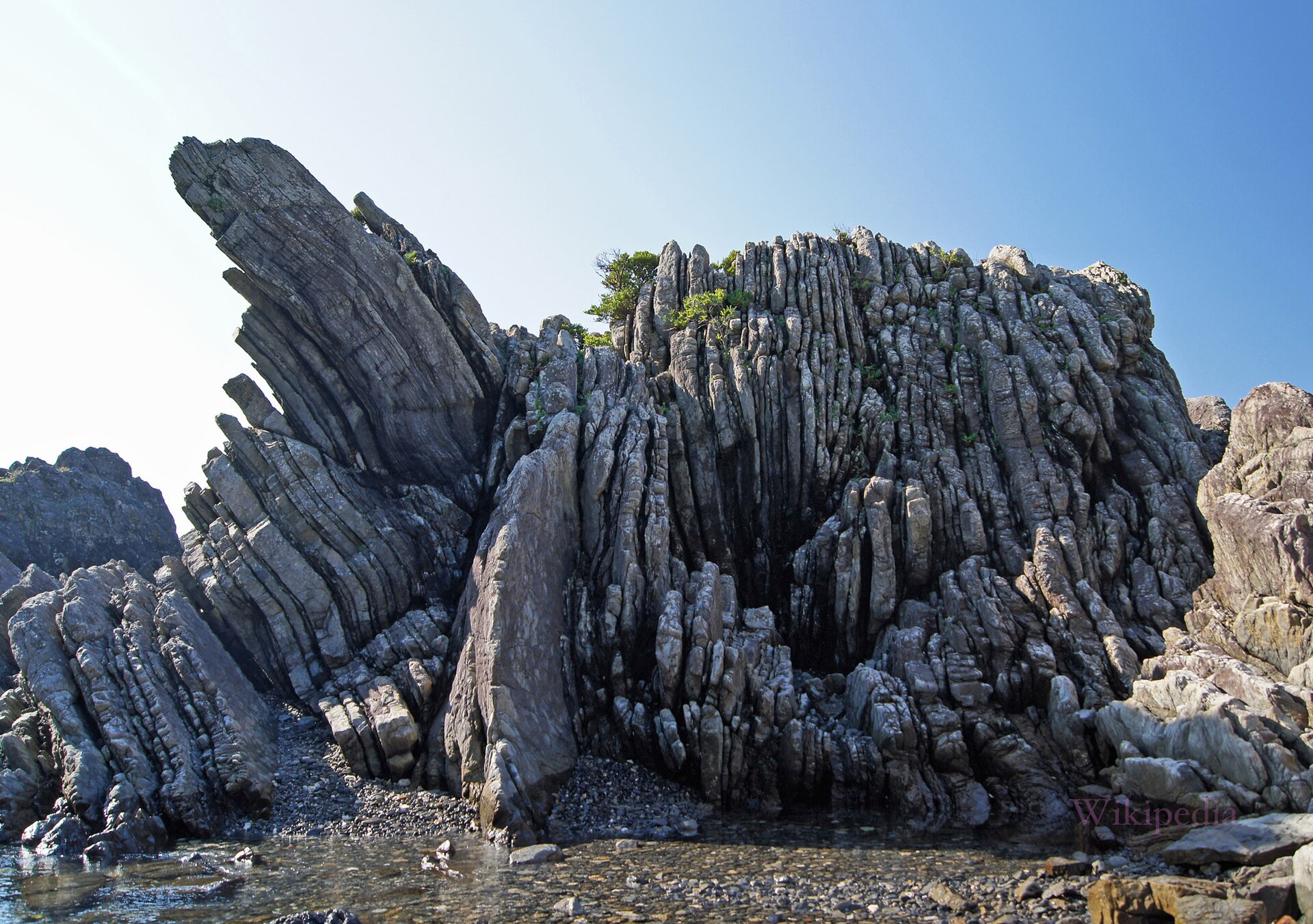
- Turbidite bedslayers of sea-floor sand and mud, tilted on edge and exposed along the shore
- Eboshi Rocka free-standing block on the rocks, one of the named stones along the promenade
- Subtropical coastal forestakou figs and salt-tolerant plants rooted into the rock, a national natural monument
How to actually get there
- Kochi → Nahari (Tosa Kuroshio Railway, Gomen–Nahari Line).
- Nahari Station → Muroto-misaki (Kochi Tobu Kotsu bus toward Kannoura, about 1 hr).
- Cross to the sea side of Route 55 and take the promenade down among the rocks.
- Climb back to the same stop for the noted departure, or walk up to the lookout first.
- Bus from Nahari Station along Route 55
- Take the Tosa Kuroshio Railway's Gomen–Nahari Line to Nahari, then the Kochi Tobu Kotsu bus toward Kannoura. The prefectural tourism site puts the run at about an hour. The Muroto-misaki stop is on Route 55, beside the Nakaoka statue.
- Back up the coast to Nahari
- Buses return to Nahari from the same roadside stop, and the same operator continues east to Kannoura. Departures are spread through the day rather than frequent, and there is nothing to do at the stop if you miss one, so fix your return before you walk down to the rocks.
About the place
Cape Muroto is the point of a peninsula that pushes into the Pacific from the eastern corner of Kochi. The rock along its shore was scraped off the sea floor as one plate slid beneath another, welded onto the edge of the islands, and then lifted clear of the water — and the lifting has not stopped. At ground level that produces a coastline of tilted, folded, pitted stone with subtropical trees rooted straight into the cracks. The geopark built around it is not a marked enclosure: it covers the whole municipality of Muroto, and the cape is simply where the process is easiest to read on foot.
How to enjoy it
The promenade is the visit, not the lookout. Give it the time you would give a walk rather than a photo stop, because the interest is in reading the rock underfoot as you go. Buses along this coast are widely spaced in both directions, so note the return departure at the stop before you drop down to the shore.
Background & history
The cape was known first as a hazard and a place of practice, not a sight. A sea cave below the road, Mikurodo, is where the young monk Kukai is said to have completed his training, and a pilgrimage temple stands on the headland above it. The coastline was taken into Muroto-Anan Kaigan Quasi-National Park in 1964. In 2011 the whole city was admitted to the Global Geopark Network, which laid a geological reading over ground that pilgrims had been walking for centuries.
Before you go
- Cash
- The cape, the shoreline promenade and the lookout behind the statue are all free to walk. Bus fares on this coast are paid on board, so carry coins and small notes.
- Before you go
- The promenade crosses bare rock beside the open Pacific with no barrier between. It takes swell and wind directly, and this coast absorbs the full weight of typhoons, so a rough sea day is a day to stay up on the road.
- Another way
- From Kannoura at the Tokushima end of the line, Kochi Tobu Kotsu buses run west to the cape, so the peninsula can be crossed rather than doubled back. By car the cape sits on Route 55, the coast road that rings the whole headland.
- After you get off
- The Muroto-misaki stop is on Route 55, a few steps from the Nakaoka statue. The promenade drops away on the sea side of the road; the lookout is up the steps behind the statue.