West Nagano · NorikuraNo.1227★★Open in map →
Norikura Kogen
— Plateau under the Northern Alps
A birch-covered plateau on the Nagano flank of Mount Norikura, in western Matsumoto. Trails link waterfalls, ponds and hot-spring sources, and in the warm months a bus runs from here up to the alpine terminal below the summit.
- FromMatsumoto Station
- ~1 hr 30 minTrain + bus, one change
- Get off atNorikura Kogen Kanko Center (Alpico Kotsu bus)
- From there
- Norikura Kogen
The sweet spot
Mount Norikura is a named peak with its own bus service, so this is not an undiscovered corner. What thins the crowd is the shape of the day. Most visitors ride up, stay near the summit terminal and ride back down, so the plateau's own trails and ponds stay comparatively open even in the high season.
Where it is
27 more notes in Nagano · open the map →What to look for — in walking order
- Norikura Kanko Centerthe bus terminal and information base where the summit shuttle starts
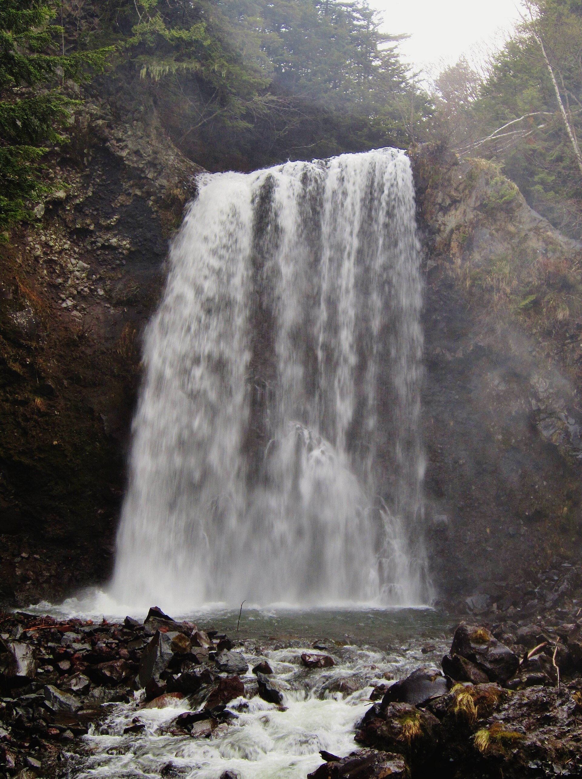
- Zengoro Fallsa broad curtain of water at the end of a short forest path off the plateau road
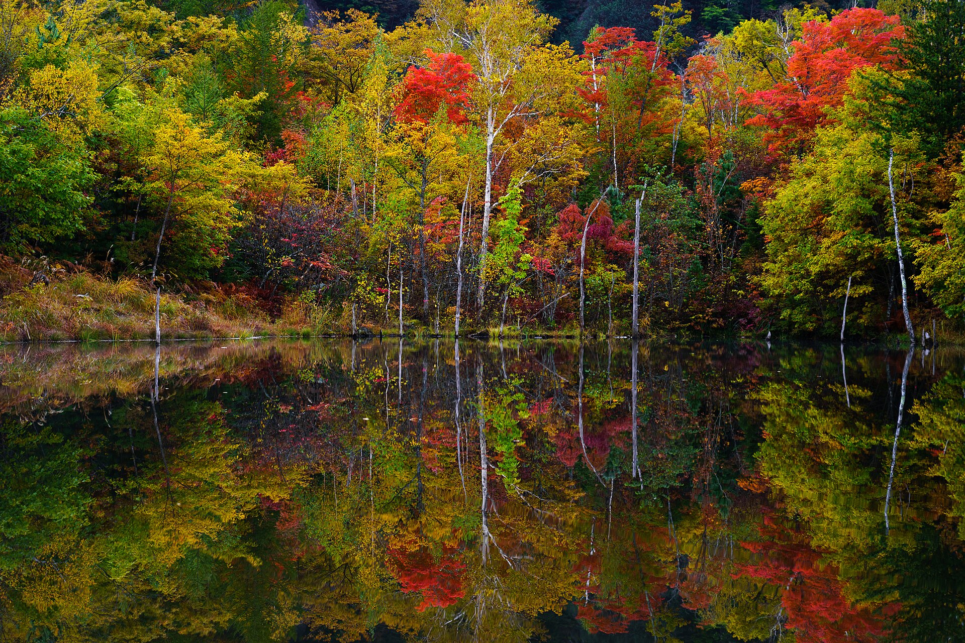
- Ushidome Ponda quiet pond on a boardwalk loop that mirrors the mountain on windless days
- Ichinose Meadow and Maime Pondopen wetland and small ponds across the southern half of the plateau
- Tatamidairathe alpine bus terminal beyond the ridge, with crater lakes and a natural flower field
How to actually get there
- Matsumoto Station → Shin-Shimashima Station (Alpico Kotsu Kamikochi Line, about 30 min).
- Shin-Shimashima Station → Norikura Kogen Kanko Center (Alpico Kotsu bus, about 60 min).
- Change at the centre for the summit shuttle to Tatamidaira (1 July to 31 October, reservation first).
- Come back down and walk the plateau trails to Zengoro Falls, Ushidome Pond and Ichinose Meadow.
- Kamikochi Line, then bus from Shin-Shimashima
- Matsumoto Station →(Alpico Kotsu Kamikochi Line, about 30 min)→ Shin-Shimashima Station, then the Norikura Kogen bus to Norikura Kogen Kanko Center (about 60 min). Train and bus are built to connect, so check the pairing rather than each timetable on its own.
- Back down to Matsumoto
- Take the bus from Norikura Kogen Kanko Center to Shin-Shimashima Station, then change to the Kamikochi Line for Matsumoto. Mountain services are few and finish well before the city ones, so fix your return departure before you set out on any trail.
About the place
Norikura Kogen spreads across the eastern foot of Mount Norikura, inside the western limits of Matsumoto. The mountain is not a single peak but a cluster of 23 summits, led by Kengamine at 3,026 metres. The plateau lies at the southern end of Chubu-Sangaku National Park, the alpine park that also holds Kamikochi. Birch woods, small ponds, three waterfalls and several hot-spring sources are strung together by walking trails across the slope. Above the plateau the road carries on into the alpine zone, but only buses and taxis may use it.
How to enjoy it
The summit shuttle runs from 1 July to 31 October and fills by reservation first, so settle the bus before the walking plan. Ride up early in the day and keep the plateau trails for the afternoon, when the light drops low into the birch woods. Autumn colour on the mountain is usually at its best from late September into early October.
Background & history
Chubu-Sangaku National Park, which reaches its southern limit here, was designated in 1934 as one of the first national parks in Japan. The mountain's name is said to come from its profile seen from the Hida side, read as a horse's saddle. Two mountain roads later opened into the alpine zone: the Norikura Echo Line from Nagano and the Norikura Skyline from Gifu. Both are now closed to private vehicles, which turned the plateau into the place where cars stop and passengers change.
Before you go
- Cash
- The plateau trails, ponds and waterfalls are free to walk. The shuttle up to the summit terminal is a separate paid service run on a reservation-first basis, with remaining seats sold on the day. Bring cash, because places to withdraw it thin out once you leave the valley.
- Before you go
- The mountain road above Sanbondaki is closed to private vehicles, so for most visitors the shuttle is the only way up. That service runs in the warm months only and is suspended for snow, storms or road damage. Above the plateau the air stays much colder than in Matsumoto even in midsummer.
- Another way
- From the Gifu side, buses climb the Norikura Skyline to the same summit terminal from Hirayu Onsen and Hoonokidaira, which suits anyone approaching from Takayama.
- After you get off
- The bus pulls in at the front of Norikura Kanko Center, and the summit shuttle leaves from the same forecourt. Trail heads for the waterfalls and ponds open off the plateau road a short walk away.