Okinawa · Miyako IslandsNo.884★★Open in map →
Kurima Island
— A farm island at the end of Kurima Bridge
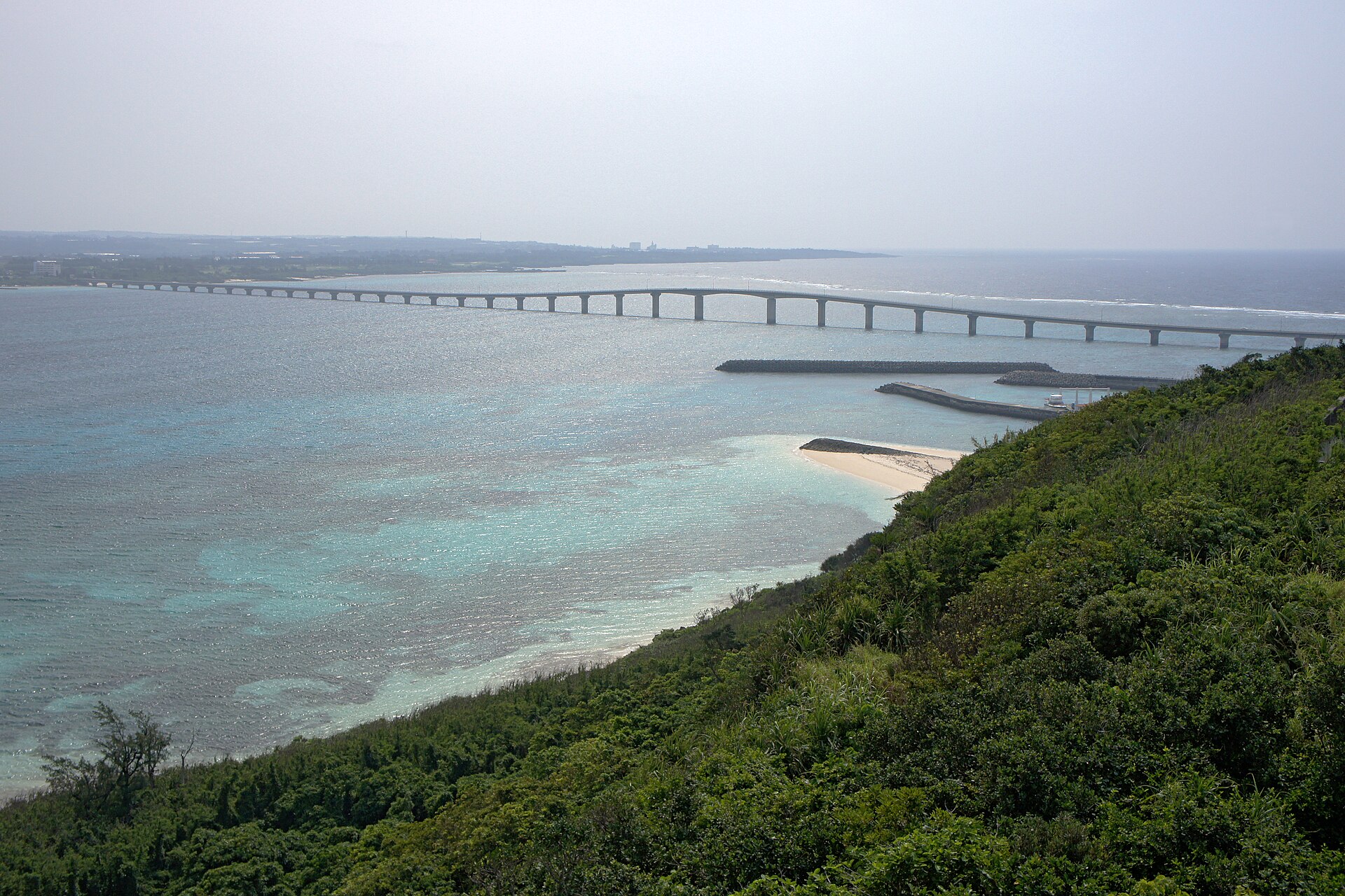
A low island off southwestern Miyako, joined to it by a farm road bridge that runs almost straight across the shallows. One village sits at the bridge end and cane plots hold the rest, with beaches along the western shore.
- FromMiyako Airport (car southwest over the Kurima Bridge)
- ~25 minRental car over the bridge
- Kurima Island
The sweet spot
Kurima is neither hard to reach nor undiscovered: cafés and craft shops have opened here fast enough that the prefectural tourism site remarks on it. What the island keeps is proportion. One village, a grid of cane plots, and a shoreline that changes character between its two sides — the interest is in crossing it rather than in finding it.
Where it is
4 more notes in Okinawa · open the map →What to look for — in walking order
- Kurima Bridgethe causeway from Miyako, straight across the shallows with Yonaha Maehama alongside it
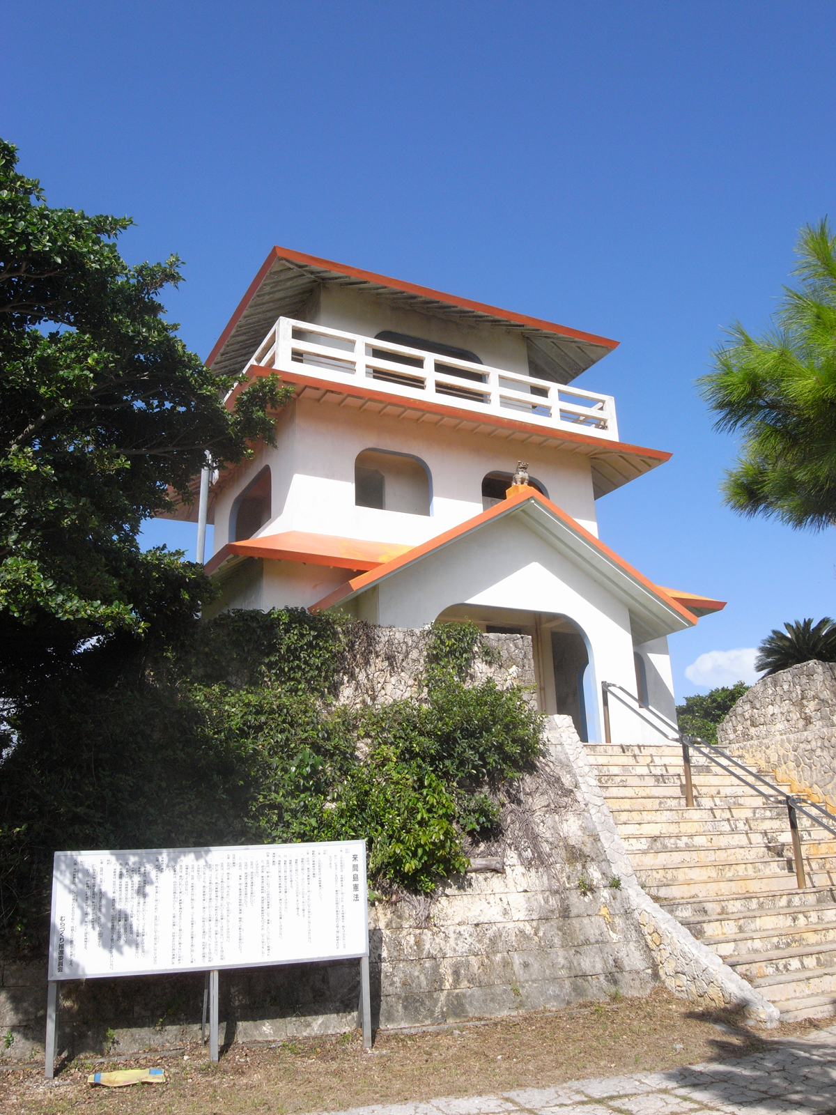
- Ryūgūjō Observatoryan orange-roofed lookout of three storeys at the island's east end, over the channel and back across the fields
- The villagethe island's single settlement, immediately inland from the lookout
- Kurima Tōmithe old fire-beacon mound on the high ground north of the village
- Nagamahamathe west-facing beach reached through a belt of scrub, and the island's sunset shore
How to actually get there
- Miyako Airport → southwest across Miyako by rental car or taxi.
- Cross the Kurima Bridge and climb to the Ryūgūjō Observatory car park.
- Walk down into the village, then north to the Kurima Tōmi mound.
- Finish on the western shore at Nagamahama, then recross the bridge.
- By road from Miyako Airport
- The Miyakojima tourism association puts the drive from Miyako Airport to the Ryūgūjō Observatory at about 25 minutes. The road runs southwest across Miyako to the Yonaha shore, then over the Kurima Bridge and up onto the island, where the lookout has its own car park. Miyako has no railway, so this is a rental car or a taxi.
- Back to Miyako Airport
- The same road in reverse, plus whatever a rental car return needs before check-in. There is no timetabled transport off Kurima, so settle the return before you cross rather than on the island.
About the place
Kurima lies off the southwestern shore of Miyako, a low island about 9 km around. The Kurima Bridge runs almost straight out to it over 1,690 m of shallow water, built as a farm road and the longest bridge of that kind in Japan when it opened. Okinawa's prefectural tourism site describes the island as having a single settlement, on the east side where the bridge lands, with nearly all the remaining ground under cultivation. The east coast stands as cliff; the west side drops to beaches. That arrangement sets the order of a visit — the lookout and the village first, the western shore last.
How to enjoy it
Take the lookout first — the prefectural tourism site says as much — because it shows the whole island and the channel in one turn and fixes where everything else sits. Late afternoon belongs on the western side: Nagamahama faces the sunset, and the way in through the scrub is easy to miss once the light goes. Allow for that light going quickly if you are driving back over the bridge afterwards.
Background & history
The Kurima Bridge opened in March 1995, built as an agricultural road and, at that time, the longest bridge of its kind in Japan. Its arrival is recent enough that the island's older landmark still stands above it. Kurima Tōmi, on the high ground north of the village, is one of the Sakishima fire-beacon mounds from which the Ryukyu kingdom watched for approaching ships; it is listed as a national historic site, and the national land survey still records the point under that name. The cane plots around it kept their shape while the crossing to them changed completely.
Before you go
- Cash
- The tourism association lists a car park at the observatory with toilets, a souvenir shop and a food counter. Neither the lookout nor the beaches carry a listed charge. Cafés and shops in the village are small and independent, and card payment is not confirmed in the association's listing, so cash is the safer assumption.
- Before you go
- The east side of the island is cliff, and the western beaches have no facilities on the sand. Typhoons cross the Miyako group between summer and early autumn, when the bridge and flights to the island can both be affected at short notice. The tourism association has posted notices about tar balls washing ashore on east-facing coasts in this part of Miyako.
- Another way
- Start at Yonaha Maehama on the Miyako side. The beach faces Kurima across the channel, so driving over afterwards lands you in the view you were just standing in — and the lookout then shows you the beach from the far end.
- After you get off
- From Miyako Airport head southwest across the island to the Yonaha shore and onto the bridge. The road climbs as soon as it reaches Kurima; the observatory car park is at the top, a short way from the bridge end, and the village lies just inland of it.