Chiba · KujukuriNo.1070★★Open in map →
Kujukuri Beach
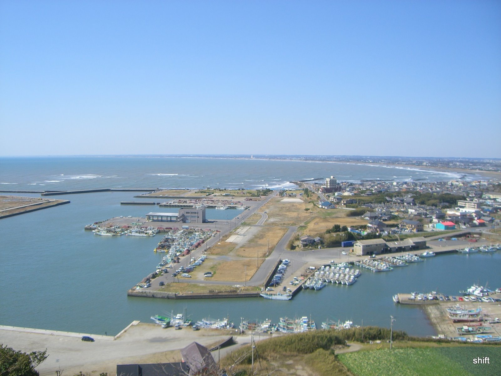
One long strand of sand down the ocean edge of Boso, too big to take in from the sand itself. At its northern end the land lifts into a cape with a free public viewing deck, and from up there the whole curve sits in a single view.
- FromTokyo Station
- ~2 h 30 minJR + coast bus
- Get off atTodai-iriguchi (bus from Asahi Station)
- On foot
- Kujukuri Beach
The sweet spot
Kujukuri is no secret. It is one of the best known beaches in the Kanto region and its surf breaks fill through the summer. But the visitors scatter across tens of kilometres of car parks and beach entrances, so no single stretch feels like a destination, and the cape at the northern end is not where most of them are heading. It gathers its own crowd once a year, at first light on New Year's Day.
Where it is
50 more notes in Chiba · open the map →What to look for — in walking order
- Kamiagai Parkthe clifftop park where the climb from the bus stop comes out
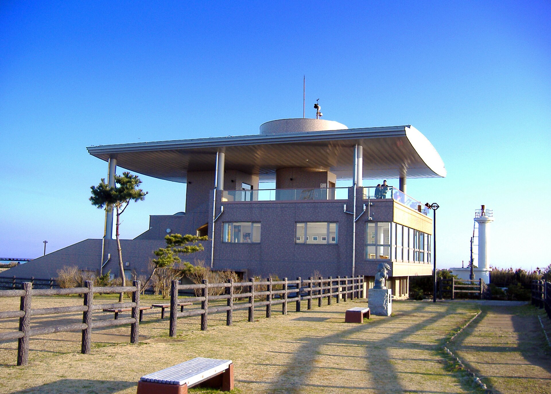
- Hikari to Kaze deckthe open third-floor viewing floor, set on a cliff of about 60 metres
- Iioka Fishing Portthe harbour directly below the cape, its breakwaters reaching into the surf
- Iioka Lighthousea small white tower near the tip, a short walk on from the deck
- The cliff line eastthe sea-cut wall running away toward Choshi on the far side of the cape
How to actually get there
- Tokyo Station → Asahi Station on the JR Sobu Line.
- Asahi Station → Todai-iriguchi on the Choshi-bound coast bus.
- Walk up through Kamiagai Park to the observation building and go up to the open deck.
- Carry on to the lighthouse at the tip of the cape, then back down for the return bus.
- JR Sobu Line to Asahi, then the coast bus
- Tokyo Station →(JR Sobu Line, limited express Shiosai or a rapid service)→ Asahi Station, then a Choshi-bound bus east along the coast road to Todai-iriguchi. The bus is the weak link: services are thin outside commuting hours, so read the return timetable before you take the outbound one.
- Back from Todai-iriguchi
- The same road takes you back to Asahi Station for the Sobu Line to Tokyo. Community-bus routes also call at the lighthouse itself, closer to the deck, but they run to a limited daily pattern. If the last one has gone, walking down into Iioka and picking up a taxi there is the fallback.
About the place
The beach runs about 60 kilometres down the Pacific edge of the Boso peninsula, from Cape Gyobu in Asahi to Cape Taito in Isumi, and it is a single strand of sand for nearly all of that. Its size is also its problem. Stand on the sand at any point and the shoreline simply runs out of sight in both directions, flat and identical. The cape at the top of the arc fixes that. The land rises into a headland here, and from the edge the beach resolves into what it actually is: one long, shallow curve closing on the horizon. The squat concrete points that interrupt the line are erosion works, not natural capes.
How to enjoy it
Dawn is the reason to come. The cape is on the national list of sunrise viewpoints, the sun clears open water rather than land, and the light rakes the whole beach sideways instead of flattening it. Sunset and the night view carry listings of their own, so an evening trip is not a wasted one either. Give yourself time to walk out to the lighthouse afterwards rather than turning straight back for the bus.
Background & history
The name comes down as a story. Minamoto no Yoritomo is said to have had arrows planted along the shore at intervals of one ri, and the count that came back gave the beach its name. The sand has a plainer origin. It was ground off the cliffs at either end of the arc and carried along the shore by the current, building the strand between them. Once those cliffs were armoured against erosion the supply thinned, and the prefecture has been holding the line since with artificial headlands and imported sand.
Before you go
- Cash
- There is no admission charge for the observation building and the car park is free as well, so nothing has to be paid on arrival. Carry cash anyway: the shops and stalls around the harbour below the cape are small, and there is no bank on the headland.
- Before you go
- The building keeps set opening hours and a weekly closing day, both worth confirming on the city's page before a long trip. The deck is described as reachable outside those hours, but do not build a dawn plan on that without checking. The clifftop is fully exposed and the wind off the Pacific is strong even on mild days.
- Another way
- By car it is the Choshi Renraku Road to the Sosa interchange and then east along the coast. Arriving from the Choshi side instead of Asahi puts the sea cliffs on your route, and the two make a natural pair in one day.
- After you get off
- From Todai-iriguchi the road turns inland and climbs toward the headland; the city gives about 10 minutes on foot. It is uphill the whole way, and the last stretch runs through the clifftop park rather than along the sea.