Okinawa · Naha ShuriNo.669★★Open in map →
Kinjocho Stone-Paved Road
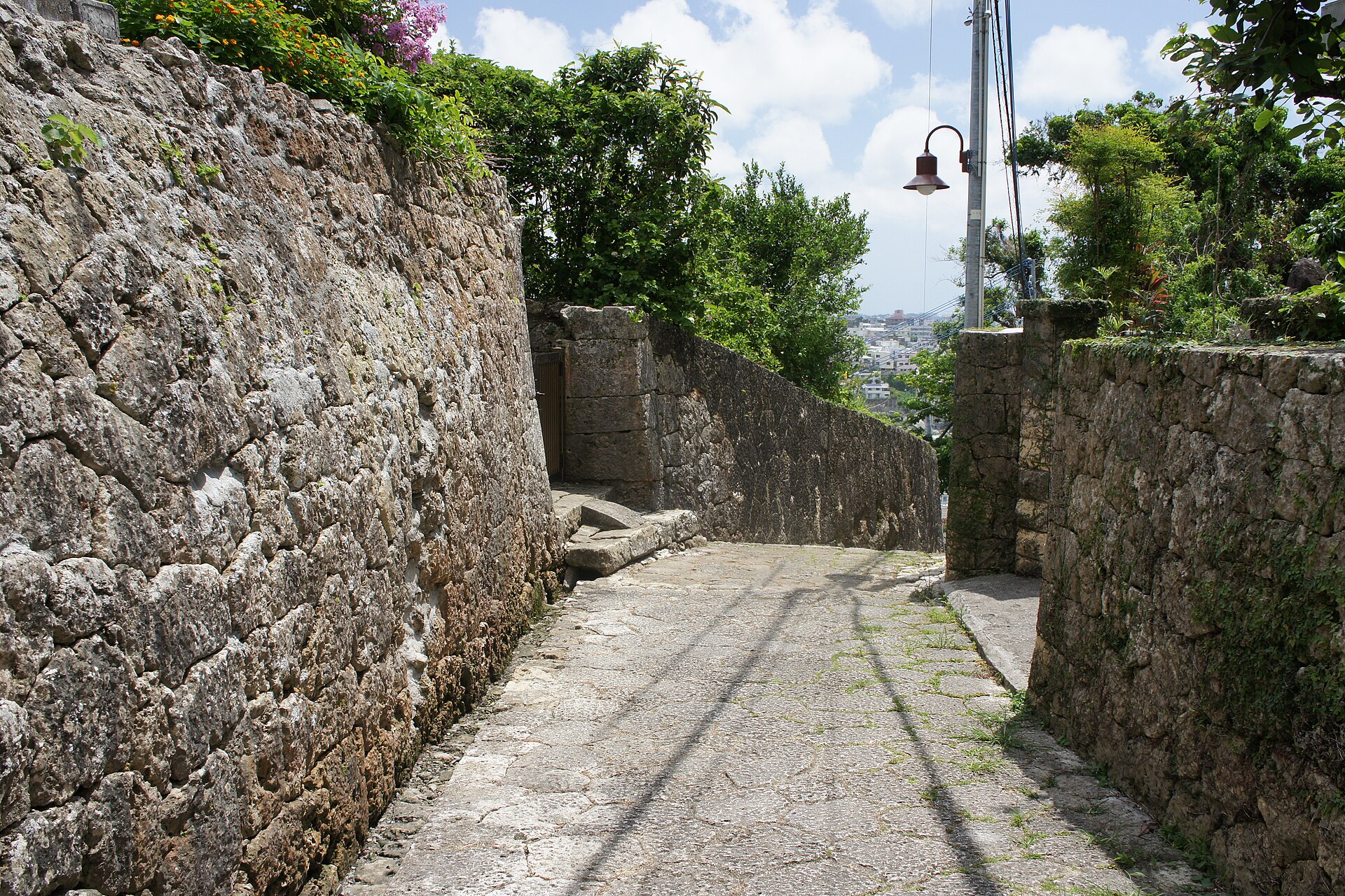
A slope of Ryukyuan limestone in Shuri, laid as part of the royal highway that once linked the castle with the southern coast. Prefecture-designated historic site, open at any hour, and still the front path of the houses along it.
- FromNaha Airport Station
- ~45 minYui Rail monorail + 15 min walk
- Get off atShuri Station (Yui Rail monorail)
- On foot
- Kinjocho Stone-Paved Road
The sweet spot
This is a designated historic site and it sits on every Shuri itinerary, so it is not a hidden lane. What most visitors miss is that it is also somebody's address, and that the slope is far easier read downhill from the castle end than climbed from the bottom.
Where it is
41 more notes in Okinawa · open the map →What to look for — in walking order
- Shuri Castle Parkthe royal castle grounds, a short walk uphill from the top of the lane
- The upper entrancethe Shuri end of the lane, where asphalt gives way to laid limestone
- Uchi-Kanagusuku-utakia sacred grove a step off the lane, holding giant akagi trees that came through the battle
- The spring and rest plazaa shaded stopping place the city built around the district's historic well
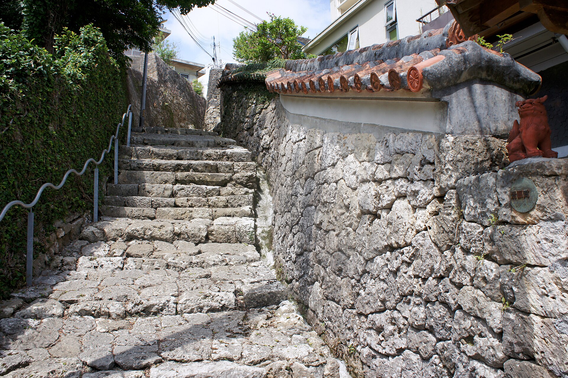
- The stepped lower stretchsteps of laid limestone between coral walls topped with red tile and shisa figures
How to actually get there
- Naha Airport Station → Shuri Station (Yui Rail monorail, 27 min, 360 yen).
- Shuri Station → the top of the stone lane (walk about 15 min, past Shuri Castle Park).
- Walk down the limestone paving, turning aside for the akagi grove and the spring plaza.
- Climb back to the top for Shuri Station, or catch a bus at the Shurijo-koen-iriguchi stop nearby.
- Yui Rail monorail from Naha Airport, then a walk
- Naha Airport Station →(Yui Rail monorail, 27 min)→ Shuri Station, fare 360 yen. From Shuri Station it is roughly a 15 minute walk southwest, passing Shuri Castle Park, to the top of the stone lane. About 45 minutes in total from the airport, and the monorail runs often enough that no timetable planning is needed.
- Return from Shuri Station
- Shuri Station sits on the same single monorail line as the airport, so the return is one ride with no transfer. Climbing back up the slope takes longer than the walk down, so allow for it. Trains run through the evening; check the platform timetable if you stay late.
About the place
Madama-michi, the royal road of the Ryukyu Kingdom, once ran about ten kilometres from Shuri Castle down toward the harbour and the south of the island. Most of it was destroyed in the Battle of Okinawa, and what survived was later resurfaced in concrete. What remains in Kinjo-cho is the stone itself: irregular slabs of Ryukyuan limestone, fitted without a repeating pattern, dropping down a steep hillside between walls of coral block. The lane is still a working city street. People live behind those walls, and the paving is their front path as much as it is a monument.
How to enjoy it
Start at the top, on the Shuri Castle side, and walk down rather than up. The paved stretch itself is short and takes only a few minutes at a stroll, so give the time instead to the akagi grove and the spring plaza. Anything from mid-morning onward works, since the lane has no gate and no opening hours of its own.
Background & history
Work on Madama-michi began in the sixteenth century, under a kingdom that had unified the Ryukyu islands and traded across East and Southeast Asia. The road carried officials, envoys and troops between the castle and the coast. The Battle of Okinawa in 1945 took Shuri Castle and nearly all of the paving with it. The Kinjo-cho stretch came through, and the prefecture has designated it a historic site. The giant akagi trees in the sacred grove beside it survived the same battle.
Before you go
- Cash
- The lane is a public road and costs nothing to walk. Yui Rail accepts OKICA and nationally interoperable IC cards such as Suica, as well as cash. There is no car park at the lane itself.
- Before you go
- The paving is Ryukyuan limestone and turns slippery in rain. The slope is steep and becomes steps in places, so it is not a step-free route. The houses along the lane are private homes, not exhibits.
- Another way
- You can also come by bus from central Naha: get off at the Shurijo-koen-iriguchi stop, served by routes 1 (Shuri-Shikina), 14 (Tomari), 17 (Ishimine-Kainan) and 46 (Itoman-Nishihara), and walk about 10 minutes.
- After you get off
- Leave Shuri Station and walk southwest for about 15 minutes, past Shuri Castle Park. The lane begins where the road surface changes from asphalt to laid limestone and starts to drop away.