Yaeyama · HaterumaNo.661★★★Open in map →
Hateruma Island
— Japan's southernmost inhabited island
The southernmost island in Japan where people live, reached from Ishigaki by a high-speed boat that is frequently cancelled. Its southeastern headland ends in a limestone cliff, and the village behind it still keeps its coral-stone walls.
- FromIshigaki Port Ferry Terminal
- ~60–80 minHigh-speed ferry from Ishigaki
- Get off atHateruma Port (Annei Kanko high-speed ferry)
- From there
- Hateruma Island
Where it is
9 more notes in Okinawa · open the map →What to look for — in walking order
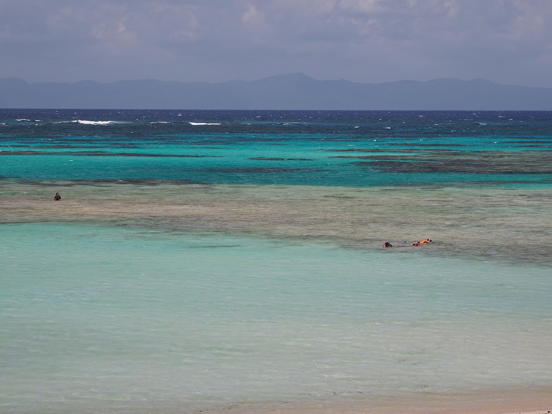
- Nishihamaa white-sand beach on the north shore, minutes from the pier on foot or by bicycle
- The coral-walled lanesvillage streets edged with stacked coral rock, red-tiled roofs behind them
- Kotomoria round coral mound raised as a fire-signal lookout under the Ryukyu kingdom
- The southernmost markersthree stones on the grass above the headland, each making the same claim
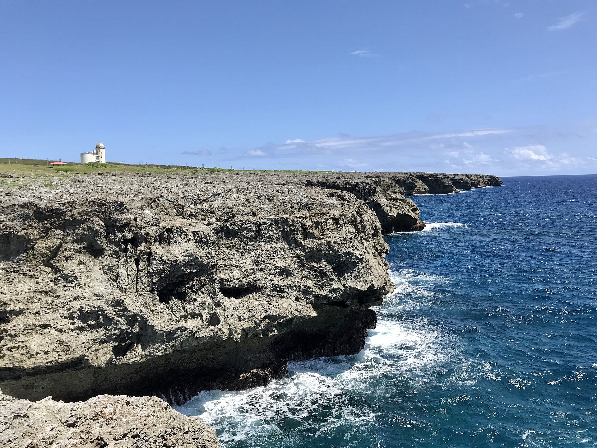
- Takanazaki cliffthe sea-cut limestone edge at the island's southeastern end, open water beyond
How to actually get there
- Ishigaki Port Ferry Terminal → Hateruma Port (Annei Kanko high-speed boat, about 60 to 80 minutes).
- Pier → Nishihama, the beach on the north shore, on foot or by hired bicycle.
- Nishihama → the village, for the coral-walled lanes and the Kotomori lookout mound.
- Village → Takanazaki, for the stone markers and the cliff at the southeastern end of the island.
- Annei Kanko high-speed boat from Ishigaki
- Ishigaki Port Ferry Terminal →(Annei Kanko high-speed boat, about 60 to 80 minutes depending on the vessel)→ Hateruma Port. Sailings run a few times a day, with an extra one in the summer schedule. Book ahead in summer and check the operator's cancellation notice on the morning you travel.
- Return sailings from Hateruma Port
- Afternoon boats run back to Ishigaki, the last leaving in the late afternoon. Because rough seas cancel individual sailings at short notice, do not plan a same-day connection to a flight out of Ishigaki — keep a night in hand.
About the place
Hateruma lies south of the main Yaeyama group, a low table of coral limestone with a few hundred residents and nothing on it high enough to call a hill. The settlement sits in the middle: a grid of lanes walled in stacked coral rock, red tiles behind them, sugar cane filling the ground around. Takanazaki, the southeastern headland, is where the island stops — a wall of Ryukyu limestone worked by the sea, with stone markers for the southern edge of the country standing on the grass above it. Nishihama, the pale beach on the north coast, is a short ride from the pier.
How to enjoy it
Boats leave Ishigaki in the morning and turn round in the afternoon, which gives a day trip only a few hours ashore — enough for the beach or for the headland, not comfortably both. Hire a bicycle or a scooter at the pier, because the island is flat and the distances are longer than they look. Staying over is what the island is really for: the Southern Cross clears the horizon here in season, and it does so nowhere else in Japan so easily.
Background & history
The markers on the headland went up in stages — a students' monument, then a stone for the island itself, then a peace marker raised in 1995 — each restating the same claim about the southern edge of the country. In the village, Kotomori is older: a round mound of stacked coral built as a fire-signal lookout in the days of the Ryukyu kingdom, when watchmen relayed warnings from island to island. An observatory tower was added on the headland in the 1990s, built for a night sky that reaches further south than any other in Japan.
Before you go
- Cash
- The beach, the headland and the village lanes cost nothing. Ferry tickets are bought at the terminal counter before boarding, and cash is the safe assumption on the island itself, for bicycle hire, shops and meals.
- Before you go
- The astronomical tower on the headland has been closed to visitors, so do not build an evening around it. The tourism association warns that island restaurants keep irregular days off, and worth checking before you go looking for dinner. Crossings are cancelled in rough weather and cancellations are common through the winter.
- Another way
- The cargo-passenger boat Ferry Hateruma 2 works the same route on a slower and less frequent schedule, and is the fallback when the high-speed sailings are off. It carries vehicles as well, which matters if you are moving between islands with more than a rucksack.
- After you get off
- Hateruma Port is on the northwest shore and the boat berths at the terminal there. Nishihama is minutes away on foot or by bicycle; the village lies inland to the south, and Takanazaki is at the far corner of the island — a ride rather than a walk. Bicycle and scooter hire, and guesthouse pick-ups, wait beside the pier.