Yamanashi east · OtsukiNo.119★Open in map →
Saruhashi Bridge
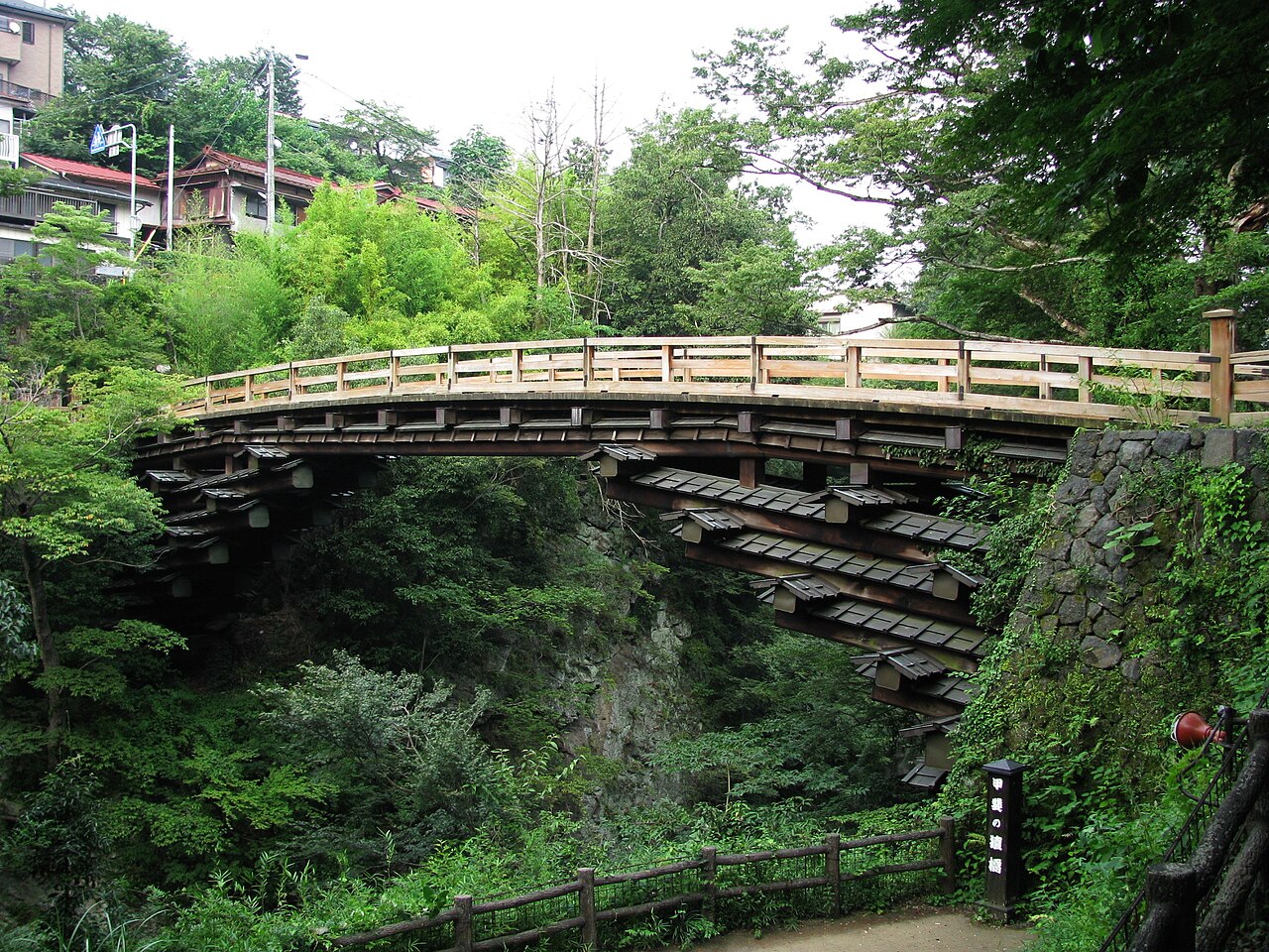
One of Japan's three unusual bridges, counted a national Place of Scenic Beauty — and the maintained gorge path below lets you look up at the four tiers of cantilever beams from the river.
- FromShinjuku Stn (Tokyo)
- ~90-120 mintrain + 15 min walk
- Get off atSaruhashi Stn (JR Chuo Line)
- On foot
- Saruhashi Bridge
The sweet spot
Saruhashi Station is a small stop with little English signage, and the riverside path down into the gorge is easy to miss, so most visitors only see the bridge from the road above and move on.
Where it is
18 more notes in Yamanashi · open the map →What to look for — in walking order
- The deck crossingwalk the 30.9-metre span across the gorge — no piers visible below the deck
- Four stacked tierseach layer of cantilever beams reaches farther out than the one below, visible from the gorge path
- Riverside gorge pathmaintained walkway below the bridge; hydrangeas line the path, at their best in late June
- One of three unusual bridgesgrouped with the Kintai Bridge; designated a national Place of Scenic Beauty
How to actually get there
- Shinjuku (Tokyo) -> Takao (JR Chuo Line rapid, ~50 min)
- Takao -> Saruhashi (JR Chuo Line local toward Otsuki/Kofu, ~35 min)
- Saruhashi Station -> Saruhashi Bridge (on foot, ~15 min, signposted)
- JR Chuo Line (transfer at Takao)
- From Shinjuku (Tokyo): take a JR Chuo Line rapid train toward Takao (~50 min). At Takao, transfer to a local train bound for Otsuki or Kofu and ride to Saruhashi (~35 min). Total about 90-120 min. From Saruhashi Station the bridge is a signed 15-minute walk. Some direct Chuo Special Rapid trains run through to Saruhashi without a transfer when available.
- Return by local train
- Take any local JR Chuo Line train from Saruhashi back toward Takao and Shinjuku. Trains on the Takao-to-Saruhashi section run less often than in central Tokyo and thin out in the evening, so check the return times posted at Saruhashi Station when you arrive.
About the place
Saruhashi carries its deck across the Katsura River with no piers at all. Four tiers of cantilever beams are set into the two facing cliffs, each reaching a little farther out than the one below until they meet over the gorge. The span is about 30.9 metres long and sits roughly 31 metres above the water. A maintained footpath runs along the riverside below, so you can experience the bridge from both angles: deck on top, and the full stack of beams overhead from the gorge floor.
How to enjoy it
Walk across the deck first, then take the riverside path down into the gorge to look up at the four tiers of beams stacked overhead. Hydrangeas line the gorge path and are usually at their best in late June. The path can be slippery, especially after rain.
Background & history
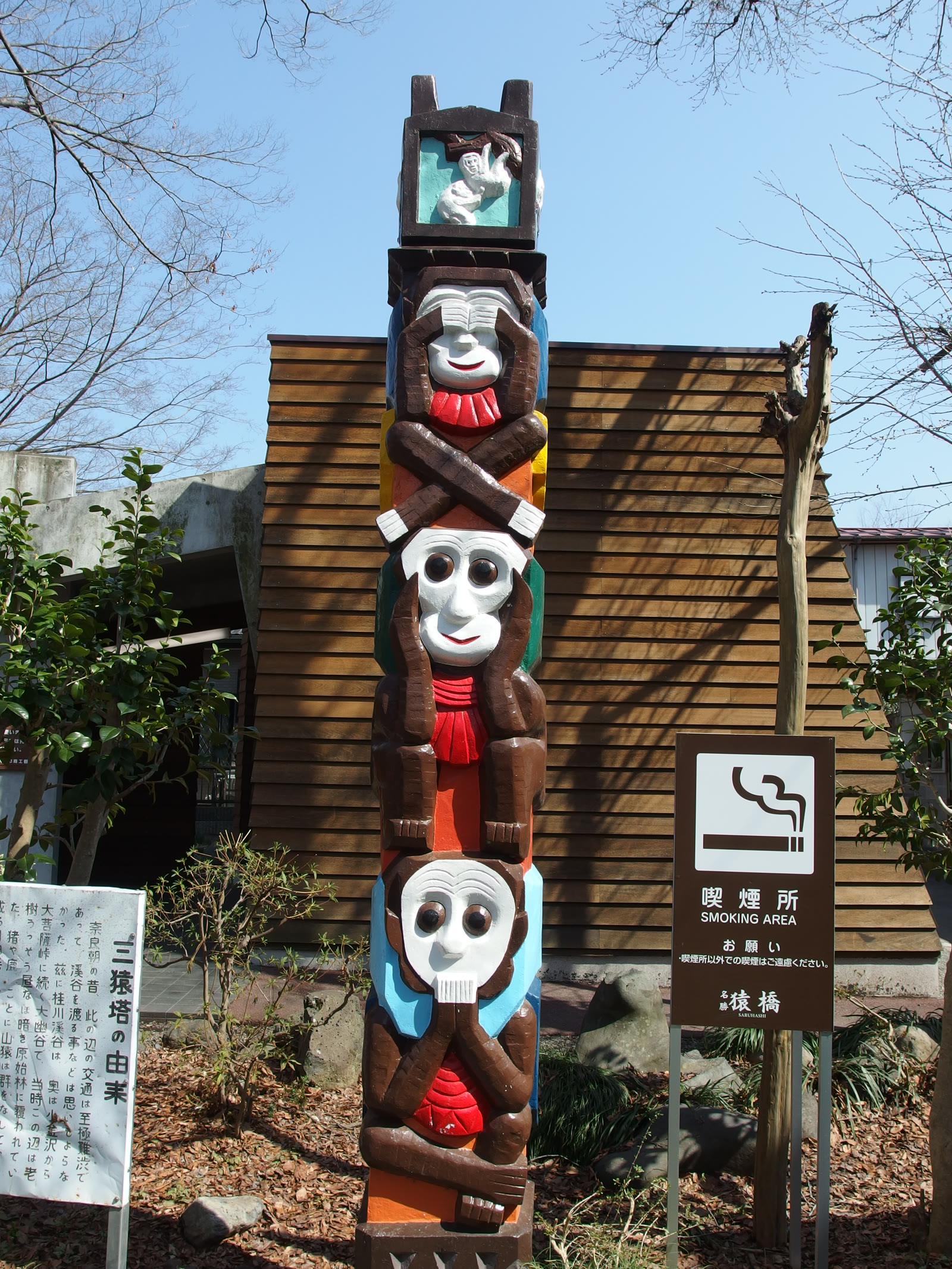
The bridge's name means 'monkey bridge' — an old legend says its cantilever form was inspired by monkeys linking their bodies to cross the ravine. Saruhashi is counted as one of Japan's three unusual bridges alongside the Kintai Bridge in Yamaguchi, and is designated a national Place of Scenic Beauty. Its hanebashi (cantilever) form was painted by Edo-period woodblock artists including Hiroshige and Hokusai. The current bridge keeps the traditional design, with beams since reinforced by a modern steel frame.
Before you go
- Cash
- The bridge is free to visit. Rural station shops may not take cards, so carry some coins and small notes.
- Before you go
- The riverside path down into the gorge can be slippery. Go carefully, especially after rain.
- Another way
- If you skip the walk, a taxi from Otsuki Station (one stop past Saruhashi) reaches the bridge in about 10 minutes.
- After you get off
- From Saruhashi Station, walk about 15 minutes downhill on the paved lane toward the river; the route to the bridge is signposted.